
12:00 PM | ***Snow now diminishing in DC metro region and arriving in Philly, NYC***
Paul Dorian

Forecast map from high-resolution model (HRRR) of freezing rain accumulations amounts; map courtesy Pivatal Weather, NOAA
Something about President’s Day and snowstorms…snow is now rapidly closing in on the Philly and NYC metro regions and is actually diminishing just to the south and west of DC. That is not the end of this storm by any means in the DC metro region - just a lull in the action. There was a good thumping of snow on the order of 3-6 inches in the DC metro region this morning (highest amounts south, lowest to the north) and it'll be pretty sporadic for the next few hours. Farther to the northeast in SE PA, New Jersey and New York City, the snow will become heavier and steadier over the next couple of hours and it will stick rather rapidly on untreated surfaces as temperatures remain well below freezing and travel conditions will deteriorate quickly. Those slick travel conditions will last in all areas through the afternoon hours and also during the evening commute.
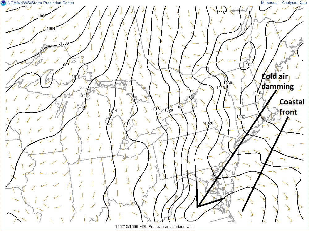
Latest surface pressure pattern showing coastal front setting up in western Atlantic and "cold air damming" east of the Appalachians...both will be crucial players in next 12-24 hours; map courtesy NOAA
Later today and early tonight, milder air will push to the north and west from the ocean and temperatures will try to climb above freezing in the I-95 corridor. Snow will change to a period of sleet and/or freezing rain late today/early tonight (~4-8pm) and there will be a significant ice buildup on untreated surfaces; especially, in the northern and western suburbs where cold air will be most reluctant to give up its ground. Indeed, this very well could turn into a significant ice event in many areas by later tonight on the northwest side of I-95. The forecast map (above) of freezing rain amounts is based on a very recent high-resolution model run and it is looking pretty ugly for the northern and western suburbs along Route I-95. Before the changeover from snow-to-ice, there will be accumulations of at least 2-4 inches in and around Philly and 1-3 inches near NYC.

There are numerous reports that snowflakes today have the perfect stellar "dendrite" shape
By late tonight and during the day on Tuesday, temperatures should climb above freezing in the I-95 corridor and ordinary rain is likely. In fact, the rain could come down heavily at times on Tuesday and - given the frozen soil conditions – immediate runoff could create flooding issues. Stay tuned for updates.
Meteorologist Paul Dorian
Vencore, Inc.