
1:30 PM | *Winter not over yet...multiple upcoming threats beginning as soon as late tomorrow night/early Friday morning*
Paul Dorian
Overview
Despite today’s mild weather and the fresh groundhog prognostication for an early spring, winter is not over yet and there will be multiple threats for snow in coming days. In fact, one threat will come as early as late tomorrow night and early Friday morning as low pressure rides up along a stalled out frontal boundary zone just off the east coast. Another storm is likely to miss the region on Sunday as it moves to the northeast well east of the big cities; however, it still bears watching and cannot be completely ruled out. Finally, the unfolding upper-level pattern is likely to generate another system near the Mid-Atlantic coastline around Monday night or Tuesday of next week and this could turn into an important snow event from the Mid-Atlantic to New England.
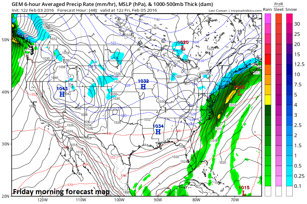
12Z Canadian model forecast map for Friday morning; courtesy tropicaltidbits.com
Late tomorrow night/early Friday threat
The frontal system that is closing in on us today and contributing to today’s heavy rainfall will slide just off the east coast by late tonight and then it’ll stall out in a north-to-south orientation. Low pressure will ride up along the frontal boundary zone late tomorrow night and early Friday morning (above map) and it could come close enough to throw some snow back into coastal and interior sections of New Jersey, New York City, and perhaps even into the immediate I-95 corridor region from DC-to-Philly. The best chance for any accumulations from this first threat will come along coastal sections and areas nearby; however, we’ll continue to monitor this system as it could push a little farther to the north and west and produce accumulations farther inland including in the metro regions of DC, Philly, and NYC. While temperatures in the upper atmosphere will support snow from this system from the onset, boundary layer conditions will be marginal initially and the precipitation could start as rain; especially, near or at the coastline, but eventually it should change to all snow .
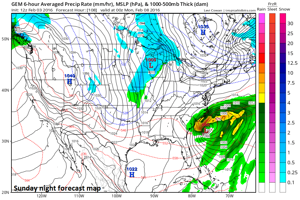
12Z Canadian model forecast map for Sunday night; courtesy tropicaltidbits.com
Sunday threat
Another low pressure area will push off the east coast late Sunday (above map) and it looks like it will deepen quite rapidly. However, at this time, it appears this system will stay well to the east of here and not impact anyone north of the Carolinas; however, we’ll still monitor this situation over the next couple of days to see if it trends to the northwest.

12Z Canadian model forecast map for Tuesday morning; courtesy tropicaltidbits.com
Next week's threat
Perhaps the biggest potential of all will take place next week around Monday night or Tuesday as a favorable upper air pattern for coastal storms unfolds across the nation. Specifically, deep upper level low pressure will form in the eastern states while strong high pressure ridging sets up out west – a classic pattern for east coast storms - but many questions still remain. In addition, there will be an influx of Arctic air dropping southeastward from southern Canada into the northern US. A third wave of energy in this unfolding pattern is likely to spin off low pressure over the Ohio Valley early next week that eventually transfers its energy to a coastal low which could end up moving from the Mid-Atlantic coastline to the New England coastline. [12Z Canadian forecast map for Tuesday morning (above) shows low pressure off the Mid-Atlantic coastline].
Bottom Line
Stay tuned – winter is not over yet and the next several days will be quite interesting with multiple snow threats.
Meteorologist Paul Dorian
Vencore, Inc.