
11:20 AM | *Atmospheric blow torch next week*
Paul Dorian
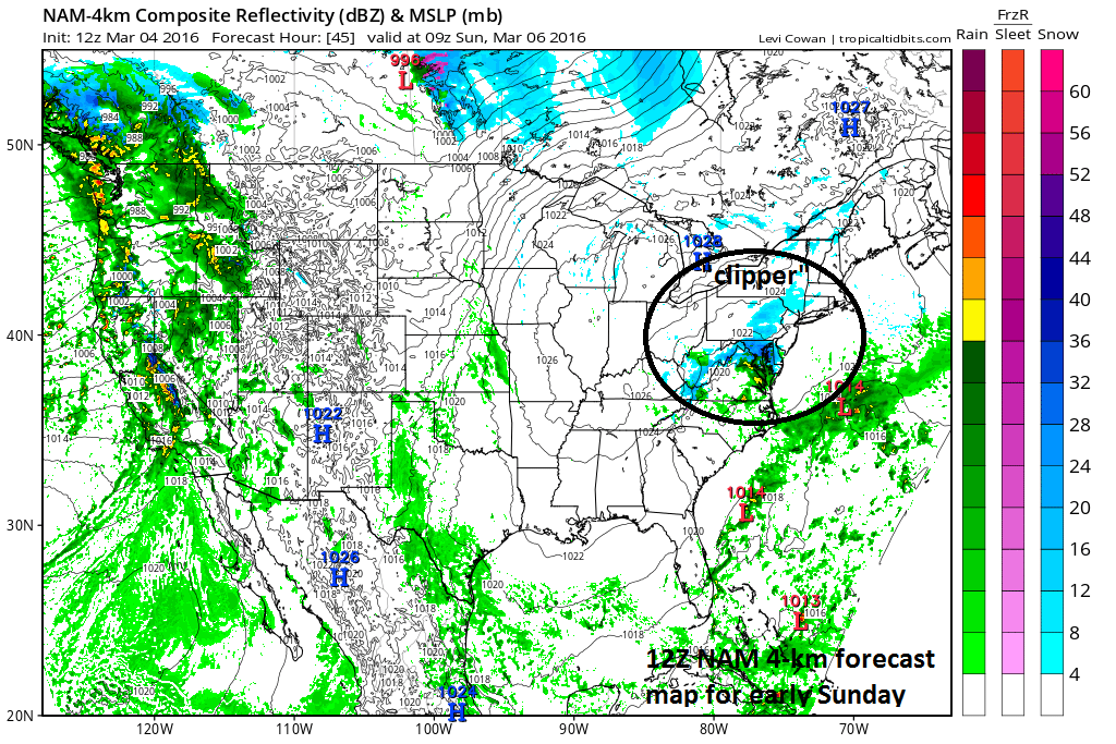
High-resolution NAM model forecast map for early Sunday (blue=snow, green=rain); map courtesy tropicaltidbits.com, NOAA
Threat for another nuisance snow event
One snow event is over for the DC, Philly metro regions and it winding down in New York City, but there is the possibility for another nuisance snowfall in the I-95 corridor from tomorrow night into early Sunday. It’ll stay relatively cold through the upcoming weekend and a fast-moving “clipper” system will drop southeastward from the Northern Plains into the Ohio Valley. This system will reach the Mid-Atlantic region tomorrow night and it could generate another “coating to an inch or two” in the I-95 corridor by early Sunday morning. Precipitation-type associated with “clipper” should be primarily snow north of the PA/MD border, but rain can be mixed in at times; especially, across the DC metro region.

00Z European ensemble forecast map for next Wednesday evening's lower atmosphere temperature anomalies; map courtesy tropicaltidbits.com
Atmospheric blow torch next week
The weekend system should be one of winter’s last gasp as an atmospheric blow torch will send temperatures soaring all across the eastern half of the nation next week. As early as Monday afternoon, temperatures could soar towards the 60 degree mark in the I-95 corridor and then 70 degrees should be reached by mid-week. The substantial warm up won’t come without its problems, however, for many parts of the nation. The south-central US will likely experience tremendous amounts of rainfall next week and there is likely to be a widespread severe weather outbreak in the Deep South. In addition, the state of California will get pounded by numerous storms which could result in a foot of rain in much of the northern half of the state and several feet of snow in the Sierra Mountains. Finally, while the eastern US warms up significantly, Mexico will experience an unusual chill that could bring rare snow to portions of that country.

Winter season snowfall information for numerous cities
Meteorologist Paul Dorian
Vencore, Inc.