
2:30 PM | *Impressive cold and possible early weekend mischief*
Paul Dorian
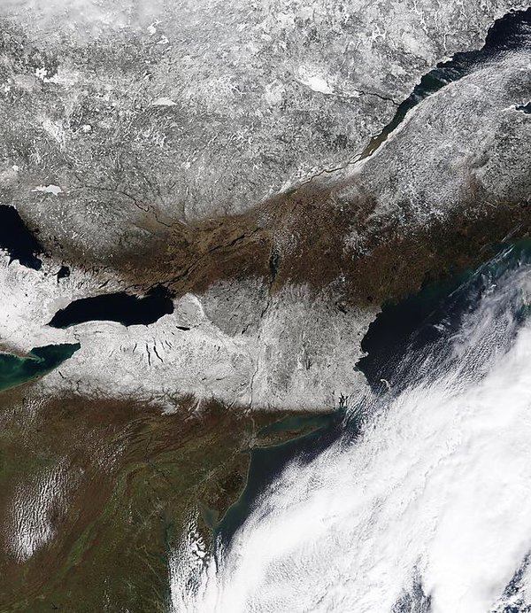
MODIS image clearly showing snow cover from the Great Lakes to New England; image courtesy NASA
Overview
April can be a cruel month. The 1 PM temperature at Philly Intl Airport was only 41 degrees despite full sunshine and northerly winds were gusting to 28 mph. This is very impressive cold for April 5th in Philly which has a normal high temperature of 60 degrees. This most recent of Arctic air outbreaks has indeed wreaked havoc on several baseball openers and has generated some remarkable low temperatures in the Northeast US and Upper Midwest with, for example, Marquette, Michigan dropping to -7°F and Syracuse, New York to 9°F – second coldest ever recorded in both places for so late in the year. A hard freeze is very likely in the overnight hours throughout the I-95 corridor with an extended period likely of below-freezing temperatures. Temperatures will modify on Wednesday afternoon after a cold start to the day, and it’ll turn milder on Thursday with occasional showers and possible thunderstorms, but yet another Arctic blast is destined to arrive for Friday and Saturday in the eastern US. In addition, an energetic upper-level pattern could result in some snow or snow shower activity on Saturday in the Mid-Atlantic region.

Record or near record low temperatures this morning as indicated by the light blue and dark blue circles; map courtesy coolwx.com
Hard freeze tonight with possible record cold
Skies should remain clear tonight and the winds should lighten up considerably after sunset – a great combination for temperatures to drop to below-freezing levels given the entrenched Arctic air mass. In fact, low temperature records are possible in many locations of the Mid-Atlantic region and Northeast US by early tomorrow morning; especially, in those areas to our north with snow cover from yesterday’s storm (MODIS satellite image).

12Z GFS forecast map for early Saturday afternoon (blue=snow, green=rain); map courtesy NOAA, tropicaltidbits.com
Wednesday-Saturday
Temperatures will modify tomorrow afternoon after the cold start and should turn noticeably milder on Thursday. To go along with the milder conditions, showers are likely late tomorrow night and Thursday and there can be a thunderstorm or two mixed in. This rain event on Thursday will be part of an interesting unfolding upper-level pattern (at 500 millibars). Deep upper-level trough will form over the Northeast US at the same time strong high-latitude “omega” blocking will form downstream over the Atlantic Ocean. The deep upper-level low will go “negatively tilted”, move very slowly, and several short waves of energy will move through by the weekend.
One short wave of energy looks like it could be strong enough to try to form a surface low pressure system in the Mid-Atlantic region on Saturday and the result could be some snow or snow shower activity (12Z GFS forecast map for early Saturday afternoon; 12Z Euro also supports snow threat idea (not shown)). Looking ahead, while there will be intervals of mild weather, the overall colder-than-normal weather pattern that has developed for the Northeast US will continue into at least the middle of the month with another cold air outbreak likely by the middle of next week.
April can be a cruel month.

Meteorologist Paul Dorian
Vencore, Inc.