1:00 PM | *Oppressive heat and humidity and a strong-to-severe thunderstorm threat*
Paul Dorian
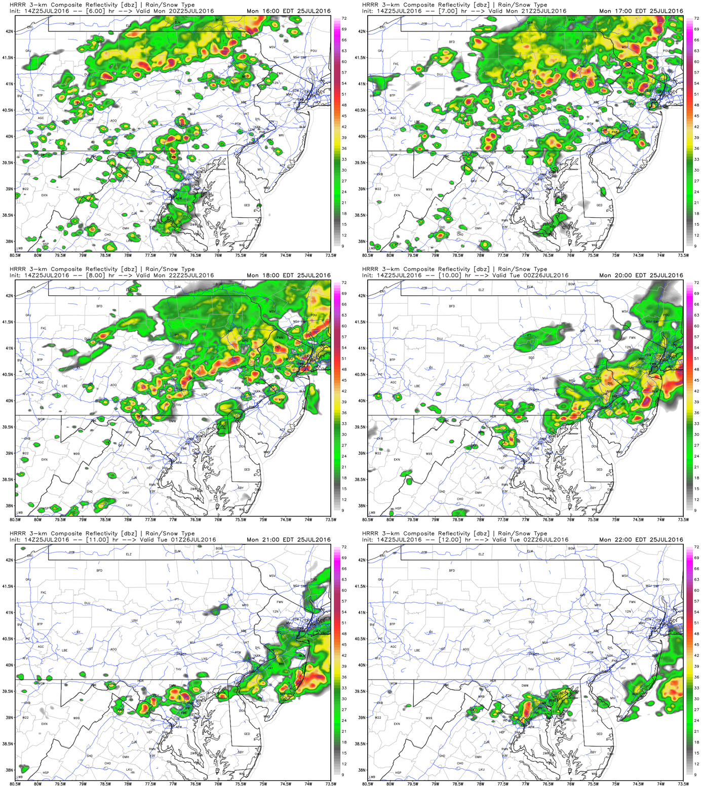
An hour-by-hour loop of simulated radar echoes between the hours of 4 and 10 pm from the latest run of High-Resolution Rapid Refresh (HRRR) model run with numerous storms; maps courtesy Weather Bell Analytics, NOAA
Overview
Today may turn out to be the worst day of all with respect to the recent hot spell as humidity levels are currently at tropical levels and this is raising “heat indices” to oppressive levels. "Heat indices” are a measure as to how uncomfortable overall conditions are to the average person as a result of the combination of heat and humidity. In addition to the overbearing heat and humidity, the combination of an upper-level wave of energy, a surface-level frontal system, and excessive heat and atmospheric moisture raises the prospects for strong-to-severe thunderstorm activity late this afternoon and evening along the I-95 corridor. There is a danger that some spots will get pounded by multiple storms during this event moving along in a "training" pattern; especially, across Pennsylvania, New Jersey and southern New York.
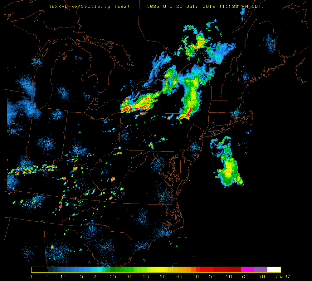
Noon time NEXRAD radar map courtesy University of Wisconsin
Details
Temperatures at the noon hour are at pretty high levels (Philly 88, DCA 94 and NYC 88), but the most impressive aspect is the humidity. Dew point temperatures are a direct measure of overall humidity levels (i.e., the higher the dew point, the higher the overall humidity) and some of the readings at the noon hour are quite amazing. For example, at Reagan National Airport (DCA) in DC metro region the noon reading of the dew point was an overwhelming 78 degrees along with the actual air temperature of 94 degrees. Perhaps even more impressive is the noontime dew point of 75 degrees at State College, PA – quite a rare occurrence for that part of the Mid-Atlantic region.
All of this heat and humidity will combine with upper-level energy and a surface-level frontal boundary zone to destabilize the atmosphere this afternoon. Thunderstorms are currently rather scattered across the Mid-Atlantic region, but should increase in coverage and intensity as the day progresses. The latest High-Resolution Rapid Refresh (HRRR) model run of simulated radar for the late afternoon and evening time frame is quite ominous with numerous lines of thunderstorms forming in the Mid-Atlantic region and this type of pattern can lead to "training" of thunderstorms whereby a given location can get hit by multiple cells. Any of these potential storms can produce tropical downpours with flash flooding, booming thunder, vivid lightning (power outages), and damaging wind gusts. The most likely timetable in the I-95 corridor for any strong-to-severe thunderstorm activity is 3-10pm.
Meteorologist Paul Dorian
Vencore, Inc.


