
1:30 PM | *It's not the heat, it's the incredible humidity*
Paul Dorian
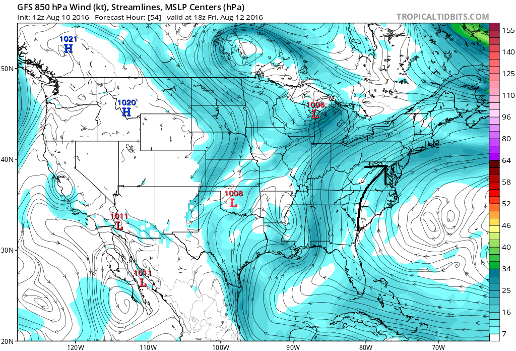
Tropical flow of air into the Mid-Atlantic region as depicted by this 12Z GFS model forecast for Friday afternoon; map courtesy tropicaltidbits.com; NOAA
Overview
The heat index is a measure of discomfort as a result of the combined effects of temperature and humidity and it will reach well over 100 degrees during the next few days. In fact, this stretch of very uncomfortable weather should continue right through the weekend in what will turn out to be the longest period of high humidity so far this summer season. A deep plume of tropical moisture is pushing into the Mid-Atlantic region and it will stick around for the next several days. High pressure has pushed off the east coast and the clockwise flow of air around it has turned our low-level winds to a south-to-southwest direction and this is pushing tropical air northward along the eastern seaboard. In addition to the heat and humidity, the overall weather pattern for the next few days will be quite unsettled with scattered showers and thunderstorms and any shower or storm can produce heavy rainfall.

Heat index forecast map for Thursday afternoon; map courtesy Weather Bell Analytics
Discussion
Dew points have already reached into the 70’s along the I-95 corridor and the trend will be up for temperatures as well during the next couple of days. Temperatures today are likely to generally hold in the 80’s this afternoon; however, for the rest of the week and weekend highs should easily reach the 90 degree mark and some areas in the I-95 corridor will climb to 95 degrees on multiple days. Combine that kind of heat with dew points well up in the 70’s and heat indices will soar to over 105 degrees – how it will actually feel outdoors. Precipitable water is another measure of atmospheric moisture and this indicator is forecast to be near record levels over the next few days. This is suggesting that while thunderstorms will be spotty during the next few days, any storm can quickly produce heavy rainfall amounts.

Heat index forecast map for Friday afternoon; map courtesy Weather Bell Analytics
The main culprit for this tropical air mass is high pressure off the coast which is now pumping this air northward into the Mid-Atlantic from the Southeast US which has been inundated by heavy rainfall in recent days. The Gulf of Mexico is very warm for this time of year and this will contribute to the heat and humidity riding up along the east coast and into our region.
Meteorologist Paul Dorian
Vencore, Inc.