2:30 PM | *Strong-to-severe storms popping to our west*
Paul Dorian
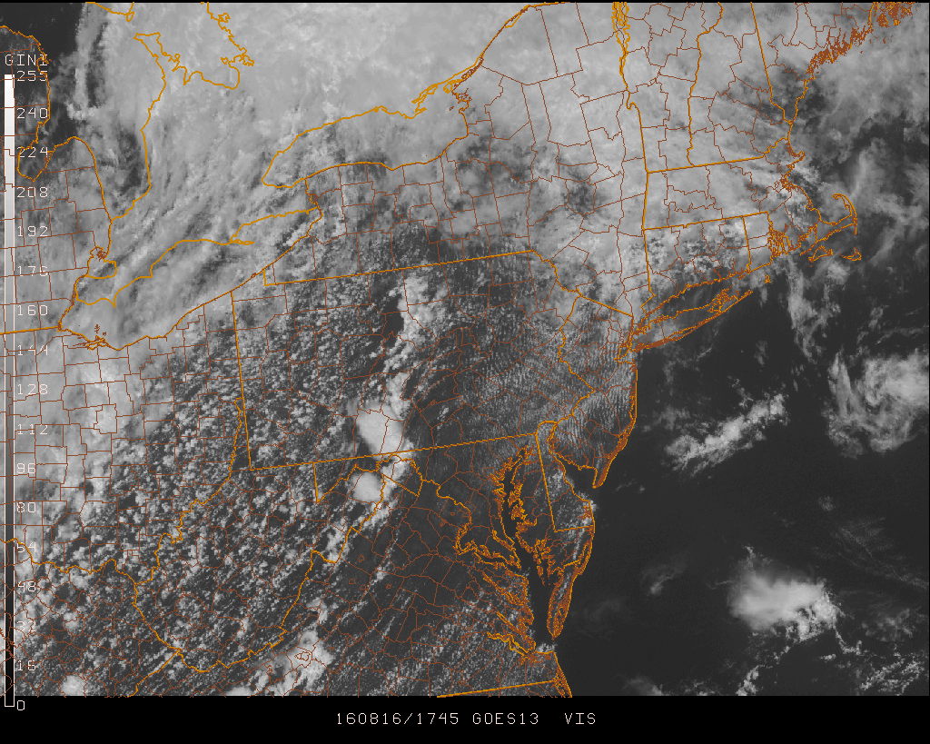
GOES visible satellite image with line of thunderstorms extending from central PA to southwestern Virginia; image courtesy Penn State eWall
Overview
The good news is that today will be the last day of the recent extended heat wave in many parts of the Mid-Atlantic region; especially, north of the PA/MD border. The bad news is that there will be strong-to-severe thunderstorms affecting parts of the Mid-Atlantic region before we get some relief around here.
Latest NEXRAD radar image; courtesy University of Wisconsin
Discussion
A cold front is now situated to our west and a warm front to our north and hot and humid conditions continue to persist across the region. The atmosphere is quite unstable and the latest radar map features a line of strong–to-severe thunderstorms extending from central PA to central VA and this could affect the immediate I-95 corridor during the late afternoon and evening hours. The latest visible satellite image features plenty of clear-to-partly cloudy skies ahead of the line of thunderstorms and this will help keep the atmosphere unstable at the high heating time of day. The greatest threat from these storms may turn out to be damaging wind gusts and brief downpours are quite likely in some areas as it passes through the region later today and early tonight. The timetable for the potential strong-to-severe thunderstorms will be the rather typical for summertime, namely, around 4-10pm.
Meteorologist Paul Dorian
Vencore, Inc.


