12:20 PM | ****Brunt of the storm next 12 hours or so…power outages a concern as winds can gust to 60 mph in inland locations****
Paul Dorian
12Z NAM-4km loop of lower atmosphere winds for 24-hour period from this morning until tomorrow morning in hourly increments...worst is still to come; maps courtesy tropicaltidbits.com, NOAA/EMS
Overview
The brunt of this major storm will take place between now and midnight or so although damaging wind gusts can last to the wee hours of the morning in and around the NYC metro region. Very strong high pressure in southeastern Canada is combining with a powerful storm to produce a tightening pressure gradient in the Mid-Atlantic region. This will result in potentially damaging wind gusts to 60 mph in interior locations over the next 12 hours or so and to near hurricane force at or just off the Mid-Atlantic coastline. In addition to the powerful winds, rain will become more widespread later today and fall heavily at times through the overnight hours before winding down early tomorrow. There is also a decent shot that some ice or snow mixes in with the rain all the way into the northern and western suburbs of the big cities along the I-95 corridor later today or tonight.
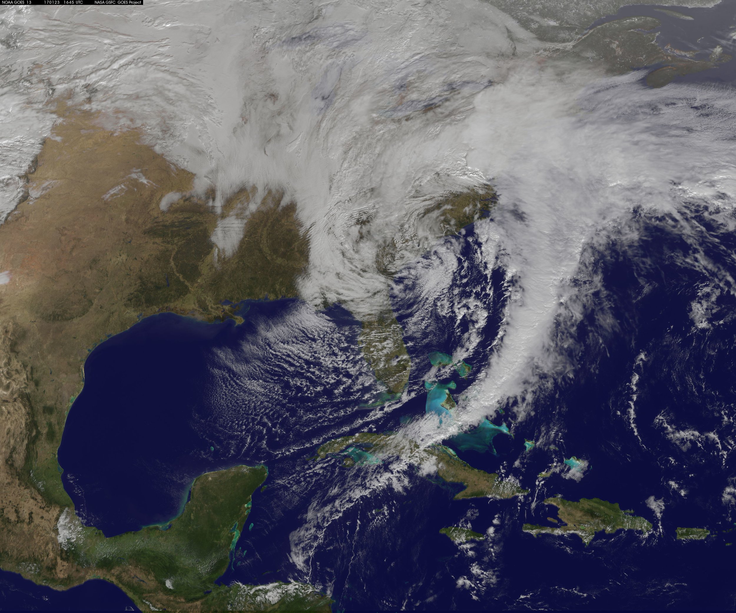
Latest GOES satellite image of major storm system with moisture influx from the Caribbean Sea; courtesy NASA, NOAA
Details
A deep, slow-moving and intensifying upper-level trough is progressing to the Mid-Atlantic coastline and this has helped to spawn a powerful storm with central pressures around 29.20 inches. This system will maintain that strength for the next several hours as it moves towards the Mid-Atlantic coastal waters. Winds can gust past 60 mph at inland locations and to near hurricane force at or close to the coast. Power outages are a real concern as there can be some downed limbs and power lines; especially, along coastal sections. Rainfall amounts between today and mid-day Tuesday are likely to average 1.0 to 2.0 inches in the DC, Philly, NYC corridor, but higher amounts are possible on a localized basis. The rain will tend to "wrap around" in bands moving from the southeast-to-the-northwest over the next several hours so look just off the coast to determine what may be headed towards SE PA, for example.
Some colder air will wrap into the system during the next several hours causing a changeover of the rain to ice or snow across higher elevation locations in central and NE PA, western Maryland/Virginia and interior NW NJ. In fact, the rain can mix with ice or snow later today or tonight all the way into the northern and western suburbs of DC, Philly and NYC. Coastal flooding is also a concern with the expected long period of powerful onshore winds (E-NE) and the high tide of most concern would be the one coming this evening. These strong winds will drop off considerably by tomorrow morning in the Mid-Atlantic region.
The latest satellite image of this storm shows an influx of moisture (note long cloud band) coming from all the way from the Caribbean Sea. The latest high-resolution (4-km) NAM model forecast of lower atmosphere winds (850 mb) suggests the worst part of the storm is yet to come for the DC-to-Philly-to-NYC corridor.
Meteorologist Paul Dorian
Vencore, Inc.
vencoreweather.com
Extended video discussion below on the 12Z high-resolution NAM model forecast


