1:30 PM | **Warm spell to end with a bang in DC, Philly, NYC...strong-to-severe thunderstorms to arrive shortly**
Paul Dorian
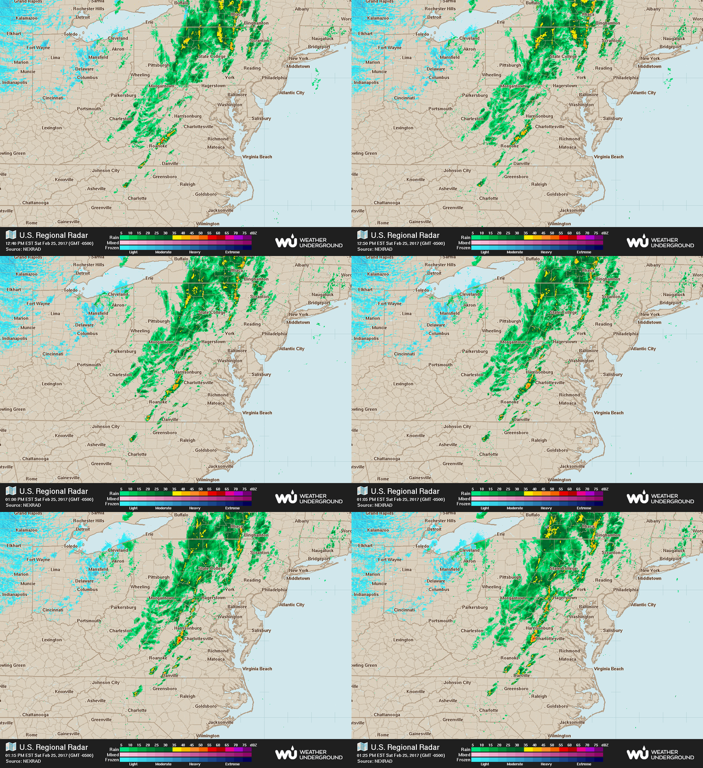
Latest radar loop of the Northeast US; courtesy Weather Underground
Our unusually warm weather will come to an end shortly as a strong cold front reaches the Mid-Atlantic’s I-95 corridor. This front will generate a long line of showers and embedded thunderstorms and some of storms will be on the strong-to-severe side containing heavy downpours, lightning, damaging wind gusts and perhaps even some hail and a few isolated tornadoes. Radar has shown an increase in intensity of echoes during the past couple of hours across western and central sections of the Mid-Atlantic region - and it is all headed to the I-95 corridor.
High-resolution (HRRR) forecast map for 4pm; courtesy tropicaltidbits.com, NOAA/EMC
The air mass ahead of the front has warmed to near or slightly above the 70 degree mark in many spots along the I-95 corridor and overall humidity has been on the rise. This will allow for additional destabilization of the atmosphere in the next couple of hours which should increase the chances for strong-to-severe storms to form along the frontal zone. The upward motion leading to destabilization of the atmosphere as indicated by the 700 mb vertical velocities (forecast map shown below) is very impressive at 4pm in and around the I-95 corridor. These strong-to-severe thunderstorms can contain heavy downpours, damaging "straight-line" wind gusts up to 60 mph, possible hail, and even a few isolated tornadoes can form in this increasingly unstable environment. Any individual thunderstorm cell should move along fairly quickly lasting on the order of 30-45 minutes in a given location
700 mb vertical velocities at 4pm suggests very impressive upward motion in the atmosphere (i.e., destabilzation) near the I-95 corridor which increases the chance for strong-to-severe storm activity; forecast map courtesy College of DuPage
The likely timetable for the line of showers and embedded strong-to-severe thunderstorms in the Mid-Atlantic I-95 corridor is as follows:
DC: 2-4pm
Philly: 3-5pm
NYC: 4-6pm
Coastal regions: 6-8pm
Temperatures on Sunday following the frontal passage will be confined to the 40’s – a far cry from the recent 70’s – and a gusty NW wind will make it feel even colder.
Meteorologist Paul Dorian
Vencore, Inc.
vencoreweather.com


