12:30 PM | **Rounds of heavy showers and embedded strong-to-severe thunderstorms this afternoon in the Mid-Atlantic region**
Paul Dorian

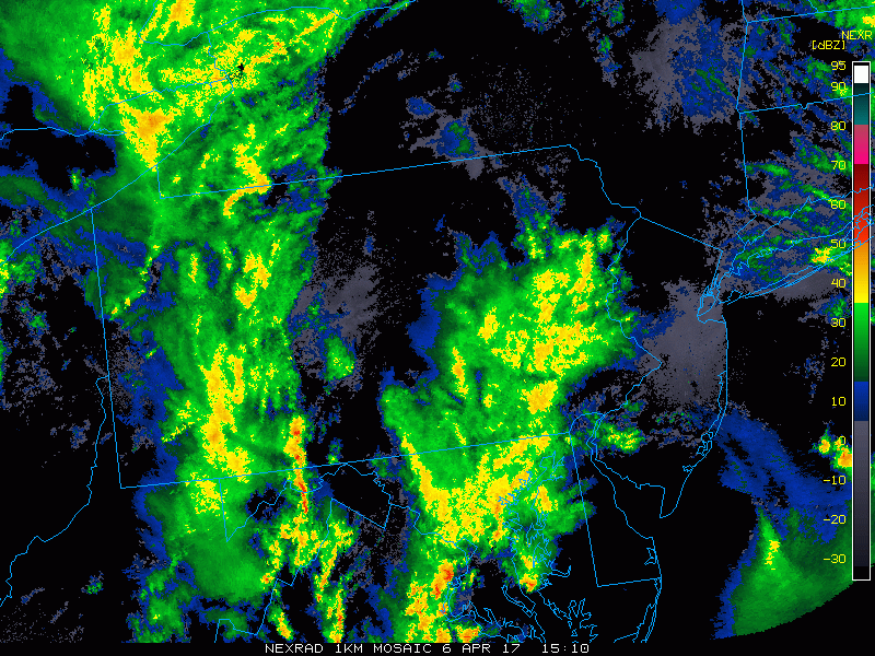
Early afternoon radar loop courtesy College of Du Page
A major storm system is currently intensifying rapidly near the Blue Ridge in northwest Virginia where pressure falls of 4 millibars have been observed in the past two hours resulting in a central pressure of 994 mb. The low pressure system will move northward into eastern PA this afternoon – enhancing instability along the way – and ultimately, make its way into New York State. As a result of this unfolding situation, there will be rounds of showers and strong-to-severe thunderstorms for the next few hours in the DC, Philly and NYC metro regions. There are currently no National Weather Service severe thunderstorm watches, but that should change shortly. Some of the rain will be heavy at times and some of the storms can reach strong or severe levels with damaging wind gusts, hail and even isolated tornadoes possible.
The low pressure intensification is occurring as a strong upper-level shortwave of energy takes on a “negative” tilt (i.e., orients from NW to SE) and this is leading to strong upward motion in the quickly destabilizing atmosphere along the I-95 corridor. In addition to the upper-level energy, there are powerful jet streaks at multiple levels of the atmosphere and this should lead to "damaging wind gusts" as the primary severe weather threat this afternoon and there can be hail and even isolated tornadoes. In addition to these threats, localized flooding is a concern as grounds are pretty well saturated; especially, in areas north of the PA/MD border. A trailing cold front will push through the I-95 corridor late in the day or early tonight and this will end the severe weather threat.
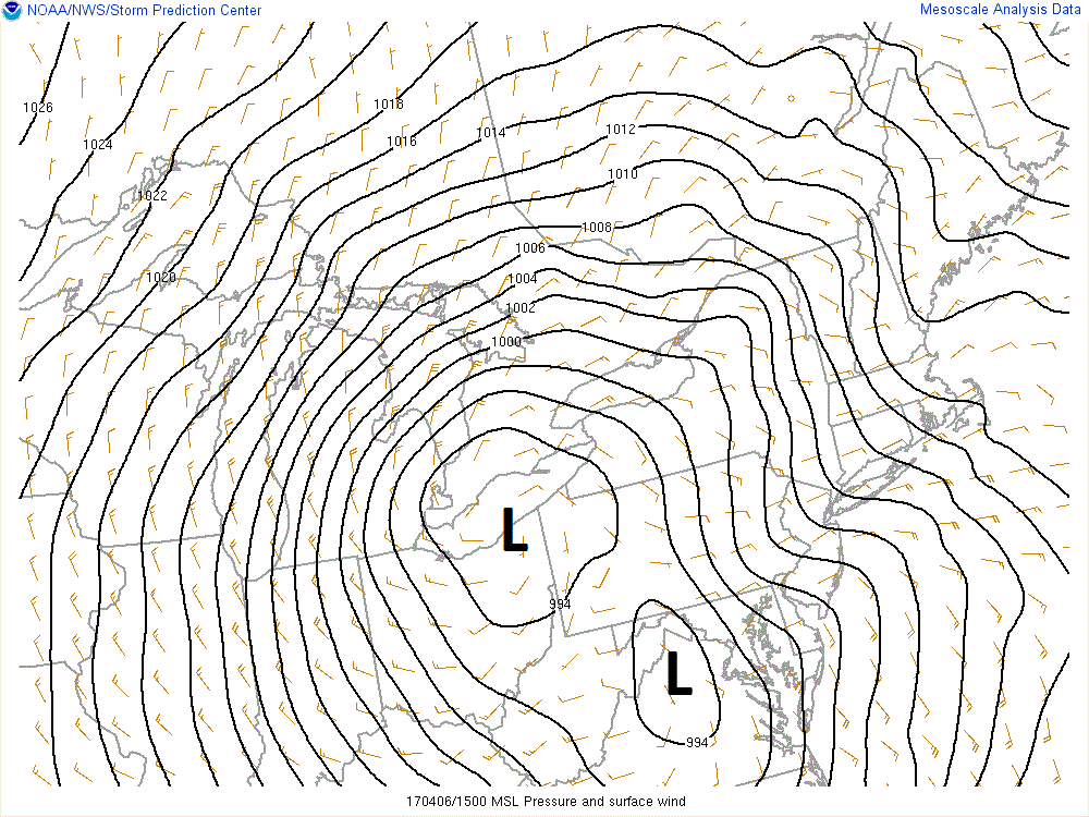
Surface isobar (pressure) pattern with developing major (secondary) storm system in NW Virginia and weakening (initial) storm over NE Ohio; map courtesy NOAA
On the backside of the storm, much cooler air will push into the Mid-Atlantic region tomorrow and winds will be quite strong out of the west-to-northwest. There are likely to be occasional light rain showers on Friday in the I-95 corridor and accumulating snow is going to occur in the Ohio Valley, Great Lakes region, and Appalachian Mountains. It’ll stay cool and breezy on Saturday around here, but spectacular weather is coming (finally) for Sunday, Monday, and Tuesday.
Meteorologist Paul Dorian
Vencore, Inc.
vencoreweather.com