11:00 AM | *Dangerous setup unfolding for late today/early tonight in Oklahoma/Kansas*
Paul Dorian
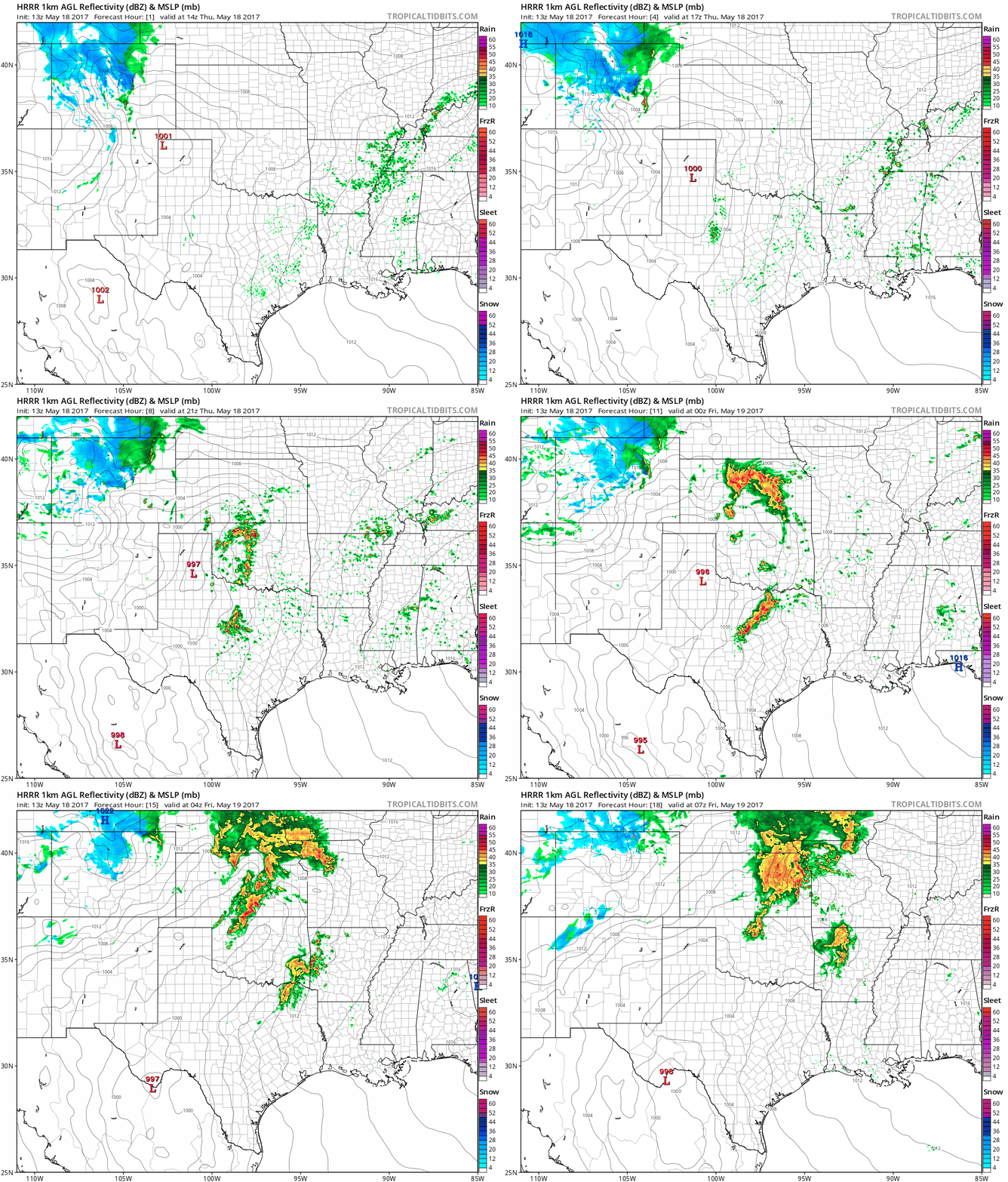
Hourly forecast maps from the 13Z HRRR with late day/evening showers and thunderstorms centered over Kansas and Oklahoma; courtesy tropicaltidbits.com, NOAA/EMC
Overview
The ingredients are coming together for a tornado outbreak late today/early tonight across Oklahoma and Kansas with a particular focus on the central parts of both states. Snow is falling today in Denver, 90+ degrees is likely for highs from DC-to-Philly-to-NYC, and the battle zone region in between these two very anomalous air masses is in the central and southern Plains. Tornadoes are not the only threat in those areas, hail is also possible later today on the order of 3-to-4 inches in diameter.
Storm Relative Helicity (SRH) forecast map at 8pm (central time) with very high values over Kansas and Oklahoma indicating the high potential for "updraft rotation"; map courtesy pivotalweather.com, NOAA/EMC
Ingredients
Many ingredients are coming together for a potential tornado outbreak across Oklahoma and Kansas late today/early tonight. First, deep upper-level (long-wave) low is situated over the Four Corners region of the US which is associated with very cold air for this time of year that is paving the way for significant snow in the mountains near and west of Denver. There is also a short-wave of upper-level energy that is swinging around this long-wave low and that will contribute to strong upward motion later today/early tonight over Oklahoma and Kansas.
In addition, there are strong jet streaks at multiple levels of the atmosphere that will move into this battle zone region later today/early tonight. These jet streaks at 850 and 250 millibar levels will contribute to shear in the atmosphere which is a necessary ingredient for rotation. At the surface, strong low pressure will form over central Kansas and extend southward into central Oklahoma and this is a red flag for those particular areas as tornadoes often tend to form near surface low pressure. In addition, high dew points of 70 degrees and higher will push northward into Oklahoma and Kansas later in the day at the same time very dry (and cold) air slides eastward into western Oklahoma, western Kansas and northern Texas. All of these factors are going to contribute to what will likely become a major severe weather outbreak late today/early tonight across Oklahoma and Kansas.
One parameter that is useful for severe weather forecasting is called the storm relative helicity (SRH) which is a measure of updraft and rotation potential in supercell thunderstorms. The forecast map for early tonight (8pm central time) shows the storm relative helicity at very high levels across Kansas and Oklahoma (circled region). There is no clear threshold value for SRH when forecasting supercells, since the formation of supercells appears to be related more strongly to the deeper layer vertical shear. Larger values of 0-3-km SRH (greater than 250), however, do suggest an increased threat of tornadoes with supercells. The SRH forecast for late today/early tonight is greater than 600 in some sections of Kansas and Oklahoma.
Meteorologist Paul Dorian
Vencore, Inc.
vencoreweather.com
Extended video discussion on the tornado threat:


