2:45 PM | *Threat for showers and thunderstorms next several hours as cold front approaches - some of the storms can be strong*
Paul Dorian

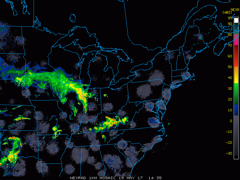
Radar loop of the Northeast US; courtesy College of DuPage, NOAA
A cold front is pushing towards the east coast and scattered showers and thunderstorms are now popping in areas to the west of the I-95 corridor. The coverage of showers and thunderstorms should increase over the next couple of hours and can impact the I-95 corridor from mid-afternoon to late evening. While many areas will not get hit, any storm can produce gusty winds, cloud-to-ground lightning and brief downpours. The chances for showers and thunderstorms will tend to increase as one goes farther southwest along I-95 with DC, for example, having a better shot than New York City.
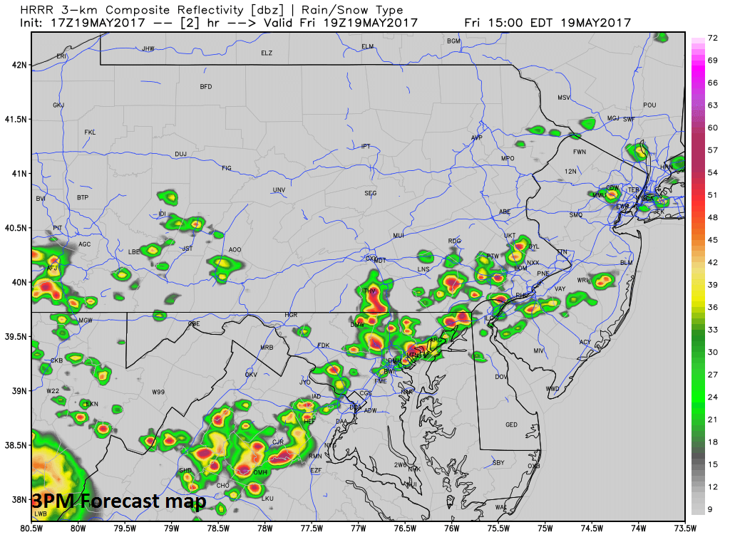
3PM forecast map of radar reflectivity from the HRRR model; courtesy Weather Bell Analytics, NOAA
The most recent run of a high-resolution model (HRRR) indicates there is a threat in some areas within the next couple of hours and the threat will still be around later this evening. Late tonight, cooler air will filter into the region – ending the threat for showers and thunderstorms – and the weekend will turn out much cooler than the last three days.

9PM forecast map of radar reflectivity from the HRRR model; courtesy Weather Bell Analytics, NOAA
Meteorologist Paul Dorian
Vencore, Inc.
vencoreweather.com