11:50 AM | **An active and interesting next 24 hours with heavy rain and strong-to-severe thunderstorms a threat…remnants of tropical storm headed our way**
Paul Dorian
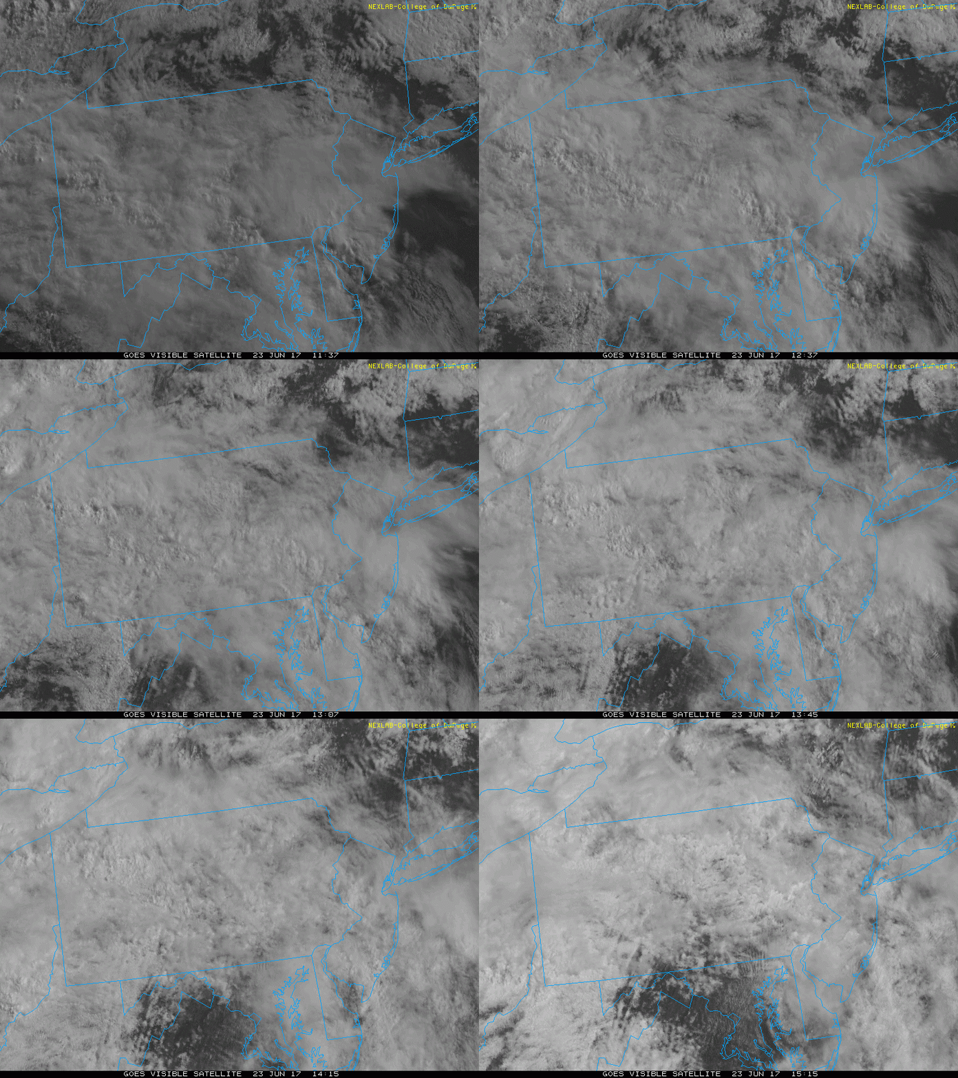
Breaks in the clouds appear on the mid-day visible satellite imagery loop and this will destabilize the atmosphere this afternoon raising the chance of thunderstorm formation; courtesy College of DuPage, NOAA
Overview
The remains of Tropical Storm Cindy are resulting in heavy rainfall today across portions of the Mississippi and Tennessee Valley and this area of moisture is headed to the Mid-Atlantic region. The tropical moisture associated with Tropical Depression Cindy should arrive in our area late tonight and early Saturday and some heavy rainfall is likely and there can be strong-to-severe thunderstorms mixed in. In addition to the tropical storm-related rainfall expected late tonight and early Saturday, an approaching upper-level wave of energy will destabilize this afternoon and the result will likely be scattered showers and thunderstorms into the early evening and some of these storms can be on the strong-to-severe side. Bottom line, it looks like an interesting period from this afternoon to about mid-day on Saturday in the DC-to-Philly-to-NYC corridor. The good news is that most of the rainfall will pull out of here by tomorrow afternoon and the weekend should close out on a pretty nice note from later tomorrow through Sunday.
Afternoon/early evening
There are pockets of clearing on the mid-day satellite imagery loop and this should allow for some sunshine in parts of the Mid-Atlantic region this afternoon. This combined with an approaching upper-level wave of energy will help to destabilize the atmosphere this afternoon. Combine that increasing instability with very high amounts of low-level moisture and a shower or thunderstorm can pop up at just about any time in the I-95 corridor during the PM hours and rain can come down hard for a brief time. In addition, scattered strong-to-severe thunderstorms cannot be ruled out for later today into early tonight with potential damaging wind gusts, hail, downpours and lightning.
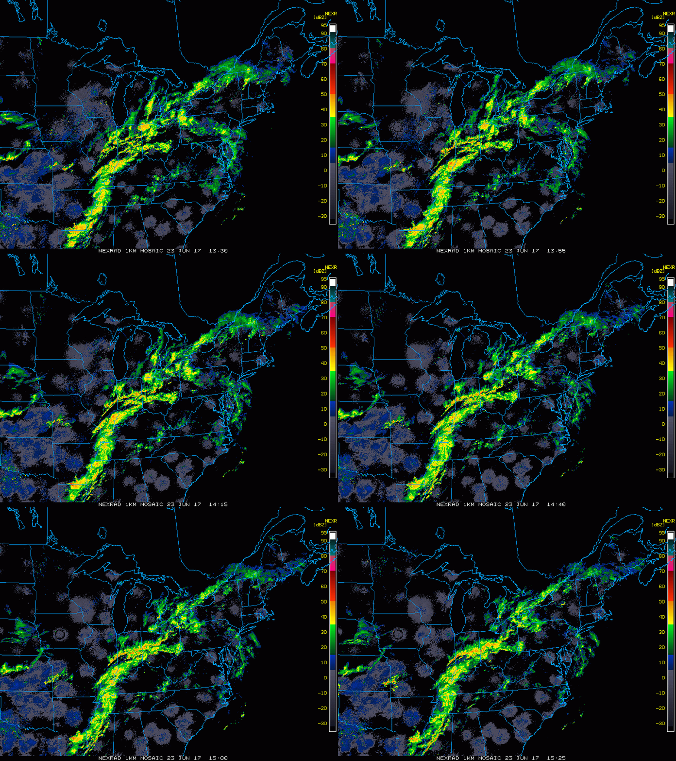
Mid-day radar loop features a bit of a rotation of the echoes across western Tennessee and southwestern Kentucky - all associated with Tropical Depression Cindy; courtesy College of DuPage, NOAA
Late tonight/Saturday morning
Tropical Depression Cindy was located this morning over the Lower Mississippi Valley and it is headed towards the Mid-Atlantic region. Deep tropical moisture is flowing northward at mid-day associated with this tropical system and its arrival here late tonight/early Saturday should bring numerous showers to the DC, Philly, NYC corridor along with possible embedded strong-to-severe thunderstorms; especially, to the south of the PA/MD border. Some of the rain late tonight and early Saturday will be heavy at times and flash-flooding may become a concern; especially, in any area that gets hit hard later today or early tonight.
Late Saturday into early next week
There can be a residual shower or thunderstorm tomorrow afternoon, but overall improvement will begin during the PM hours and then Sunday should turn out to be a pretty nice day with lowering humidity as we close out the weekend. It’ll turn a bit cooler early next week in the Mid-Atlantic region and actually quite a bit below-normal across the Midwest and Central Plains. In addition, even the currently very hot desert Southwest US will experience cooler-than-normal weather as the month of June winds down.
NASA/Wallops next rocket launch attempt comes tomorrow night
No guarantees here, but NASA will try for the 15th time (yes, the 15th time) to launch a sounding rocket at Wallops Island, Virginia which would generate colorful artificial clouds at very high altitudes and visible in the DC (look southeast), Philly and New York City (look south-to-southeast) metro regions. The window of opportunity for launch is between 9:07 and 9:22 PM. The artificial clouds should begin to form about 5 minutes after launch. Follow the countdown on the Wallops Ustream site - coverage is set to begin at 8:30 PM. For the full story on the purpose of the mission click here.
Meteorologist Paul Dorian
Vencore, Inc.
vencoreweather.com
Extended video discussion:


