
10:15 AM | *”Meteorological” summer has begun and 90 degrees is on the horizon*
Paul Dorian
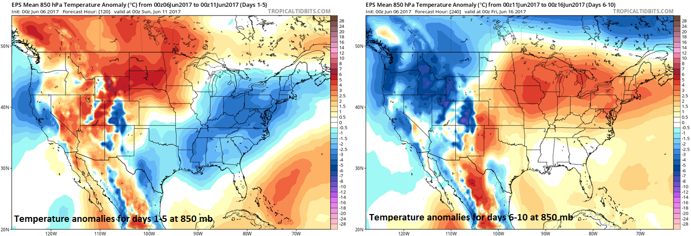
00Z Euro ensemble model forecast maps of 5-day average 850 mb temperature anomalies for days 1-5 (left) and days 6-10 (right); maps courtesy tropicaltidbits.com
Overview
“Astronomical" summer begins on June 21st this year and the exact date and time are determined by the Earth’s position relative to the sun. Meteorologists use the annual temperature cycle to determine the time frame for the seasons by splitting the year into four quarters with the statistically hottest three months of June, July and August considered to be “meteorological" summer. Whatever the declaration, the next several days will bring about a dramatic change in temperatures to the Mid-Atlantic region with much cooler-than-normal conditions today, tomorrow and Thursday and then a big warm up for the weekend and much of next week. This upcoming warm up is quite likely to bring the return of 90+ degree highs to the DC-to-Philly-to-NYC corridor.
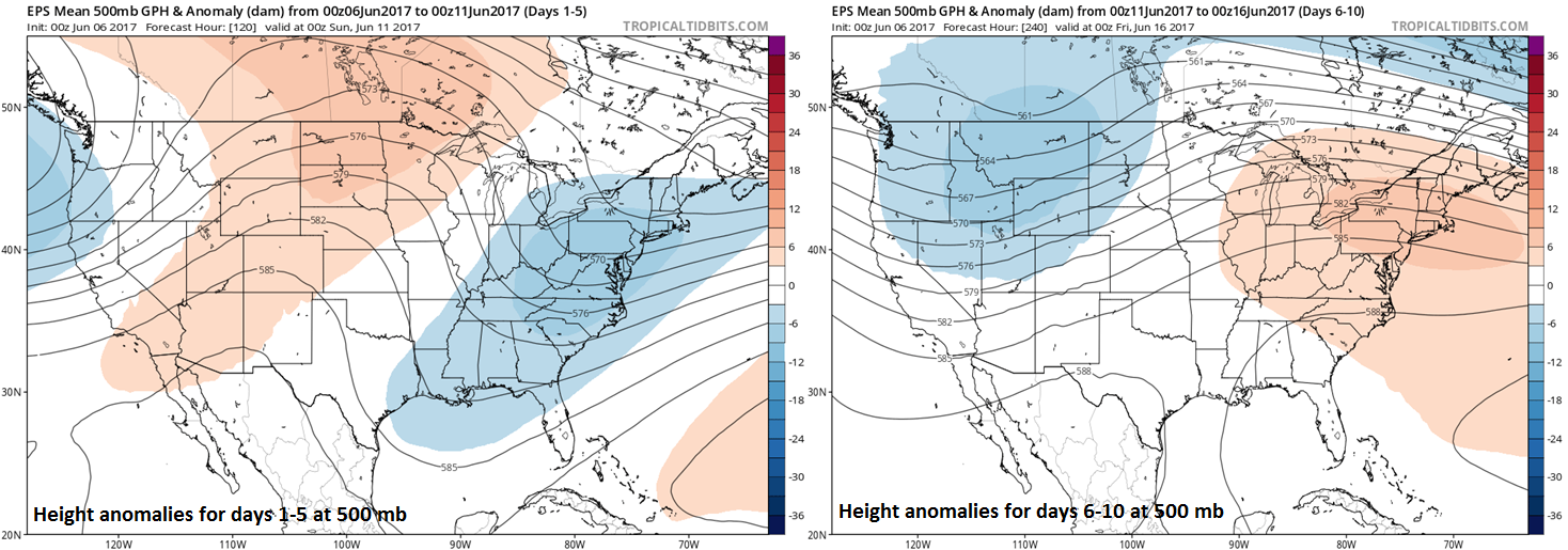
00Z Euro ensemble model forecast maps of 5-day average 500 mb height anomalies for days 1-5 (left) and days 6-10 (right); maps courtesy tropicaltidbits.com
Discussion
For the past several weeks, deep upper-level low pressure has consistently been positioned over the Northeast US and this type of pattern has led to lots of rainfall and generally cooler-than-normal weather conditions. For example, the month of May turned out cooler-than-normal in DC (-0.5°F), Philly (-0.8°F) and New York City (-1.3°F) and wetter-than-normal in all three metro regions (DC +1.56”, Philly +2.62”, NYC +2.19”). In fact, this same type of weather pattern exists today with deep upper-level low situated over the Northeast US and it’ll produce another period of unsettled weather and cooler-than-normal conditions in the I-95 corridor. In fact, temperatures on Wednesday and Thursday will likely struggle to reach 70 degrees in DC and be confined to the 60’s for highs in Philly and NYC – quite a bit below normal for this time of year (DC normal high is 81°F, Philly normal high is 80°F, NYC normal high is 76°F).
By the early part of the upcoming weekend, high pressure ridging in the upper part of the atmosphere will begin to edge into the Great Lakes region and then into the Northeast US later in the weekend. This significant change in the upper atmosphere from deep low pressure to stronger-than-normal high pressure ridging will cause a dramatic change in surface air temperatures. Temperatures on Saturday are likely to reach 80 degrees for highs in much of the I-95 corridor, then climb to well up in the 80’s on Sunday, and then likely to the 90 degree mark in many areas on Monday. This warm up is likely to last at least through the middle part of next week.
Meteorologist Paul Dorian
Vencore, Inc.
vencoreweather.com