11:05 AM | *Threat later today for heavy rainfall and strong-to-severe thunderstorms in areas north of PA/MD border...threat actually becomes more widespread on Friday*
Paul Dorian

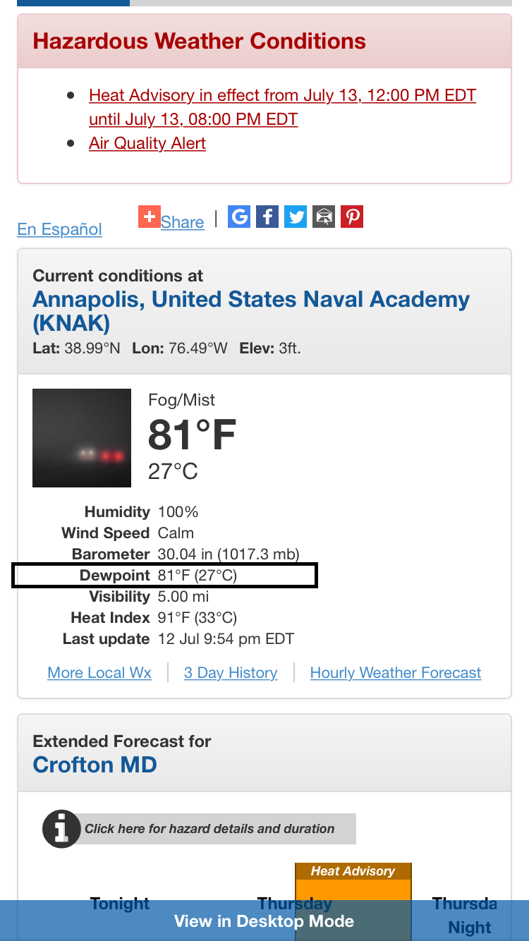
Quite an incredible dew point reading of 81 degrees recorded last night in Annapolis, Maryland; courtesy National Weather Service, NOAA/EMC employee Tracey Dorian
Overview
The atmosphere is hot and excessively humid in the Mid-Atlantic region and all it will take to “squeeze out” that moisture is some lifting action that can be provided by a surface frontal system or an upper-level wave of energy. While there will be some heavy showers and strong thunderstorms later today and tonight in parts of the I-95 corridor, the best chance of heavy rain and strong-to-severe thunderstorm activity for all areas appears to be unfolding for the Friday afternoon and evening hours. A surface cold frontal system and an upper-level wave of energy will cross the Great Lakes over the next 24 hours and likely provide enough lifting around here later tomorrow for some heavy rainfall and possible strong-to-severe thunderstorms.

06Z GFS forecast map of 500 mb vorticity for 2pm on Thursday; map courtesy tropicaltidbits.com, NOAA/EMC
Discussion
Whenever the atmosphere is excessively humid, it can produce some heavy rainfall and that is certainly a threat for any part of the Mid-Atlantic region over the next 24-36 hours. In fact, it is about as humid as it gets around here at any time of year with an incredible dew point reading last night of 81 degrees in Annapolis, Maryland and this example is pretty representative of the high moisture content that currently exists all along the I-95 corridor (the higher the dew point temperature, the higher the moisture content of the air mass). Clouds will tend to thicken this afternoon in the I-95 corridor and there can be some heavy showers and strong thunderstorms later today and tonight; primarily, in those areas north of the PA/MD border. Any shower or thunderstorm storm that forms later today can produce heavy rainfall in a short period of time given this excessive moisture content of the atmosphere.

06Z GFS forecast map of 500 mb vorticity for 2pm on Friday; map courtesy tropicaltidbits.com, NOAA/EMC
Perhaps an even more widespread chance of heavy rainfall and strong-to-severe thunderstorms for the DC-to-Philly-to-NYC corridor is to come later tomorrow and tomorrow night when a surface cold frontal system and a wave of energy in the upper atmosphere (circled area above) approaches the Mid-Atlantic region from the Great Lakes. The combination of these systems will produce deep wind shear, lifting action and strong upward motion in the atmosphere – all of which will enhance the chances for heavy rainfall and strong-to-severe thunderstorm activity later tomorrow and tomorrow night. Any storm that forms during the PM hours on Friday can include torrential downpours, damaging wind gusts and perhaps there will even be an isolated tornado or two. Don't be surprised to see some "severe thunderstorm" and "flash flood" watches put up later today, tonight and tomorrow by the National Weather Service for much of the Mid-Atlantic region.
Weak high pressure will build into the region this weekend and the overall weather pattern will improve, but do not expect a cool and refreshing type of air mass. It’ll be quite warm on Saturday with sunshine and then pretty hot on Sunday, but the rain chances will be far less this weekend than what is expected over the next 24-36 hours.
Meteorologist Paul Dorian
Vencore, Inc.
vencoreweather.com
Video discussion: