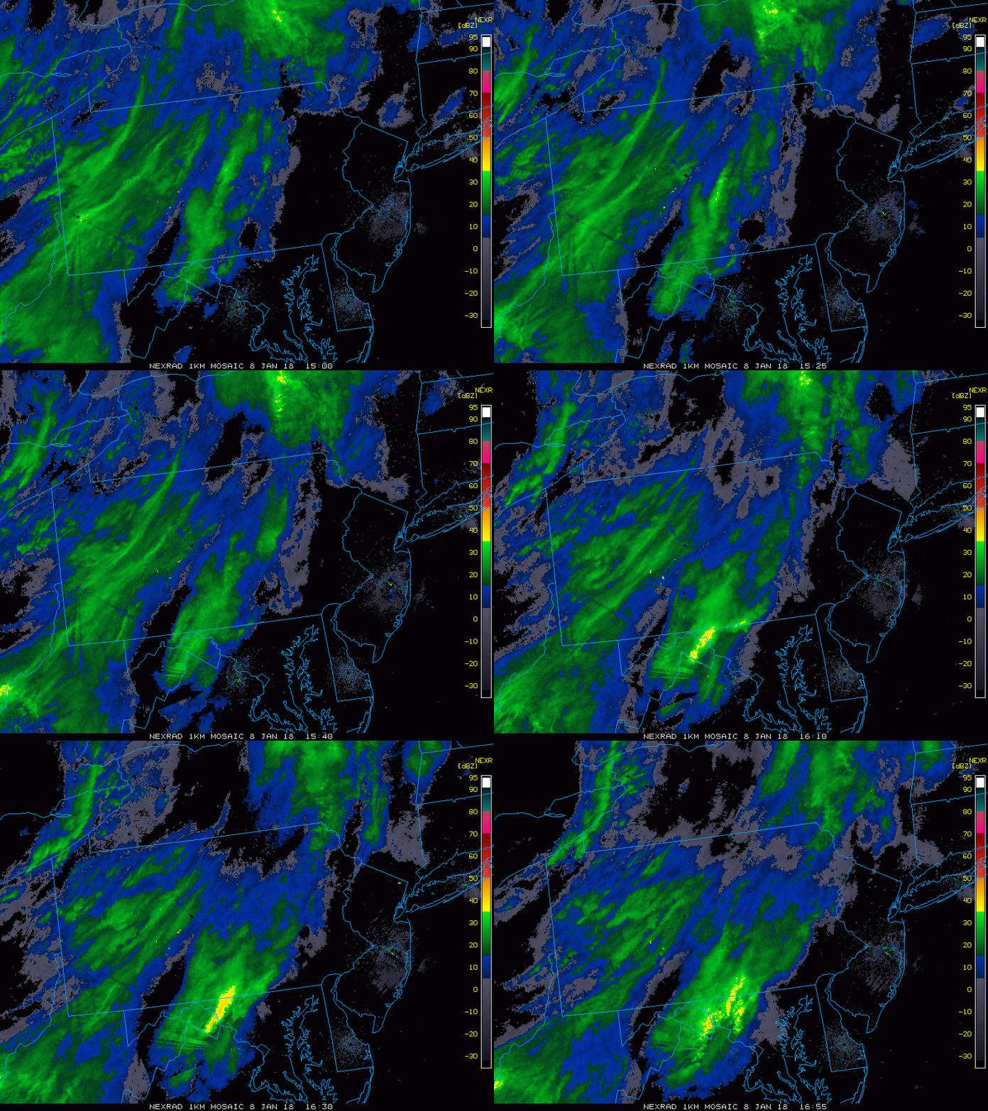
Monday 12:30 PM | *Precipitation closing in on the DC-to-Philly corridor*
Paul Dorian
Latest radar loop with precipitation closing in on the DC-to-Philly corridor, yellow banding on radar probably indicates where ice pellets are falling as they generally result in brighter echoes; images courtesy College of DuPage, NOAA
Overview
The ground is very cold and there is some precipitation closing in on the DC-to-Philly corridor – not a great combination for the late day commute. A mix of freezing rain and sleet is likely to reach the DC metro region before 1 PM or so and a mix of snow, sleet and/or freezing rain is likely to reach the Philly metro region before 2 PM or so.
High-resolution model forecast map at 1 PM with ice (i.e., sleet, freezing rain) represented by the pink and snow is in blue; courtesy NOAA/EMC, tropicaltidbits.com
Details
Precipitation is closing in on the DC-to-Philly corridor at mid-day and is moving in a general west-to-east fashion. In this particular case, the more the precipitation falls in the form of snow, the better, as ice is potentially more dangerous on the roadways. The chances for snow are better north of the PA/MD border, but even in those areas, the precipitation is likely to become mixed. Farther to the north, the NYC metro region is likely to have predominately snow which is rather good news for them as it should only amount to an inch or less.
High-resolution model forecast map at 2 PM with ice (i.e., sleet, freezing rain) represented by the pink color and snow is in blue; courtesy NOAA/EMC, tropicaltidbits.com
Temperatures have climbed to the freezing mark at noon in much of the DC metro region, but are still in the 20’s across the Philly metro region. In all areas, the ground has been very cold for an extended period of time and even with temperatures slightly above freezing, there can be some icing on roadways later today. Temperatures tomorrow afternoon should reach the 40's in many parts of the I-95 corridor and, just as a word of caution, this "thaw" could lead to an explosion of potholes.
Meteorologist Paul Dorian
Vencore, Inc.
vencoreweather.com


