
3:15 PM | **Large area of heavy rain associated with Tropical Storm Michael headed towards the DC-to-Philly-to-NYC corridor (and points east to the coast)**
Paul Dorian

Latest radar loop shows clearly the heavy rain circulating around the center of Tropical Storm Michael; courtesy NOAA
Tropical Storm Michael is now located over central North Carolina and moving rapidly northeastward at 23 mph with max sustained winds of 50 mph. Torrential rains circulating around the center of the tropical storm are now closing in on the DC metro region and this large blob of moisture will continue moving northeastward over the next few hours. A strong cold front is also pressing east at this time and is combining with moisture from Michael to generate bands of showers and thunderstorms in the interior sections of the Mid-Atlantic region.
The result of all this will be heavy rain late today and tonight in the DC-to-Philly-to-NYC corridor where flash flooding can develop. The highest rain totals are likely to extend from SE VA to the Delmarva Peninsula to southern NJ, but even in the immediate I-95 corridor there will be heavy rainfall and potential flooding issues. Winds could get very gusty as well tonight with 50+ mph wind gusts possible along coastal sections of NJ and the Delmarva Peninsula and there are likely to be embedded thunderstorms as the front and remains of Michael pass through the area.
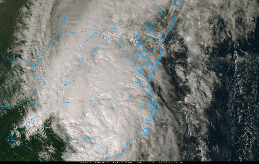
Latest satellite image of Tropical Storm Michael; courtesy NOAA
Once this front and tropical system clear through the area, a major change in the air mass will take place beginning on Friday. It’ll become much cooler and less humid compared to recent days and overnight lows this weekend will drop into the 40’s for the first time this season and upper 30’s is not out of the question in some spots early Sunday morning. There will be a weak disturbance passing through late tomorrow night and early Saturday and it could produce some shower activity as we begin the weekend.
Meteorologist Paul Dorian
Perspecta, Inc.
perspectaweather.com