12:55 PM | **Numerous cold air outbreaks for the eastern US during the second half of October**
Paul Dorian

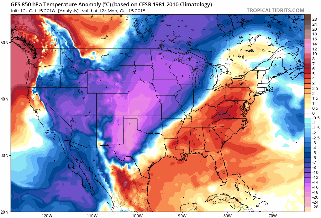
12Z GFS forecast of 850 mb temperature anomalies during the next ten days with numerous cold air outbreaks reaching the eastern US from Canada; courtesy NOAA/EMC, tropicaltidbits.com
Overview
It is not unusual this time of year to see a strong tropical system become the catalyst for a significant pattern change and indeed, the passage of Hurricane Michael late last week has seemingly opened the flood gates for cold air masses to drop southeastward into the eastern US from Canada. Canada suffered through one of their coldest Septembers on record, but the widespread cold was largely bottled up north of the border. The pattern shift that began after the passage of Hurricane Michael looks like it is going to result in numerous cold air outbreaks into the eastern US during the second half of October.

The month of September was unusually cold across Canada (boxed region) and one of the coldest in many years; courtesy NOAA, Weather Bell Analytics
Details
A strong cold front merged with the remains of Hurricane Michael last Thursday and following the passage of both of these systems the atmosphere became cleansed of all the recent unseasonable warmth and high humidity. This past weekend featured low temperatures in the 40’s in most areas for the first time this season and it was a struggle to climb through the 50’s in most spots. After a milder day today to start the new work week with highs not far from 70 degrees, a much cooler air mass will drop temperatures some 10-15 degrees for Tuesday’s afternoon highs. Another strong cold front will arrive late Wednesday with very noticeable winds and Thursday promises to be the coldest day so far this season with highs struggling to reach the 50 degree mark (normal high in Philly is now 67 degrees and 69 degrees at DCA).

It’ll turn much cooler tomorrow in the Mid-Atlantic region, even colder on Thursday, and perhaps the coldest weather will take place on Sunday; courtesy NOAA, tropicaltidbits.com
Yet another strong cold front will arrive in the Mid-Atlantic region this weekend and this cold air outbreak means business. It is quite likely going to result in the coldest day so far on Sunday and there very well can be snow flurries and snow showers in many higher elevation locations of the Northeast US. Additional cold air outbreaks will follow for the latter stages of the month of October dropping southeastward from central Canada.
Meteorologist Paul Dorian
Perspecta, Inc.
perspectaweather.com
Video discussion: