11:20 AM | ****The first significant winter storm of the season and there will be bursts of heavy precipitation****
Paul Dorian
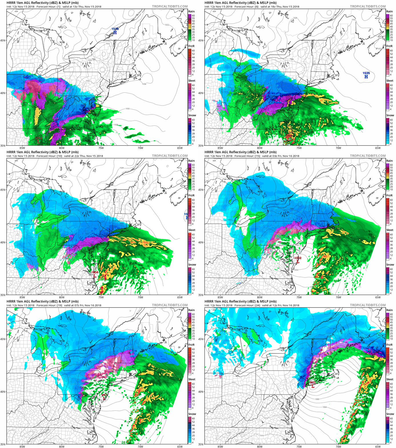
High-resolution forecasts maps for this storm from early Thursday to early Friday; courtesy NOAA/EMC (HRRR model), tropicaltidsbits.com
Overview
The first significant winter storm of the season has arrived in the Mid-Atlantic region as low pressure begins to intensify along the Carolina coastline. Snow accumulations of a couple of inches have been already reported in some suburban areas of Washington, D.C. – their first measureable November snow since 1996 – and the snow has now begun in the Philly metro region and is on its way to NYC. A wintry mix of precipitation can be expected in many areas during the afternoon hours as surface temperatures have trouble rising above the freezing mark. This is a very energetic storm system and there will be bursts of heavy precipitation into early Friday morning which can result in a quick changeover from sleet/freezing rain-to-snow and potential quick accumulations.
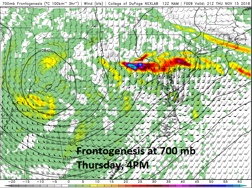
Possible heavy burst of precipitation later today associated with 700 mb frontogenesis; courtesy NOAA/EMC (NAM model), College of DuPage
Discussion
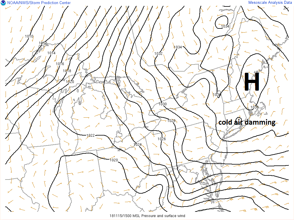
Snow has already accumulated in the DC metro region and will do so in the Philly and NYC metro region during the next several hours. While plain rain can develop in areas just to the south and east of the big cities, frozen precipitation is likely to continue through much of the day in the big cities and especially across the northern and western suburbs as temperatures hover rather close to the freezing mark. As a result, slippery road conditions can be expected to last right through the day and into tonight; especially, in many suburban locations given the reluctance of the entrenched cold, dense air mass to give up its ground (anchored by strong high pressure to the north).
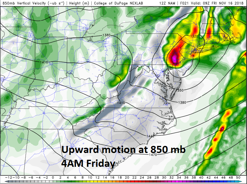
Possible heavy burst of precipitation later tonight associated with 850 mb upward motion; courtesy NOAA/EMC (NAM model), College of DuPage
This unfolding major coastal storm is supported by energy at all levels of the atmosphere and there can be bursts of heavy precipitation later today and even as late as early Friday morning. Models generally agree on a very impressive region of “frontogenesis” (temperature gradient) that will consolidate in the Mid-Atlantic region later today and push slowly northward. This boundary zone can result in a burst of heavy precipitation later this afternoon and early this evening in many spots along the DC-to-Philly-to-NYC corridor. Any burst of heavy precipitation can see a quick changeover from sleet/freezing rain-to-snow as the atmosphere will tend to dynamically cool potentially leading to quick accumulations.
Latest surface map features a classic setup for snow in the I-95 corridor with strong high pressure to the north and “cold air damming”; courtesy NOAA
Later tonight and early Friday morning, there will be an area of strong upward motion sliding over the I-95 corridor associated with an upper-level low and this too can result in a burst of heavy precipitation and a quick change from liquid-to-frozen. Overall snow accumulation estimates for the DC metro region are a coating to an inch or two in the District and 2-4 inches in the northern and western suburbs; 3-5 inches throughout the Philly and NYC metro regions. Even heavier snowfall amounts of 6-12 inches are expected across interior, higher elevation locations (e.g., central PA) from this the first winter storm of the season.
A couple of final cautionary notes: (1) there is the chance that freezing rain lasts for quite awhile in some spots and, if gusty winds develop during the latter half of the storm as expected, that could become a problem for some tree limbs and branches, (2) localized flooding is also a threat in some areas as plain rain could fall heavily at times on top of snow, ice and fallen leaves.
Meteorologist Paul Dorian
Perspecta, Inc.
perspectaweather.com
Video discussion:


