
1:25 PM | *There is a snow threat for late Saturday*
Paul Dorian
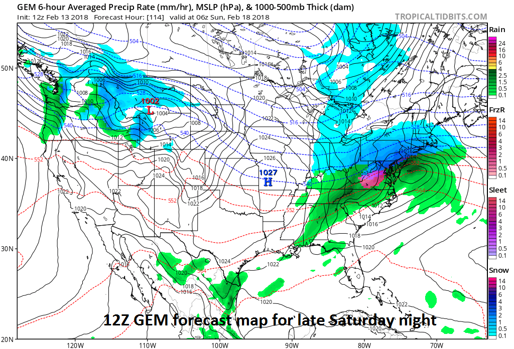
Canadian model features snow for much of the Mid-Atlantic region late Saturday; map courtesy NOAA/EMC, tropicaltidbits.com
Overview
Even in an overall mild weather pattern, there can be snow threats this time of year. Indeed, the I-95 corridor may experience temperatures near 70 degrees on Thursday, but then a strong cold front will bring dramatically colder temperatures by the weekend and low pressure is going to try to push in this direction from the southern states. If that system can make it this far north – and this is on the table, but not yet certain – then it may be just cold enough for some snow in the region over the weekend before it warms up again next week. Longer term, there are signs for a return to more sustained cold in the eastern US come late February and March.
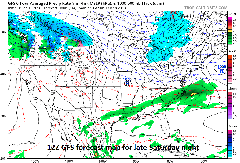
12Z GFS computer forecast map for late Saturday has no snow in the Mid-Atlantic region - but this is likely to change in coming days; map courtesy NOAA/EMC, tropicaltidbits.com
Details
A warm front will pass through the region on Wednesday night and likely bring some showers to DC, Philly and NYC. Following the passage of the warm front, temperatures on Thursday could soar to near 70 degrees in DC and well into the 60’s in the Philly and NYC metro regions. However, this warm up will be rather short-lived as a strong cold front arrives on Friday – likely with additional rainfall – and then colder air pushes by the early part of the weekend.
At the same time the cold air arrives early this weekend, low pressure will form in the southern states and likely make a run for the Northeast US. If this system can make it this far north, the cold may be just enough for snow to fall in the I-95 corridor; especially, in the colder suburbs to the north and west of the big cities. Computer forecast models are all over the place with this potential system with a range of an all-out snowstorm (e.g., 12Z Canadian) for parts of the I-95 corridor to nothing at all in the latest 12Z GFS. The 12Z Euro is definitely more in-line with the threatening look of the Canadian model and, to be fair to NOAA's GFS model, it's 06Z forecast had a similar "threat of snow" look to it in this region. The overall pattern that is evolving does suggest to me that low pressure could indeed ride up along a frontal boundary zone and into this region over the weekend and the threat for snow is real.
Stay tuned.
Meteorologist Paul Dorian
Vencore, Inc.
vencoreweather.com