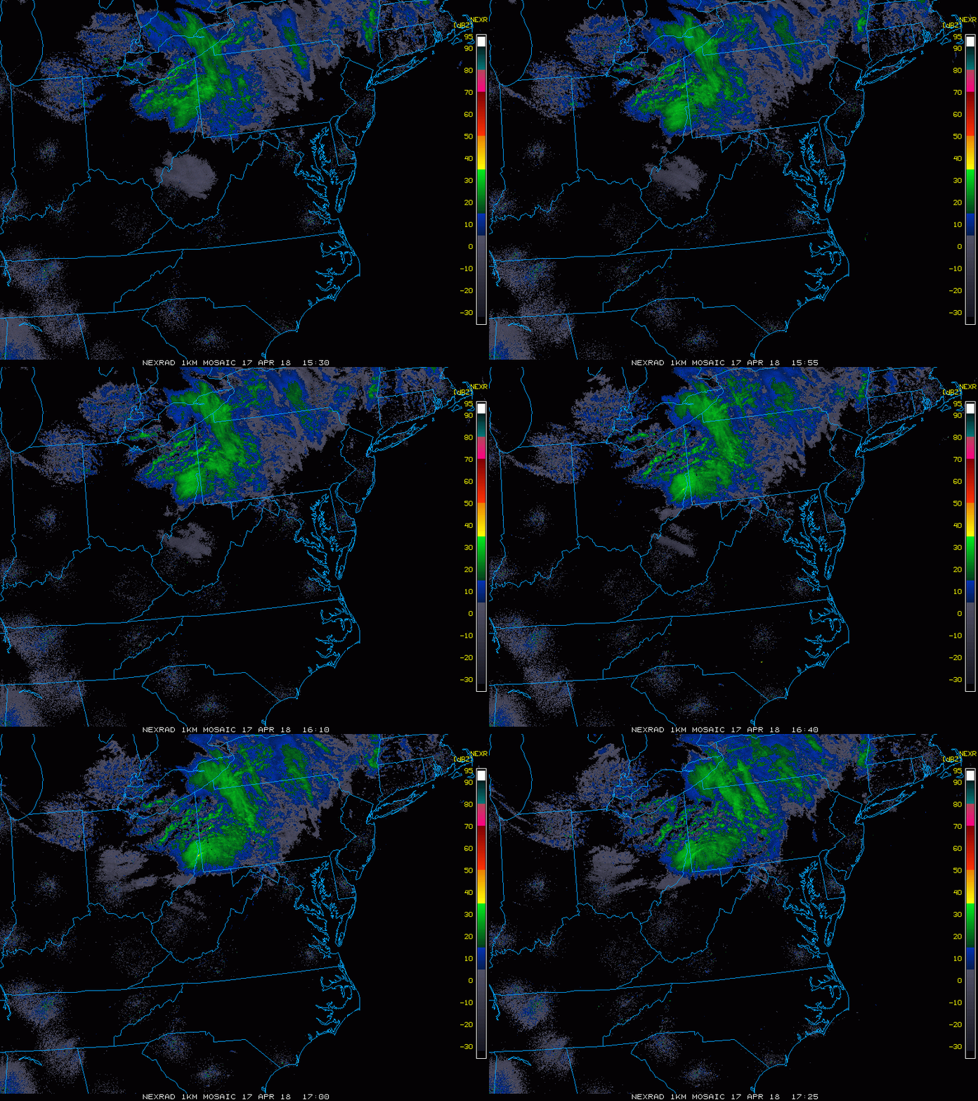
1:55 PM | *Don’t be surprised to see a few snowflakes later today and near freezing temperatures late tonight*
Paul Dorian
Radar loop in the early afternoon featuring lots of shower activity breaking out; especially, north of the PA/MD border. Many of these areas in upstate Pennsylvania are seeing snow and there can be some flakes seen around here later today. courtesy College of DuPage, NOAA
A vigorous upper-level feature is dropping southeastward from the Great Lakes region this afternoon and headed right over the DC-to-Philly-to-NYC corridor. As a result, showers are breaking out generally in areas north of the PA/MD border and they should head towards Philly and NYC later in the day and a couple of showers could very well sneak as far south and east as the DC metro region. Much colder-than-normal air is entrenched in the region and there can be some snowflakes seen around the big cities later today into early tonight.
The culprit behind the rain and snow shower activity is a strong upper-level wave of energy which is now moving right over the DC, Philly, NYC corridor; courtesy NOAA/EMC, tropicaltidbits.com
Once this upper-level feature passes by early tonight, it should dry out and temperatures will drop sharply and late night lows in many suburban locations to the north and west of DC, Philly and NYC could see freezing conditions by early tomorrow morning with patchy frost possible. As a precaution, it is probably a good idea to shelter any sensitive plants early tonight if at all possible.
The colder-than-normal pattern will continue around here until the end of the month of April - but it could be worse. Places like Wisconsin and Minnesota have not only had unusual cold, but also historic snowfall in many spots. For example, Green Bay, WI had nearly two feet of snow when we were enjoying our heavy rain event earlier this week and this was not only the biggest snowstorm in April for many Wisconsin towns, but the biggest snowstorm ever in some spots – and more substantial accumulating snow is on the way for the Upper Midwest over the next couple of days.
Meteorologist Paul Dorian
Vencore, Inc.
vencoreweather.com


