2:40 PM | *Strong-to-severe thunderstorm threat later today/early tonight in DC-to-Philly corridor*
Paul Dorian

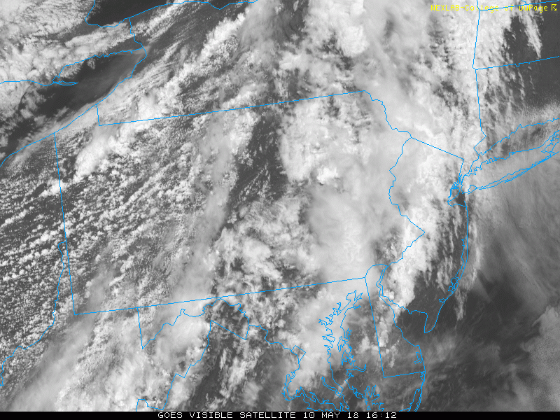
Loop of the latest visible satellite images with an explosion of thunderstorms in the western Mid-Atlantic region; images courtesy NOAA, College of DuPage
Thunderstorms are increasing in intensity and coverage across western sections of the Mid-Atlantic region and they are headed towards the I-95 corridor region from DC to Philly. These thunderstorms are associated with a cool frontal system which is slowly dropping southeastward over the Ohio Valley. With the heating in the lower atmosphere this afternoon in the I-95 corridor; especially, to the south of the PA/MD border, there should be enough instability to support the convection now firing up in places like central and western Pennsylvania. The timetable for this threat of strong-to-severe thunderstorm activity is 3-8 pm in the DC metro region and 4-9 pm in the Philly metro region. The greatest threat from these potential strong-to-severe thunderstorms will be damaging wind gusts and hail. In areas to the north of the Philly metro region (e.g., New York City) and at the coastline, the atmosphere is more stable with persistent cooler temperatures and the threat for severe weather is considerably lower.

Mid-afternoon radar map shows location of thunderstorms across the western Mid-Atlantic region; map courtesy NOAA, College of DuPage
The same cool frontal system will stall out just to our south and east later tomorrow and this will set the stage for an unsettled weekend; especially, to the north of the PA/MD border. Additional rounds of showers and thunderstorms are possible this weekend in the I-95 corridor and this threat will continue for part of next week as well. Depending on the movement of this meandering front this weekend, it could turn out to be quite warm and humid on Saturday and then noticeably cooler on Sunday, Mother’s Day.

High-resolution model forecast map of radar echoes as of 5pm; courtesy NOAA, tropicaltidbits.com
Meteorologist Paul Dorian
Vencore, Inc.
vencoreweather.com