
11:35 AM | **Hottest day of the year so far likely coming on Monday for DC, Philly, NYC**
Paul Dorian

06Z GFS surface (2-m) temperature forecast map for Monday afternoon, June 18th; courtesy NOAA/EMC, tropicaltidbits.com
Overview
So far this year, 90 degree days have been relatively few and far between in the I-95 corridor. The highest temperature of the year in Philly and DC actually came in early May with 91 degrees measured at Reagan National Airport (DCA) on May 2nd and 91 degrees at Philly Airport (PHL) on May 3rd. These high temperature marks of the year should easily be surpassed on Monday, June 18th, with 95-100 degrees on the table from DC-to-Philly-to-NYC. The good news is that the excessive heat looks like it’ll be a one-day affair on Monday with somewhat cooler conditions likely on Tuesday and Wednesday.

06Z GFS forecast map of 500 mb height anomalies for Monday morning, June 18th, with excessive ridging (shown in orange) over the Mid-Atlantic region; courtesy NOAA/EMC, tropicaltidbits.com
Details
After a very refreshing day on Friday to close out the work week, high pressure ridging will build eastward this weekend from the Midwest into the Mid-Atlantic region. As a result, high temperatures will climb in the DC-to-Philly-to-NYC corridor from the upper 70’s on Friday to the mid-to-upper 80’s by Sunday afternoon.
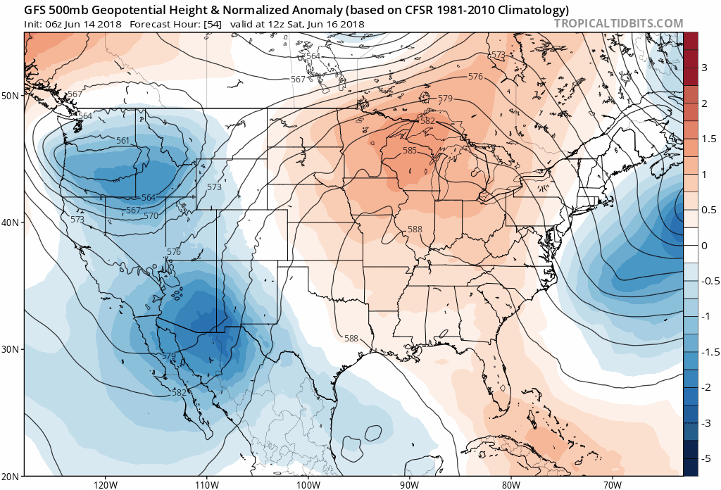
06Z GFS forecast maps of 500 mb height anomalies from Saturday morning (forecast hour 54) to Monday morning (forecast hour 102) with high pressure ridging reaching its peak relative-to-normal on Monday, June 18th, in the Mid-Atlantic region; courtesy NOAA/EMC, tropicaltidbits.com
By Monday, the anomalous high pressure ridging in the upper atmosphere will reach a peak relative-to-normal and this will likely lead to excessive heat in DC, Philly and New York City and humidity will become quite uncomfortable as well. There is the potential on Monday for highs to reach the 95-100 degree range in parts of the I-95 corridor and records could fall in several spots along the eastern seaboard.
The good news is that the high pressure ridging will begin to be surpressed on Tuesday as a cool front approaches the region from the northwest and highs should be noticeably lower than those experienced on Monday. As the front approaches the area, the chances for showers and thunderstorms will increase from Tuesday into Wednesday and there is the potential for another very pleasant air mass to arrive in the Mid-Atlantic region by the end of the next week.
Meteorologist Paul Dorian
Perspecta, Inc.
perspectaweather.com
Extended morning video discussion on the excessive heat possibilities for next Monday: