1:30 PM Saturday | ***A prolonged event and a "DC Special"...accumulating snow about to begin in much of the Mid-Atlantic region...DC's biggest of the year so far***
Paul Dorian

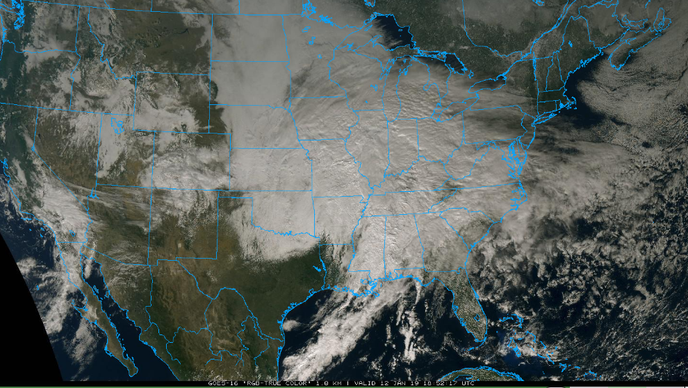
Early afternoon “true color” satellite image of the gathering storm; courtesy NOAA, College of DuPage
Overview
A large area of snow currently extends from the central Plains to the Ohio Valley and it is closing in on parts of the Mid-Atlantic region. There will be two stages to this weekend snow event with overrunning and jet-streak induced light-to-moderate snow later today and early tonight. By late tonight and for the day on Sunday, low pressure induced snow aided by upper-level energy will produce heavier snow; primarily, in the region near and south of the PA/MD border. In fact, the heaviest snow accumulations in this event are likely to come in the region from Virginia-to-Delmarva Peninsula-to-southern New Jersey. This is looking like a prolonged event with snow possibly lasting until later tomorrow night in some parts of the Mid-Atlantic.

12Z GFS forecast map for Sunday morning with initial low pressure over Tennessee and snow (in blue) throughout much of the Mid-Atlantic; courtesy NOAA, tropicaltidbits.com
Details
In terms of snowfall, the New York City region may very well escape with little to no snow in this weekend event…maybe a coating to an inch, 1-4 inches are likely in the Philly metro region beginning early tonight, and 6-10 inches are likely in the DC metro region beginning by mid-to-late afternoon in many spots. The snow will have trouble reaching the ground at the onset around here as the low-level air is so dry (and cold) with dew points in the single digits across, for example, southeastern Pennsylvania. The radar may actually make it appear that it should be snowing outside at the onset while nothing is actually reaching the ground (known as virga). The snow will begin to reach the ground once the lower levels of the atmosphere become somewhat better saturated.

Early afternoon radar map with large swath of snow (in blue) extending from the central Plains to the Ohio Valley; courtesy WSI, Inc., NOAA
In the Philly and DC metro regions, the higher amounts in the estimated snowfall accumulation ranges will generally occur to the west and south of the city and the lower amounts to the north and east. The snow will only slowly wind down from northwest-to-southeast on Sunday…likely extending until the nighttime hours in much of the area from near Philly and southward to the southeastern part of Virginia and eastward to the NJ coastline - definitely a prolonged event.
Looking ahead
One final point, the snowstorm in December that hit southern parts of the Mid-Atlantic region and the one in November that hit the DC-to-NYC corridor quite hard turned out be to relatively isolated snow events. This weekend snow event, however, will be just the beginning act in what promises to a relatively long-term colder and snowier weather pattern….more on that later and on the threat of a major storm along the east coast next weekend.
Meteorologist Paul Dorian
Perspecta, Inc.
perspectaweather.com