
1:10 PM | *2019 to start off much like 2018...on the wet side*
Paul Dorian

Two separate systems will impact the Mid-Atlantic region over the next few days. The first system is rather weak and skirts the region, the second will be stronger and spread more rain here on Friday night. Courtesy NOAA/EMC, tropicaltidbits.com (surface forecast loop by the 12Z NAM from hour 12 to hour 84).
Overview
2018 turned out to be one of the wettest years ever in many spots across the central and eastern US and, in some areas, it turned out to be the wettest on record. For example, Washington, D.C. experienced its wettest year ever in 2018 and Philadelphia wound up in 2nd place just a few inches behind 2011. The first few hours of the 2019 began with some rain in the I-95 corridor and the next few days will feature more rain as tow low pressure systems pull out of the southern states and heads towards the Mid-Atlantic.

Much warmer than a year ago in the I-95 corridor for New Year’s Day.
Next few days
The New Year began with some lingering rainfall in the I-95 corridor following the soaking rain of Monday, New Year’s Eve. It also was quite a bit warmer than the prior New Year’s Day with temperatures some 40 degrees warmer than January 1st, 2018 in the DC-to-Philly-to-NYC corridor. As was the case quite often in 2018, moisture is gathering in the southern states and it is headed right towards the I-95 corridor.
Low pressure will pull out of the southern US later today and skirt the DC-to-Philly-to-NYC corridor with some rainfall late tonight and early Thursday. This system is rather weak and the northwest fringes of its precipitation shield will not result in much rainfall for the already-waterlogged I-95 corridor. A second system, however, will be stronger and it will push more rain into the area on Friday night into early Saturday and some of that rain can come down hard at times. Later Saturday, high pressure will take over and the second half of the weekend looks pretty decent from this vantage point with sunshine returning and temperatures in the 40’s.
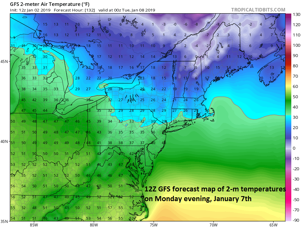
Very cold air will spread into southeastern Canada and New England early next week anchored by strong high pressure; courtesy NOAA/EMC, tropicaltidbits.com
Early next week
Looking ahead, an interesting pattern is setting up for early next week. Strong, cold high pressure will form over southeastern Canada and very cold air will slide through New England from the north. At the same time, a strong cold front will push eastward across the Great Lakes and there could be more rain here by later Monday or Tuesday. However, with the very cold air not too far away, it wouldn’t take much of a change in this pattern for frozen precipitation to threaten the Mid-Atlantic region.
Meteorologist Paul Dorian
Perspecta, Inc.
perspectaweather.com
Video discussion: