10:30 AM | *****Arctic front to arrive this afternoon in the I-95 corridor with potentially damaging wind gusts and a possible heavy snow squall…temperatures plunge to near zero by late tonight*****
Paul Dorian

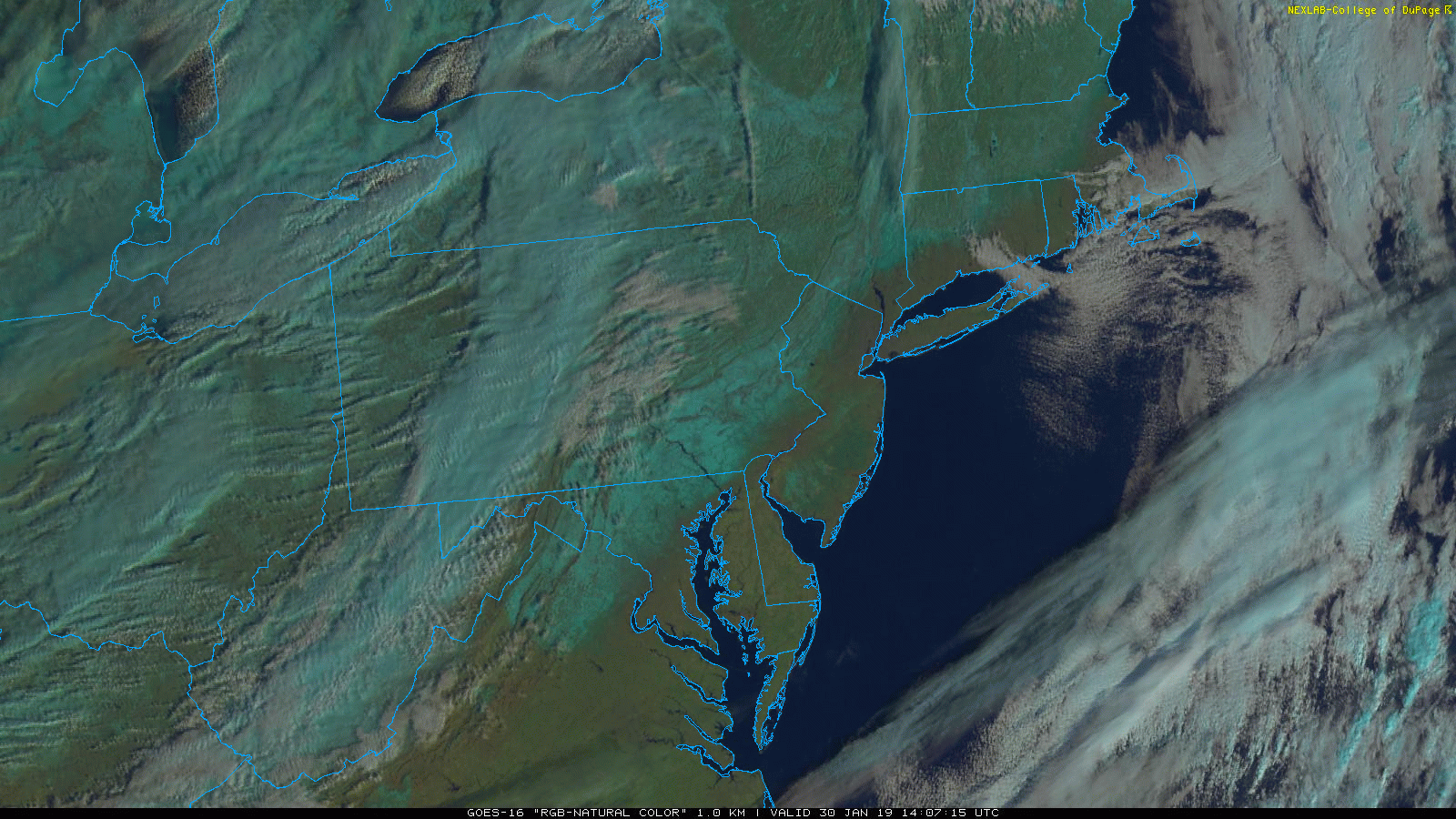
GOES-16 satellite imagery loop (natural color) with clouds associated with squall line; courtesy NOAA, College of DuPage
Arctic frontal passage this afternoon
An Arctic front will blast through the region this afternoon and it could be accompanied by potentially damaging wind gusts of 50 mph or so, scattered snow showers, and perhaps dangerous, heavy snow squalls. The combination of strong upper-level energy and “frontogenesis” enhancing the chances for snow squall activity with the most likely time period of noon-to-2PM in the DC and Philly metro regions and 2-to-4 PM in NYC. Any spot hit by a snow squall later today will see dramatically reduced visibility with near “white-out” conditions, strong winds, brief, but intense snowfall with a quick small accumulation of a coating to an inch and very slippery roads….do not drive in this!

12Z NAM surface forecast map (left) and of 850 mb “frontogenesis” (right) as of 1PM this afternoon, ; courtesy NOAA/EMC, tropicaltidbits.com
Once the front clears the region, temperatures will plunge today and early tonight reaching late night lows near zero degrees in many suburban locations along the DC-to-Philly-to-NYC corridor. Temperatures on Thursday will struggle to climb through the teens despite plenty of sunshine. Wind chills will be painfully cold both tonight and on Thursday at levels far below zero. The winds do lighten up tomorrow night, but temperatures can fall back to the single digits in some spots. A quick-hitting low pressure system could throw some accumulating snow our way on Friday afternoon; primarily, in the region from central PA south to the DC metro region (i.e., less chance for snow in NYC).

Squall (snow) line passed through State College, PA this morning dropping visibility dramatically

12Z NAM forecast map of 2-meter temperatures early Thursday morning; courtesy NOAA/EMC, tropicaltidbits.com
Upper Midwest extreme cold
Extreme cold has grinded the Upper Midwest to a virtual standstill today with most schools and businesses closed and many will be closed again on Thursday. Wind chills have reached very dangerous levels in some spots at more than 60 degrees below zero and this type of cold can cause frostbite in just a matter of a few minutes. The lowest wind chill seen this morning was -70°F in Ely, MN as a result of a temperature of -31°F and wind speed at 35 mph. There were some impressive readings from this morning with a monthly record low set in Milwaukee, WI at -22°F and an all-time record low set in Fairmont Municipal, MN at -28°F. Chicago bottomed out at -24°F this morning – three degrees short of their all-time low of -27°F set in January 20th, 1985…they’ll have another shot at that record low late tonight. Chicago’s wind chill reached -50°F this morning and it’s a lock to be the second coldest day there ever on Wednesday with an expected high of around -10°F.

Wind chills values as of 10AM Wednesday with incredibly low readings across the Upper Midwest; map courtesy hailpoint.com, Wright-Weather.com, Drudge Report
The current and recent cold air outbreaks in the Upper Midwest have played a major role in the dramatic increase of ice cover extent on the Great Lakes. For example, Lake Erie has jumped over the past ten days from 3% ice coverage to 71% - before the brunt of the current Arctic air outbreak. This is an important parameter to monitor even here in the Mid-Atlantic region as the more the ice cover there is on the Great Lakes, the less the modification in temperatures of future Arctic air outbreaks before they reach us.

Lake Erie ice cover extent has increased dramatically in the recent cold wave; courtesy NOAA