
11:30 AM (Thursday) | *Two storms to deal with next several days…mainly a rain event from initial storm, but there can be some icing at the onset early Friday…snow/ice/rain threat early next week*
Paul Dorian
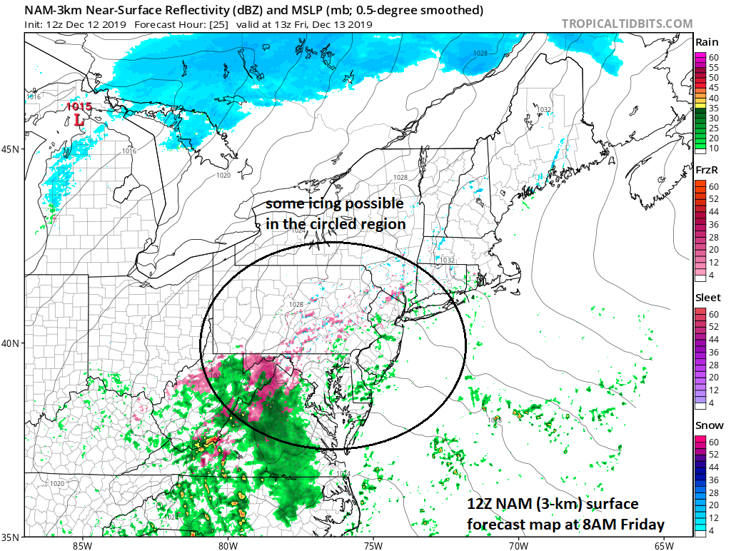
12Z NAM (3-km version) forecast map for early tomorrow features some scattered light freezing rain and/or ice pellets in the circled region; map courtesy NOAA, tropicaltidbits.com
Overview
There will be two storms to deal with in the Mid-Atlantic/NE US in coming days with the first storm impacting this area from Friday into Saturday and the second storm Monday into Tuesday. The initial storm will be predominately a plain rain event; however, there can be some icing at the onset early tomorrow; especially, south of the PA/MD border include the N/W suburbs of DC. By late tomorrow, enough milder air will arrive for plain rain to fall in the DC-to-Philly-NYC corridor and this can become a soaking rain event from Friday night into Saturday. The departure of the first storm will result in an influx of another cold air mass at the end of the weekend and this could set the stage for some snow and/or ice later Monday as the next storm system closes in on the area.
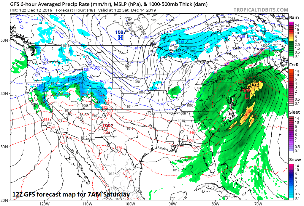
12Z GFS forecast map for early Saturday with plain rain (green, yellow) throughout the Mid-Atlantic/NE US; map courtesy NOAA, tropicaltidbits.com
Storm #1 (Friday/Saturday)
Clouds will increase overnight tonight as low pressure storms to form over the southeast US. This system will rapidly intensify early tomorrow in the SE US and the main part of the storm for the Mid-Atlantic/NE US will be tomorrow night and Saturday. However, there are signs that an initial burst of precipitation could push into the Mid-Atlantic region early on Friday and this could lead to a period of freezing rain for the AM commute; especially, across the northern and western suburbs of DC and perhaps even as far north as SE PA. Somewhat milder air will arrive later tomorrow and all precipitation should be in the form of plain rain in the I-95 corridor by tomorrow night and it can come down hard at times through much of the day on Saturday. Following the departure of this first storm, there will be an influx of another cold air mass into the Mid-Atlantic/NE US riding in on brisk NW winds late Saturday night and on Sunday. This cold air mass could set the stage for some snow and/or ice early next week as another storm approaches the eastern US.
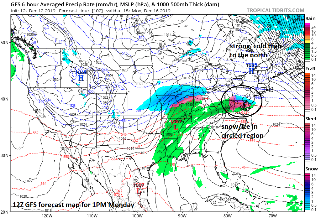
12Z GFS forecast map for early Monday afternoon with some snow (blue) and ice (pink, purple) in the Mid-Atlantic region; map courtesy NOAA, tropicaltidbits.com
Storm #2 (Monday/Tuesday)
With cold air in place, a narrow stretch of precipitation is likely to extend from west-to-east ahead of developing low pressure in the middle of the country and this could reach the Mid-Atlantic region during the day on Monday when it’ll be cold enough for snow and/or ice. As we begin the day on Monday, strong high pressure will be centered over southeastern Canada and this will ensure that cold air stays in place when precipitation is likely to arrive leading to high probability of something frozen in the I-95 corridor. Ultimately, the extent of the cold air in the Mid-Atlantic/NE US will depend on the storm track and this will determine how much frozen precipitation can fall as compared with plain rain. There are significant disagreements among computer forecast models on the eventual track of storm #2 with one scenario featuring a storm track well to the west of the I-95 corridor and another possibility has a track much closer to the east coast. A track closer to the east coast would be a colder solution (i.e., more in the way of snow and/or ice), but we’ll have to wait a few days to iron this out – at least until after storm #1 passes by to the northeast – stay tuned.
Meteorologist Paul Dorian
Perspecta, Inc.
Video discussion: