11:50 AM (Wednesday) | ***An Arctic blast arrives later today with gusty winds, scattered snow showers and heavier snow squalls…sharply colder later tonight and Thursday***
Paul Dorian

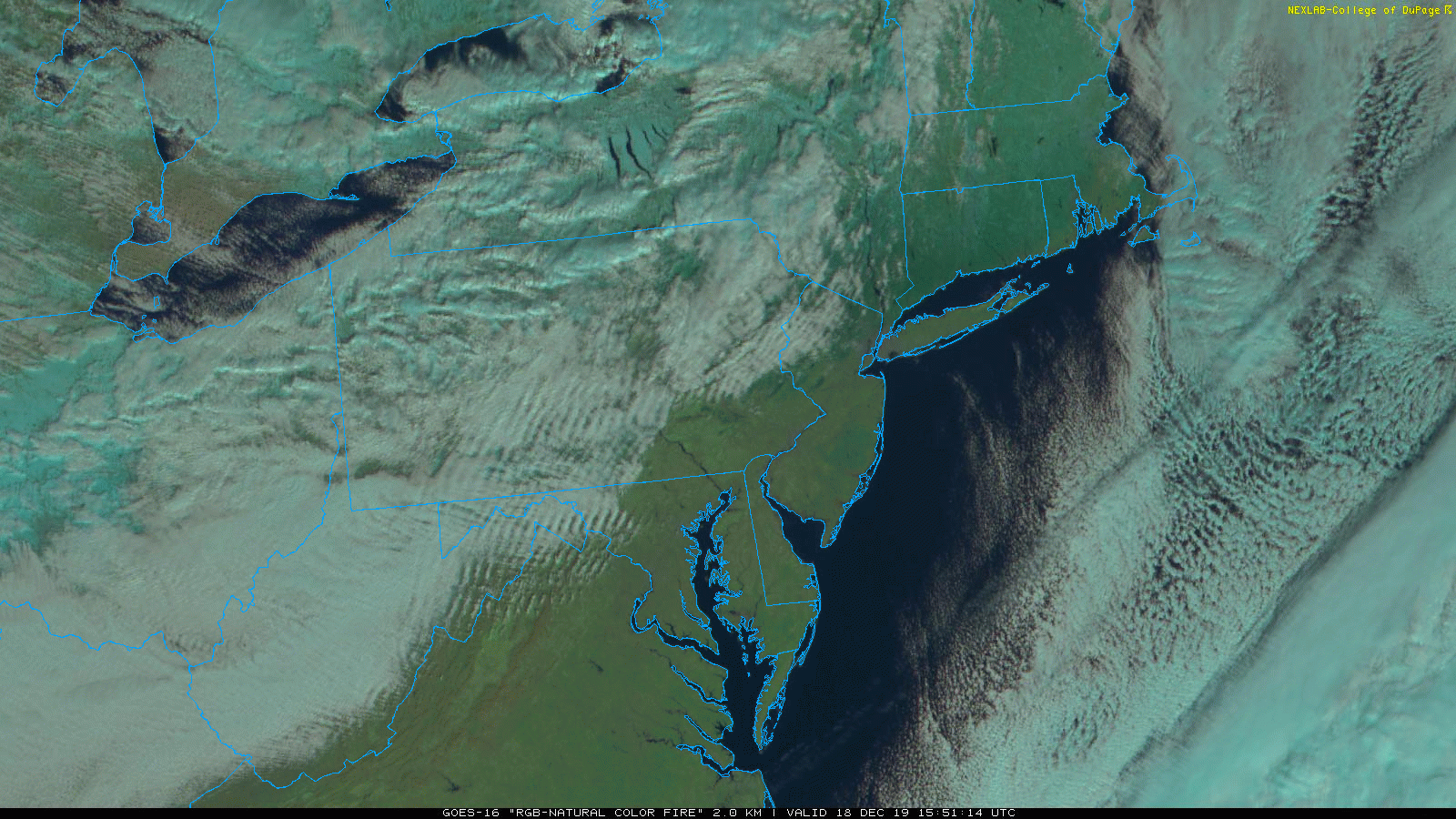
Snow showers and snow squalls have formed as an Arctic front drops southeastward from the Great Lakes; images courtesy College of DuPage, NOAA
Overview
An Arctic frontal system will arrive in the I-95 corridor later today/early tonight and it will be accompanied by strong wind gusts, snow showers, and heavier snow squalls. Any snow squall can reduce visibilities in a hurry, put down a quick coating of snow and create dangerous driving conditions. It’ll stay windy tonight and on Thursday and it’ll turn sharply colder with some of the lowest wind chill values and temperatures so far this season in the Mid-Atlantic/NE US.

The Arctic front will impact the I-95 corridor from mid-afternoon to mid-evening; map courtesy NOAA, tropicaltidbits.com
Threat of a burst of snow
An Arctic frontal system will impact the I-95 corridor from the mid-afternoon to the early evening hours. This northwest-to-southeast moving front will be accompanied by snow showers and there will be heavier snow squalls as well. The best chance for heavier snow squalls later today will be across upstate PA, northern NJ, and in the NYC metro region; however, they can sneak all the way down into the Philly and DC metro regions as well. Any snow squall can reduce visibilities in a hurry, put down a quick coating of snow, and create dangerous driving conditions. The upper-level energy that will contribute to the formation of these snow squalls will be stronger north of the PA/MD border; hence, a better shot at encountering a heavier snow squall in those regions, but keep an eye on the skies all the way south to DC and east to Philly.

Upper-level energy will drop into the NE US later today and will contribute to the formation of snow showers and isolated heavier snow squalls; especially, to the north of the PA/MD border; map courtesy NOAA, tropicaltidbits.com
Strong wind gusts
In addition to the threat for a burst of snow, this Arctic frontal passage will be accompanied by strong, gusty winds as its parent low pressure system will intensify rapidly late today as it moves across New England. As high pressure builds simultaneously in the Ohio Valley, the pressure gradient will tighten around here and the result will be wind gusts to 40 mph or so late today and tonight and it’ll stay quite blustery on Thursday as well.

Low temperatures by early tomorrow will be in the teens across much of the I-95 corridor; map courtesy NOAA, tropicaltidbits.com
Sharply colder conditions
Temperatures will bottom out in the teens in much of the DC-to-Philly-to-NYC corridor by early tomorrow morning and single digits are not out of the question in some spots; especially, across east-central and northeastern PA, interior northern NJ, and in the western and northern suburbs of NYC. Given the combination of strong winds and low temperatures, wind chills will reach some of the lowest levels of the season so far overnight and into the day on Thursday. Despite sunshine on Thursday, high temperatures will likely do no better than the low-to-mid 20’s in the Philly and NYC metro regions and will struggle to make it to 30 degrees in DC. Some moderation in temperatures will take place on Friday and Saturday, but it’ll remain below-normal for mid-December.

Temperature anomalies for this time of year will be sharply negative by the middle of the night in the Mid-Atlantic/NE US; map courtesy NOAA, tropicaltidbits.com
Meteorologist Paul Dorian
Perspecta, Inc.
perspectaweather.com
Video discussion: