
10:30 AM (Wednesday) | ****Winter storm is now underway and will have impacts into early tonight…very heavy snow bands setting up in some areas****
Paul Dorian

Watching closely an area of lightning strikes along the PA/MD border it is moving east and is associated with heavy precipitation bands.
Snow began early this morning across the DC metro region and arrived during the mid-morning hours in Philly. Snow should break out during the mid-day/early afternoon hours in the NYC metro region. The snow will vary in intensity across the DC metro region for the next couple of hours and then transition to sleet and/or freezing rain during the mid-day or early afternoon. In Philly, the snow will become moderate-to-heavy at times for the mid-day and early afternoon hours and could begin the transition to sleet and/or freezing rain late this afternoon. All indications are that surface temperatures will stay at or slightly below freezing into the early evening hours in areas to the north and west of Route 95 from DC-to-Philly-to-NYC. This will keep the threat for icing intact right into the early evening in suburban locations along the I-95 corridor.

12Z NAM forecast map at noon with moderate-to-heavy snow across SE PA and a wintry mix in the DC metro region; courtesy NOAA, tropicaltidbits.com
One area of interest that has popped up during the past couple of hours is an area of lightning strikes along the PA/MD border. There is some very heavy precipitation in this region with strong upward motion and it could very well enhance greatly precipitation rates across DC, northern MD, and southern PA later in the morning and early this afternoon – something to closely monitor. In fact, in areas around DC that change to sleet, these enhanced precipitation bands with strong upward motion could result in a change back to snow for awhile. Accumulation estimates remain unchanged from prior forecasts with 4-7 inches across DC metro region, 3-6 in Philly, and 2-5 in NYC with the higher amounts in those ranges to the north and west of the cities and the lower amounts to the south and east. The precipitation may lighten up for a while this afternoon as we transition from the first phase of the storm (i.e., snow) to the second phase (i.e., sleet, freezing rain, rain). Even treated roads will be slick during times of moderate-to-heavy snow and/or bursts of sleet and untreated surfaces will stay slick right through the evening hours. In the overnight hours, temperatures will slowly rise and plain rain is likely for awhile up and down the I-95 corridor and they’ll reach 50 degrees or above on Thursday afternoon. Be safe and try to stay off the roads.
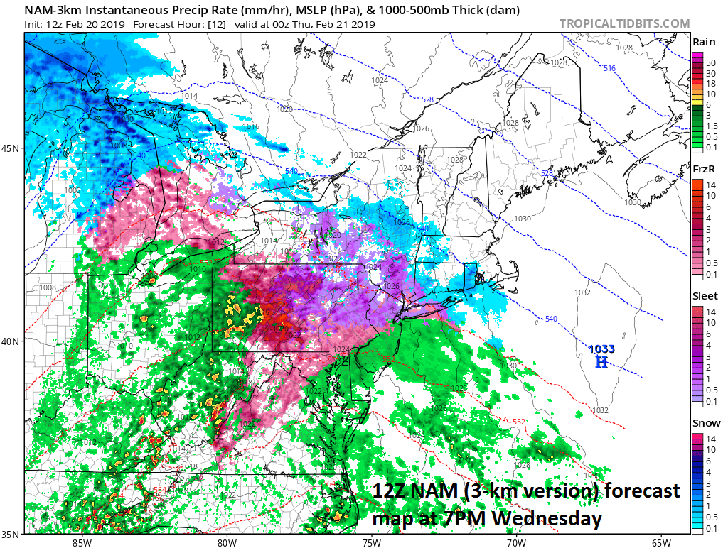
12Z NAM forecast map for 7PM this evening with sleet and/or freezing rain still occurring in many suburban locations to the north and west of Route I-95; courtesy NOAA, tropicaltidbits.com
Meteorologist Paul Dorian
Perspecta, Inc.
perspectaweather.com