
8:50 PM (Saturday) | ****Threat of heavy rain and severe weather in the I-95 corridor from late Sunday into early Monday morning****
Paul Dorian

High-resolution surface forecast map for 4AM Monday morning features a line of strong-to-severe thunderstorms near Route I-95; courtesy NOAA/EMC, tropicaltibits.com
Overview
A powerful storm system will push towards the Great Lakes on Sunday with accumulating snow on its northwest side in places likely Chicago, Illinois and severe weather and downpours will be a threat in its warm sector to the southeast of the storm track. The threat for downpours and severe weather will be “enhanced” across the Ohio Valley on Sunday and indeed there can be some heavy rain and severe thunderstorm activity that works its way into the I-95 corridor from later tomorrow afternoon into early Monday - including the possibility of isolated tornadoes..
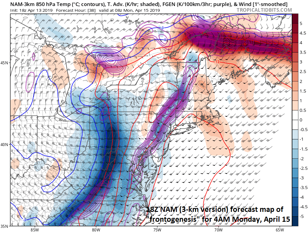
“Frontogenesis” will be quite strong along the cold frontal boundary zone near the I-95 corridor in the wee hours of Monday morning; courtesy NOAA/EMC, tropicaltidbits.com
Late Sunday into early Monday
This will be quite an active period in the eastern US as a strong surface low passes to the northwest of the I-95 corridor with lots of strong energy aloft to support this system. The trailing cold front from the low pressure center will be the focus of the heavy rain and the severe weather threat from later tomorrow into early Monday. The combination of deep moisture (dew points will become much higher on Sunday), an impressive jet streak in the upper atmosphere, and the sharp temperature gradient at the lower-levels of the atmosphere will result in a severe weather threat as the cold front treks eastward towards the I-95 corridor and this threat may actually reach its peak here in the wee hours of Monday morning. The severe weather threat includes potentially damaging wind gusts of up to 60 mph, hail and even isolated tornadoes. The latest high-resolution forecast model (NAM 3-km) suggests a N-S oriented line of strong-to-severe thunderstorms could cross the DC-to-Philly-to-NYC corridor around 3 or 4 am on Monday and this could also result in a localized flooding threat as grounds are well saturated and downpours will likely accompany the frontal band.

An “enhanced” severe weather threat on Sunday across the Ohio Valley and this “enhanced” threat may very well extend to the I-95 corridor for the period late Sunday into early Monday; courtesy NOAA/SPC
Meteorologist Paul Dorian
Perspecta, Inc.
perspectaweather.com