
1:10 PM (Friday) | *Back-to-back rain events for the Mid-Atlantic region with downpours and strong storms possible in each…a third significant rain event possible at the end of next week*
Paul Dorian

A line of showers and thunderstorms is pressing east across the Ohio Valley and right towards the I-95 corridor; courtesy NOAA, College of DuPage
Overview
The grass will certainly get off to a good start in the Mid-Atlantic region over the next few weeks as water will be quite plentiful – much as it was for all of the last growing season. The Mid-Atlantic region will get hit by back-to-back rain events in coming days and each one can result in some heavy downpours and perhaps even some strong thunderstorm activity. Looking ahead, there is even a good chance at a third significant rain event at the end of the next week for much of the eastern US including the Mid-Atlantic as the overall wet pattern shows no sign of slowing down.
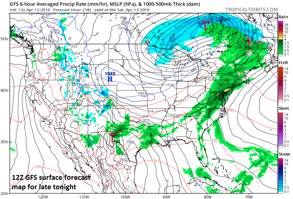
12Z GFS surface forecast map for late tonight features some heavy rainfall in the I-95 corridor (shown with dark green, yellow); courtesy NOAA/EMC, tropicaltidbits.com
Event 1 from early tonight into early Saturday
Latest radar features a line of showers and thunderstorms over the Ohio Valley that is gradually working its way to the east at the same time moisture is riding northward along the Atlantic seaboard. The rain across the Ohio Valley is associated with a cold frontal system while a warm front is pressing northward along the I-95 corridor. Following the passage of the warm front, it’ll turn more humid here this afternoon and warmer setting the stage for a more unstable atmosphere as the cold front presses our way from the west. The result will be shower activity later this afternoon and then steadier and heavier rainfall in the overnight hours. A strong thunderstorm can mix in as well at just about any time. Any heavy downpour later today or tonight can result in localized flooding in poor drainage areas as grounds are well-saturated. The steadiest rain will end early Saturday, but clouds will dominate the skies and there can be another shower or two possible any time on Saturday and again tomorrow night.

12Z GFS surface forecast map for late Sunday night features some heavy rainfall in the I-95 corridor (shown with dark green, yellow, red); courtesy NOAA/EMC, tropicaltidbits.com
Event 2 from later Sunday into Monday
An even more impressive upper-level system compared to today will close in on the region later Sunday from the Midwest. This next wave of energy will create very unstable conditions on Sunday in the Ohio Valley where severe weather will be a serious threat and some strong-to-severe storms could make it into the I-95 corridor late Sunday or Sunday night.

Event #2 will have an even better chance at featuring severe weather compared to the first rain event beginning Sunday in the Ohio Valley and then potentially reaching the I-95 corridor from late Sunday into Monday; courtesy NOAA/SPC
Rain is liable to be heavy at times in the Mid-Atlantic from later Sunday into early Monday as another warm front/cold front combination impacts the region. Later Monday, following the departure of low pressure to the northeast over New England, our winds will pick up in intensity out of the NW and drier, colder air should push into the Mid-Atlantic region with 30’s likely as lows by early Tuesday morning in many suburban locations.

The second event coming to the Mid-Atlantic region from later Sunday into early Monday will be accompanied by a strong wave of energy in the upper atmosphere. This feature will enhance chances for strong-to-severe thunderstorm activity in the Ohio Valley and the Mid-Atlantic. Map courtesy NOAA/EMC, tropicaltidbits.com
Event 3 next Friday/Friday night
Looking ahead, yet another heavy rain event is possible in the eastern states at the end of next week. An impressive cold shot of air will slide towards the east coast and significant rain could form here ahead of the front in the Friday/Friday night time frame.

12Z GFS surface forecast map for next Friday evening, April 19, features more heavy rainfall in the I-95 corridor (shown with dark green, yellow, red); courtesy NOAA/EMC, tropicaltidbits.com
Get the lawn mower ready…the grass will be growing rapidly in coming days.
Meteorologist Paul Dorian
Perspecta, Inc.
perspectaweather.com
Video discussion: