1:45 PM | *An active couple of days in the Mid-Atlantic region*
Paul Dorian
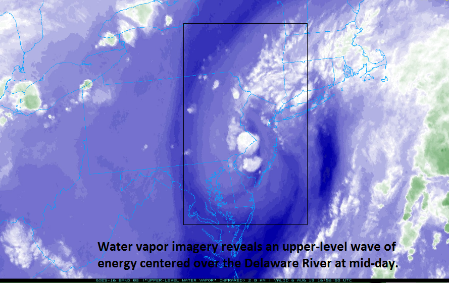
A comma-shaped featured revealed by water vapor imagery at mid-day is the area where powerful thunderstorms have formed; courtesy NOAA, College of DuPage
Overview
An active couple of days is in store for the Mid-Atlantic region with scattered showers and thunderstorms today and more widespread showers and thunderstorms later tomorrow. There is a wave of upper-level energy setting off some powerful and slow-moving thunderstorms at mid-day along the Delaware River region of the Mid-Atlantic and an even stronger system will likely generate numerous showers and thunderstorms later tomorrow into tomorrow night. Any of these thunderstorms can produce heavy rainfall and flash flooding given the well-saturated grounds. Looking ahead, a beautiful air mass for August will arrive on Friday and provide comfortable weather conditions for the weekend.
Thunderstorms near the Delaware River between PA and NJ will slowly move into NJ over the next hour to two and flash flooding may be the result; courtesy NOAA, College of DuPage
Details
Water vapor imagery at mid-day clearly shows a comma-shaped system over the Delaware River and this upper-level feature is providing enough upward motion to cause some powerful thunderstorm activity in places like Philly and its nearby suburbs. The thunderstorm activity is slow-moving and resulting in a couple inches of rain in a relatively short period of time. The bulk of this activity is moving into New Jersey where flash flooding can occur over the next couple of hours. There are more showers and thunderstorms popping up to the west of the I-95 corridor and these could have an impact in some spots late in the day and early tonight.
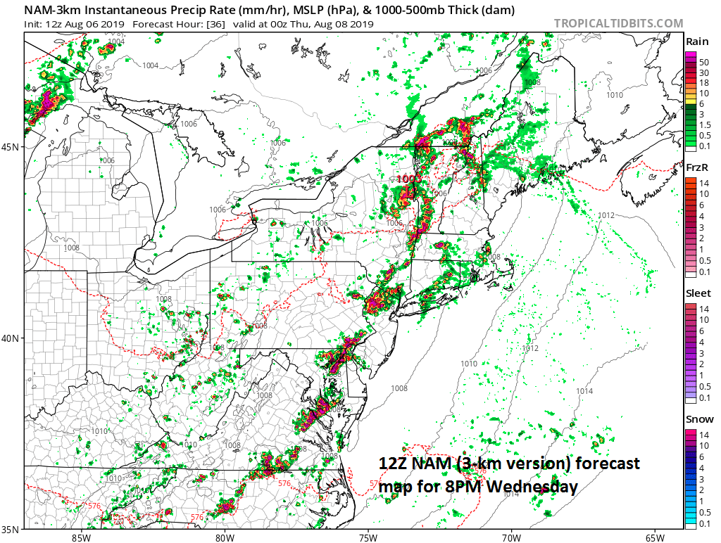
A fairly solid line of thunderstorms will stretch late tomorrow from near DC to interior New England as depicted by the 12Z NAM computer forecast model; courtesy NOAA, tropicaltidbits.com
On Wednesday, another upper-level trough will pivot eastward and there will be plenty of warmth and humidity entrenched in the Mid-Atlantic region as this system arrives. As a result, more showers and thunderstorms will re-develop and any storm later tomorrow and early tomorrow night can result in heavy rainfall and flash flooding conditions along the DC-to-Philly-to-NYC corridor. Short-term high-resolution computer forecast models depict a rather solid line of such storms at the end of the day tomorrow and this could extend from the DC metro region to the NYC metro region lined up along an approaching frontal boundary zone.
Looking ahead
The good news is that after a couple of active days in the Mid-Atlantic region things will tone down some on Thursday with a lessening chance of showers and storms and then a very nice air mass for August will arrive on Friday with noticeably lowering humidity levels. The comfortable air mass will stay around through the upcoming weekend with pleasant temperatures and humidity for this time of year.
Meteorologist Paul Dorian
Perspecta, Inc.
perspectaweather.com


