11:00 AM (Wednesday) | *Scattered strong-to-severe thunderstorms today as upper-level low continues to meander over the Northeast US*
Paul Dorian

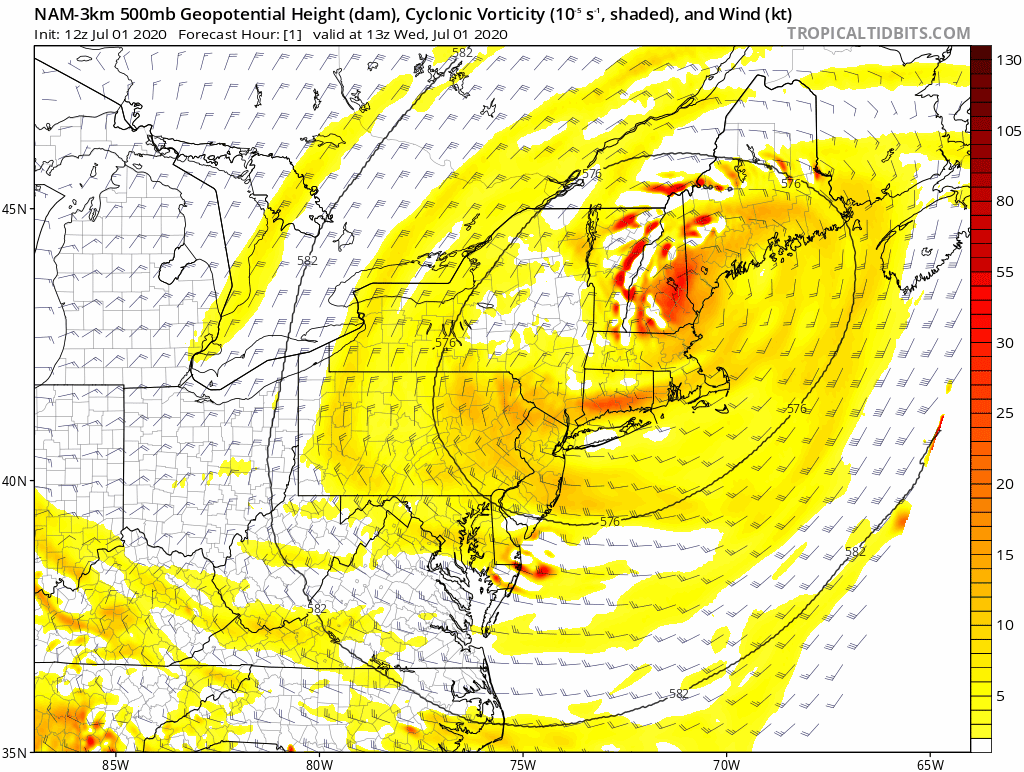
An upper-level low over the Northeast US will finally begin to push towards the southeast by early tomorrow. This system will help to produce another unsettled afternoon and evening the Mid-Atlantic/Northeast US with scattered strong-to-severe thunderstorms, but rain-free conditions are possible throughout the region on Thursday. 24-hour forecast loop of 500 mb heights (12Z NAM- 3 km) courtesy NOAA, tropicaltidbits.com
Overview
An upper-level low continues to meander over the Northeast US and showers and thunderstorms will again “pin wheel” around this system during the afternoon and evening. Some of the thunderstorms will reach strong-to-severe levels with highly unstable conditions given the cool air aloft combined with warm lower levels of the atmosphere. Any thunderstorm that forms today can include heavy downpours and perhaps small hail as the freezing level is rather low in this pattern. The upper-level low will finally slide to the southeast by tomorrow and this will reduce the chances for showers and thunderstorms.
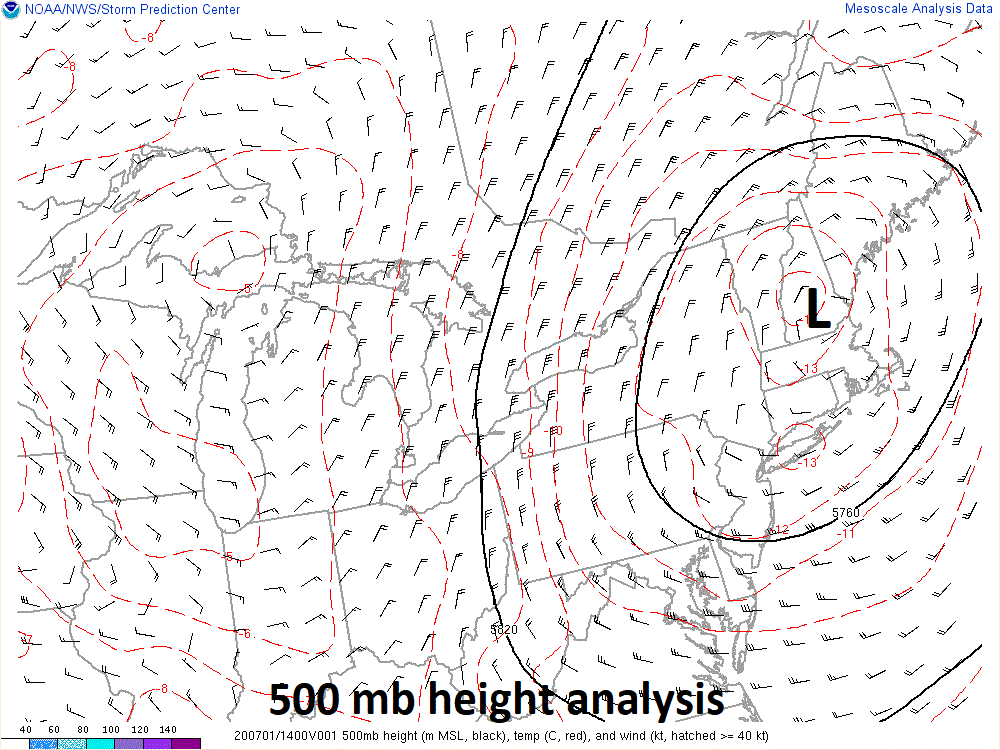
Late morning position of the upper-level (500 mb) low (map courtesy NOAA)
Discussion
Temperatures will be quite comfortable today in the Mid-Atlantic/NE US for the beginning of July with highs only in the low-to-mid 80’s, for example, in cities like Philadelphia and New York City. It is actually cooler-than-normal in upper parts of the atmosphere correlated with the upper-level low and this is helping to create increasingly unstable conditions - and scattered afternoon and evening showers and thunderstorms are likely to be the result. Any thunderstorm that forms later today can contain some heavy rainfall and there is an outside chance for small hail.

A heat wave will develop in the middle of the country next week and then expand to the eastern US by days 6-10 (July 6- July 11). Map courtesy NOAA, tropcialtidbits.com
This upper-level feature will push to the southeast on Thursday and out over the open waters of the western Atlantic. As a result, rain-free conditions are quite likely on Thursday in the Mid-Atlantic/NE US and then it’ll turn hot on Friday with plenty of sunshine to close out the week. In fact, temperatures could climb into the 90’s on Friday in the DC-to-Philly-to-NYC corridor ahead of a weak cool frontal system. This back door cool front should push through the Mid-Atlantic region on Friday night and its passage should knock off a few degrees from temperatures for the upcoming weekend.

Monthly temperature departures from normal in Philly, DC, and NYC for April, May and June 2020
Looking ahead, there are signs for sustained heat to push into the eastern US later next week as it is likely to first build in the central states and then expand to the east. The month of June ended up slightly warmer-than-normal in the DC, Philly, NYC corridor and this followed cooler-than-normal months of April and May.
Meteorologist Paul Dorian
Perspecta, Inc.
perspectaweather.com
Follow us on Facebook, Twitter, YouTube
Video discussion: