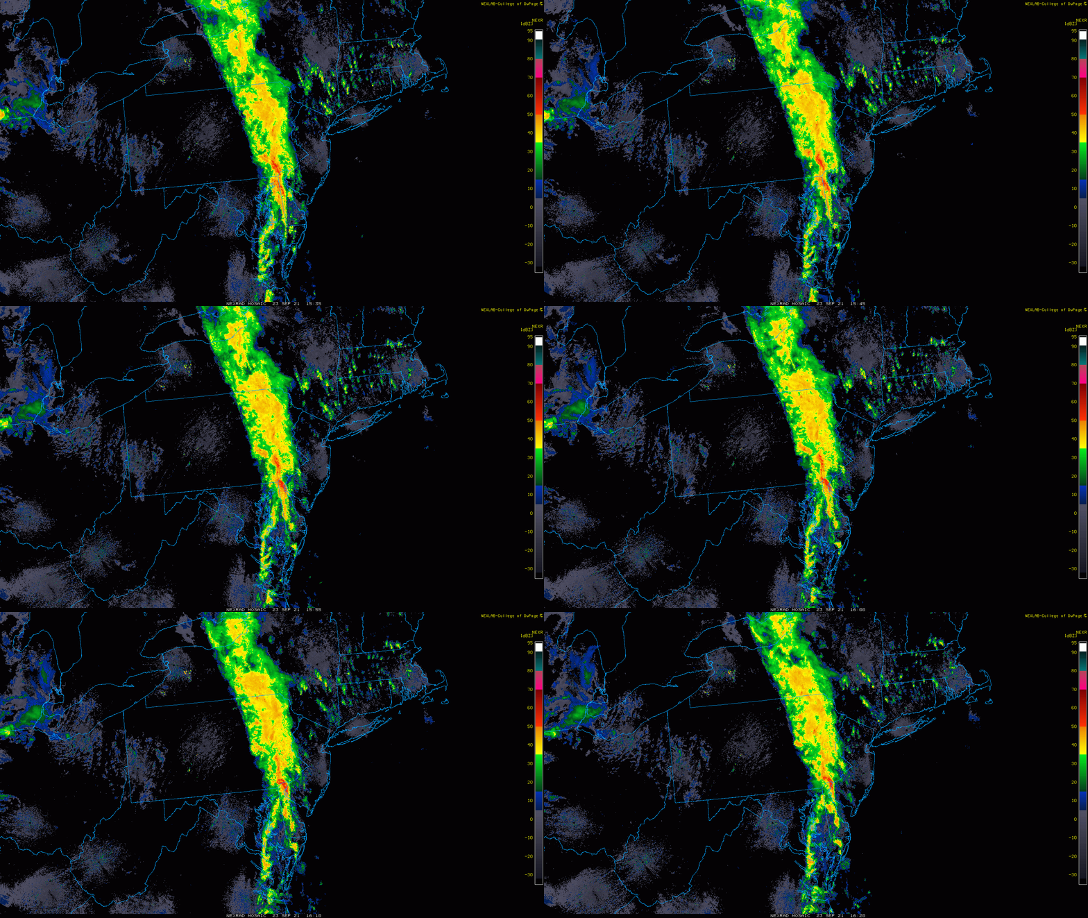
12:30 PM | ***Significant rain and severe thunderstorms extend at mid-day from Delmarva-to-eastern PA-to-central NY…watch for localized flash flooding***
Paul Dorian
A line of showers and storms extends at mid-day from the Delmarva-to-eastern PA-to-central NY. Images courtesy College of DuPage, NOAA
Overview
A cold front continues to push slowly to the east today through the Mid-Atlantic region and it is currently generating heavy downpours and strong-to-severe thunderstorms that extend from the Delmarva Peninsula-to-eastern Pennsylvania-to-central New York. This line of showers and storms associated with the cold front has been creating havoc and flash flooding in many areas as it slides eastward. On the back side of the front, an extended period of nice weather is in store for the Mid-Atlantic region, but it’s going to be painful for many before we get to that point.
Cooler than normal conditions will develop in the Mid-Atlantic region following the passage of the cold front and temperatures will remain comfortable for several days. Forecast map for Friday afternoon courtesy NOAA, tropicaltidbits.com
Details
The DC metro region got hit hard in the overnight hours with a widespread 1-3 inch rainfall and plenty of flooded streets. Cooler and drier air has pushed into that area from the west and the threat for heavy rain there is over. However, in Philly and NYC, heavy rain has either arrived or is on the way. A line of showers and embedded strong-to-severe thunderstorms is sliding slowly to the east and extends at midday from the Delmarva Peninsula-to-eastern PA-to-central New York State. Flooding rains have pushed into the western suburbs of Philly and will move into the city early this afternoon. The heavy rain should reach the NYC metro region late in the day and continue well into tonight. On the backside of the front, the Mid-Atlantic region will enjoy an extended period of nice weather from tomorrow through at least Tuesday of next week with plenty of sunshine, low humidity and comfortable temperatures for the latter part of September.
Video discussion:


