
11:15 AM (Wednesday) | ***Another day and another severe thunderstorm threat for the Mid-Atlantic/Northeast US…includes possible downpours, hail and even isolated tornadoes are on the table***
Paul Dorian
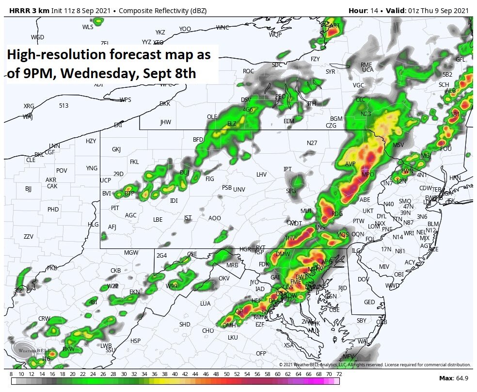
A high -resolution forecast model known as the HRRR depicts an impressive line of storms later this evening extending from New York State-to-Virginia. Map courtesy Weather Bell Analytics, NOAA
Overview
The weather has certainly been active in the Mid-Atlantic/Northeast US in recent weeks and there is yet another threat for severe thunderstorm activity later today and tonight. A strong cold front will drop southeastward later today from the Great Lakes and into the region and it will be supported by an impressive wave of energy in the upper atmosphere. As a result, there is the chance for downpours later today into tonight and any severe storm can produce hail and perhaps even isolated tornadoes. Give the already well-saturated grounds, any heavy rainfall can result in localized flash flooding conditions. The passage of the strong cold front will usher in a very comfortable air mass for the region to close out the work week and begin the upcoming weekend.
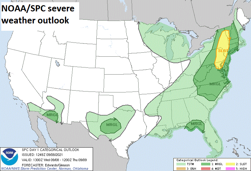
NOAA’s Storm Prediction Center (SPC) has a slight risk of severe weather today in the Mid-Atlantic/Northeast US. Map courtesy NOAA/SPC
Details
A strong cold front is advancing towards the eastern seaboard and it is accompanied by an impressive short-wave of energy in the upper part of the atmosphere. As the surface front approaches, the pressure gradient will tighten, winds will strengthen and gust to 30 mph or so in the afternoon, and overall humidity levels will rise as air pushes this way from the south and southwest of here. In addition to these ingredients, high-resolution models have been rather consistent in developing a potent low-level jet which will add to the instability of the atmosphere, especially, across eastern PA, Delmarva, and New Jersey.

Today’s severe weather threat includes the possibility of isolated tornadoes given the high-levels of wind shear that is expected later in the day and tonight. The highest probability of isolated tornadoes later today and tonight will be in eastern Pennsylvania/northwestern New Jersey, but they cannot be ruled out in other parts of the Mid-Atlantic. Map courtesy Weather Bell Analytics, NOAA
While there can be a shower or thunderstorm during the mid-day and early afternoon hours, the main threat time period for heavy showers and strong-to-severe thunderstorms in the Mid-Atlantic/Northeast US will be from later today into later tonight (~4PM to midnight). This severe weather threat includes the possibility of heavy downpours in any of the late day/nighttime showers and thunderstorms and - given the already well-saturated grounds - any heavy rainfall can result in localized flash flooding. In addition to the threat of downpours and flash flooding, damaging straight-line winds will be possible and there is likely to be enough wind shear for the possibility of isolated tornadoes; primarily, to the north of the PA/MD border across eastern PA and interior sections of New Jersey.
The cold front will be near the coast early Thursday and tend to linger for awhile as an upper-level trough pushes overhead. As a result, there can be a lingering shower or thunderstorm on Thursday and skies are likely to remain mainly cloudy in much of the region. Cooler air will become more noticeable tomorrow night and a refreshing air mass will dominate the scene on Friday and Saturday to go along with copious amounts of sunshine as we close out the work week and begin the weekend. It remains pretty nice early next week, but temperatures will creep up some compared to the early part of the weekend.
Meteorologist Paul Dorian
Peraton
peratonweather.com
Follow us on Facebook, Twitter, YouTube
Video discussion: