10:15 AM | ***Watch for icing later today in suburban locations with an influx of Arctic air...freeze-up on Friday night***
Paul Dorian
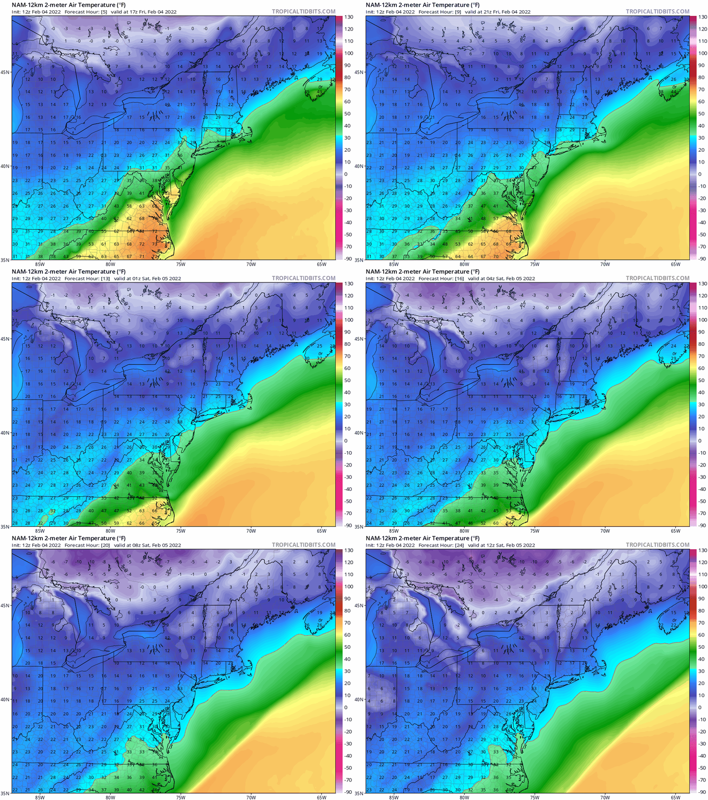
Arctic air descends on the Mid-Atlantic region from mid-day Friday through early Saturday. Maps courtesy NOAA, tropicaltidbits.com
Overview
The slow-moving Arctic front that has been the focus area of significant snow, ice and rain in recent days has crossed through the I-95 corridor region this morning and temperatures have responded accordingly by dropping quickly from very mild early day levels. As a result, plain rain that continues to fall at this time can begin to freeze on some untreated surfaces later in the day and sleet and/or snow can mix in as well by day’s end. Temperatures will continue to drop in the nighttime hours so any still-standing water will certainly freeze as the Arctic air mass arrives in full. Overall impacts of the icing in the immediate I-95 corridor region will be rather limited since drier air will tend to inhibit any appreciable precipitation amounts not long after temperatures drop to the freezing mark or below.
12Z NAM model forecast map of total freezing rain amounts by early Saturday morning. Map courtesy NOAA, tropicaltidbits.com
Details
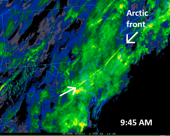
Temperatures stared off the day in the 50’s in the DC-to-Philly-to-NYC corridor, but an Arctic front crossed through the region earlier today and temperatures have dropped rather quickly on its back side. Plain rain continues to fall at this time, but as temperatures drop towards the freezing mark during the early-to-mid afternoon, icing will begin take place on untreated surfaces such as trees and grass. Even some roads can be vulnerable to icing conditions later today/early tonight as salt from recent days has very likely been washed away with the recent rainfall. The best chance for any build of ice on those untreated surfaces will be across any of the suburbs of Philly and New York City and in the far northern and northwestern suburbs in the DC metro area. There is also a chance that sleet and/or snow mixes in with the freezing rain later today and a bit of snow, sleet and/or freezing rain can continue into the early part tonight in some spots. Overall impacts of the icing will be rather limited in nature along the immediate I-95 corridor region since drier air will tend to inhibit any appreciable precipitation amounts once temperatures drop to the freezing mark or below.
The location of the surface Arctic frontal system at 9:45 AM can be clearly seen in this radar image. Map courtesy NOAA, College of DuPage
Temperatures will continue to drop tonight as Arctic air takes full control and lows on Saturday morning may be in the upper teens across some of the normally colder suburban locations. Cold high pressure will take control on Saturday and both weekend days will feature some sunshine, but temperatures will remain well below-normal for the early part of February. Low pressure will then organize just off the east coast on Monday and it could have an impact on the eastern Mid-Atlantic region by late Monday or Monday night possibly in the form of snow and/or ice at inland locations and rain along coastal sections. Longer term, there are some signals for a potential storm in the eastern states around the middle portion of the month.
Meteorologist Paul Dorian
Arcfield
arcfieldweather.com


