11:30 AM | ***Next batch of precipitation associated with intensifying low pressure reaches I-95 corridor later today with residual cold air around…snow/ice a threat; especially, in N/W suburbs***
Paul Dorian
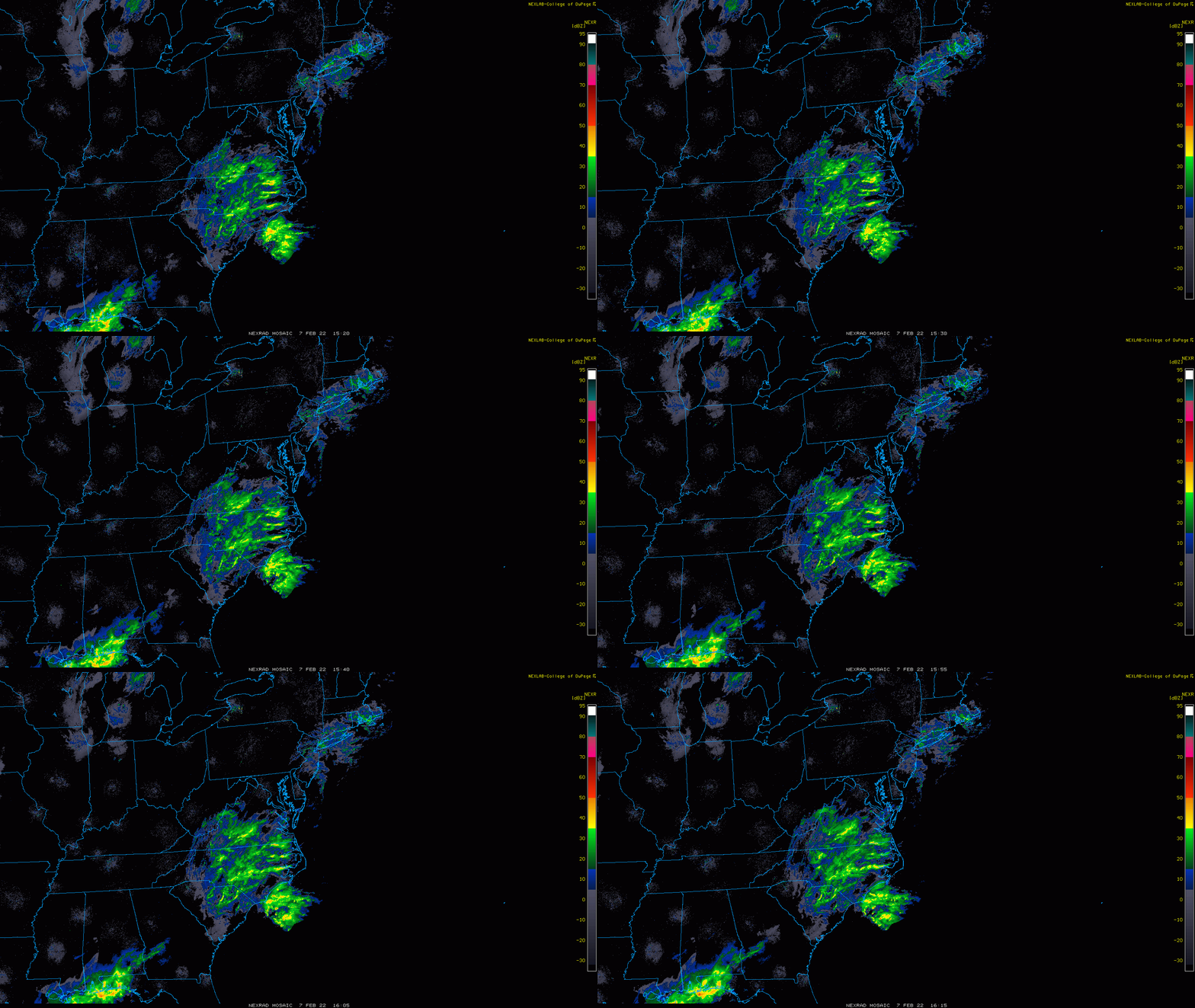
An expanding area of precipitation is headed to the DC-to-Philly-to-NYC corridor and there is enough cold air around for snow and/or sleet to be mixed into the picture for later today and early tonight; especially, across suburban locations to the north and west of the big cities. Maps courtesy NOAA, College of DuPage
Overview
Weak low pressure is currently located over the Carolina coastline and it will intensify over the next 6-12 hours as it pushes northeastward. A batch of precipitation well in advance of the low pressure system broke out earlier today in the DC-to-Philly-to-NYC corridor resulting in some patchy freezing drizzle and light snow in spots. A second and more widespread batch of precipitation is now headed northeastward as the low intensifies and it will arrive later today in the same DC-to-Philly-to-NYC corridor with enough residual cold air around to allow for the likelihood of some snow and/or sleet. The threat for some snow, ice and/or rain will continue into the latter part of the evening and small snow/ice accumulations are quite possible; especially, in suburban locations to the north and west of the big cities. Watch out for icy patches on the roads early Tuesday morning as temperatures should be at or below freezing.
12Z GFS surface forecast map as of 7PM, Monday, February 7th with snow (in blue) in the I-95 corridor and on the western edge of the precipitation shield. Map courtesy NOAA, tropicaltidbits.com
Details
A batch of precipitation broke out earlier today in the DC-to-Philly-to-NYC corridor associated with warm advection and low-level convergence in the eastern Mid-Atlantic region. This batch of precipitation developed well in advance of a low pressure system now located near the Carolina coastline and resulted in patchy freezing drizzle for most areas and light snow in others. There is a lull in the precipitation at mid-day in the DC-to-Philly-to-NYC corridor and it should continue through the the early afternoon hours. However, radar is showing a rapidly growing area of precipitation across North Carolina and southern Virginia and it should arrive in the I-95 corridor later in the afternoon moving in a southwest-to-northeast fashion . Low pressure now over the Carolina coastline is currently on the weak side, but it will intensify during the next 6-12 hours as it pushes to the northeast and its upper-level support becomes better phased.
12Z GFS forecast map of 500 mb vorticity field as of 7PM, Monday, February 7th with intensification of low pressure likely as northern and southern stream disturbances phase together. Map courtesy NOAA, tropicaltidbits.com
Temperatures at mid-day have climbed to above-freezing levels in DC and in its nearby suburbs and also in the cities of Philadelphia and New York; however, they are near or even still below-freezing in the nearby northern and western suburbs of Philly and NYC and in some of the far northern and western suburbs of DC. Therein lies the problem as the main batch of precipitation makes a rapid advance towards the DC-to-Philly-to-NYC corridor. Precipitation should re-develop in these areas later in the afternoon (3-6 pm) and continue into tonight and temperatures in the suburban locations (far suburbs in DC, nearby suburbs in Philly and NYC) will allow for the possibility of snow and/or sleet at the onset. In fact, the chance for snow and/or sleet is likely to increase throughout all of the metro regions by early tonight as the intensifying surface low pressure system slides by to the east and out over the open waters of the western Atlantic. Small snow and/or ice accumulations are certainly on the table by later tonight from round two of this system; especially, in suburban locations along the DC-to-Philly-to-NYC corridor. Watch out for icy patches on the roads early Tuesday morning as temperatures should be at or below freezing. Looking ahead, after a brisk and cold day on Tuesday with a stiff wind, the second half of the week looks relatively quiet in the Mid-Atlantic region.
Meteorologist Paul Dorian
Arcfield
arcfieldweather.com
Follow us on Facebook, Twitter, YouTube
Video discussion:


