2:45 PM | ***Latest trends and observations suggest the worst of the MCS on Tuesday morning could focus on DC, Maryland, Virginia and the Delmarva Peninsula...stay on guard in Philly***
Paul Dorian
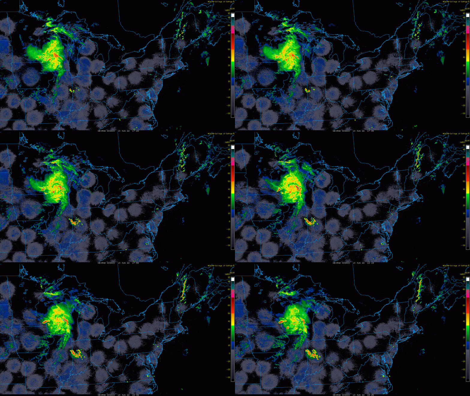
A complex of thunderstorms now exploding over the Upper Midwest is likely to impact portions of the Mid-Atlantic region on Tuesday morning. Images courtesy College of DuPage, NOAA
Overview
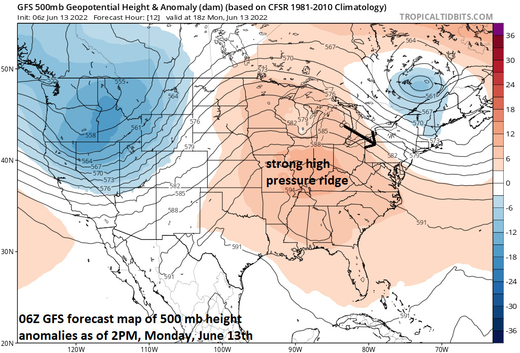
A strong ridge of high pressure in the upper part of the atmosphere has formed over the nation’s mid-section and the Mid-Atlantic region is on the outer periphery of this large-scale system. As such, winds aloft in this part of the nation are flowing from northwest-to-southeast and often times this time of year, the outer perimeter of strong high pressure ridging is an active zone with strong thunderstorm activity. Indeed, this “ring of fire” around the high pressure system is very active today with a complex of thunderstorms now exploding over the Upper Midwest. This “mesoscale convective system” (MCS) as it is referred to by meteorologists is likely to drop southeastward in the overnight hours and reach somewhere in the Mid-Atlantic region on Tuesday morning. Latest trends and observations suggest the worst of the MCS could focus on DC, Maryland, Virginia and the Delmarva Peninsula, but stay on guard in Philly.
The Mid-Atlantic region is on the outer perimeter of a strong high pressure ridge that is now centered over the Mississippi Valley region. A northwest flow aloft will likely bring a complex of strong thunderstorms now forming over the Upper Midwest into the Mid-Atlantic region on Tuesday morning. Map courtesy NOAA, tropicaltidbits.com
Details
Strong high pressure ridging has built across the nation’s mid-section and will result in very hot weather from the central states to the southeastern part of the country. The Mid-Atlantic and Northeast US are on the outer periphery of this large-scale system with an upper-level flow from northwest-to-southeast. The outer perimeter of such large-scale upper-level ridges can be active regions this time of year with rather tight temperature gradients and often times the formation of very strong thunderstorms. Occasionally, these thunderstorms form into a “small-scale complex” in what is dubbed by meteorologists as a “mesoscale convective system” or MCS. It appears this type of system is forming now over the Upper Midwest and it is likely to travel from northwest-to-southeast in the overnight hours around the perimeter region of the high pressure ridge.
The 12Z NAM forecast map for mid-day Tuesday features the remains of the “mesoscale convective system” over eastern PA and New Jersey. Note - this model appears to be an outlier with other computer forecast models such as the GFS and Canadian farther south in their outlooks as to where the MCS will travel by Tuesday morning (i.e., more of an impact in DC, MD, VA compared to this NAM model forecast)…stay tuned. Map courtesy NOAA, tropicaltidbits.com
This complex of thunderstorms is likely to maintain much of its strength in the overnight hours and should arrive somewhere in the Mid-Atlantic region on Tuesday morning with the latest trends and observations favoring the worst impact coming to DC, Maryland, Virginia and Delmarva Peninsula…but certainly stay on guard in Philly. These type of systems are difficult to forecast in terms of both timing and destinations as a slight discrepancy in the expected movement upstream can change results substantially downstream.
The 12Z Canadian model (aka GEM) pushes the remnants of the “MCS” farther to the south as compared with the 12Z NAM (i.e., directly into the DC metro region). Map courtesy Canadian Met Centre, tropicaltidbits.com
A key factor in the movement of this complex of thunderstorms will be final location of a stalling-out frontal boundary zone that is now dropping southward through the Mid-Atlantic region. This boundary zone will act as a corridor for the MCS to travel along later tonight and into Tuesday morning. Stay tuned…it could be a wild weather morning on Tuesday in at least some parts of the Mid-Atlantic region.
Meteorologist Paul Dorian
Arcfield
arcfieldweather.com
Follow us on Facebook, Twitter, YouTube
Video discussion:


