11:15 AM | ***Heavy rain/thunderstorms a threat once again in parts of the Mid-Atlantic region from later this afternoon through tonight...DC-to-Philly the likely threat zone***
Paul Dorian

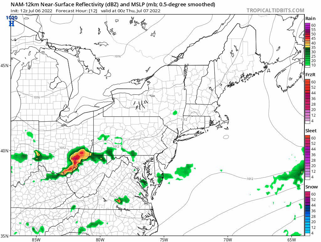
12Z NAM forecast maps of radar reflectivities from early tonight to mid-day on Thursday indicates some heavy rainfall is possible in the region from around DC-to-Philly (yellow, orange, red). Maps courtesy NOAA, tropicaltidbits.com
Overview
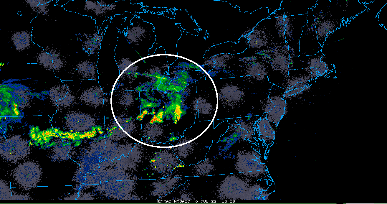
An active weather pattern continues at mid-week in the Midwest and Mid-Atlantic regions with persistent northwesterly flow aloft on the outer perimeter of a strong high pressure system that is centered over the southern states. This “ring of fire” on the periphery of the high pressure system continues to feature batches of showers and thunderstorms rotating around in its northeastern quadrant from northwest-to-southeast. The next upstream batch of showers and thunderstorms is now pushing through the Ohio Valley and its remnants will enhance the chance of heavy rain and thunderstorms later today and tonight - likely in the region from DC-to-Philly.
Details
High pressure ridging in the upper part of the atmosphere continues to be focused on the Lower/Mid Mississippi and Tennessee Valley regions bringing excessive heat to such places as St. Louis, Missouri, Huntsville, Alabama and Dallas, Texas where temperatures will climb to the 100 degree mark for afternoon highs. Meanwhile, on the outer reaches of the high pressure system, northwesterly flow aloft has prevented any kind of sustained heat in the Great Lakes, Mid-Atlantic and Northeast US. For example, the official recording station for Washington, D.C. - Reagan National Airport (DCA) – has not had any three consecutive days this season with 90+ degrees for (three consecutive 90+ degree days is considered by many to define a “heat wave” in this part of the country).

In addition to the inhibiting factor for sustained heat in the Mid-Atlantic region, northwesterly flow aloft has kept the weather quite active as the periphery region of a strong high pressure system - often referred to as the “ring of fire” – has featured numerous embedded shortwaves traveling from northwest-to-southeast. This kind of pattern has resulted in many upstream batches of showers and thunderstorms that then dropped south and east from the Upper Midwest to the Mid-Atlantic and that is on the table once again for later today and tonight likely to impact the region from DC-to-Philly. Much like yesterday, an early morning “mesoscale convective system” or MCS developed over the Upper Midwest and its remnants are sliding through the Ohio Valley at mid-day and headed for the southern part of the Mid-Atlantic. As a result, there is an enhanced chance for showers and thunderstorms in the DC metro region later today and perhaps later tonight across southeastern PA. Any shower or storm in this humid air mass can produce some heavy rainfall amounts in a short period of time.
The remainder of the work week is likely to see a continuation of this overall active weather pattern with little chance of sustained heat. With a meandering frontal system nearby, the chance of showers and storms will continue on Thursday and Friday, but a second front should clear the way for a decent weekend in the northeastern states. In fact, the air mass headed to the Mid-Atlantic/NE US for the weekend could be quite comfortable and high pressure is likely to ensure that both weekend days will feature plenty of sunshine in the DC-to-Philly-to-NYC corridor.
Meteorologist Paul Dorian
Arcfield
arcfieldweather.com
Follow us on Facebook, Twitter, YouTube
Video discussion: