9:30 AM (Monday) | ***Beneficial rainfall for the Mid-Atlantic region…some of the rain can be heavy at times and some of the storms can be strong-to-severe***
Paul Dorian

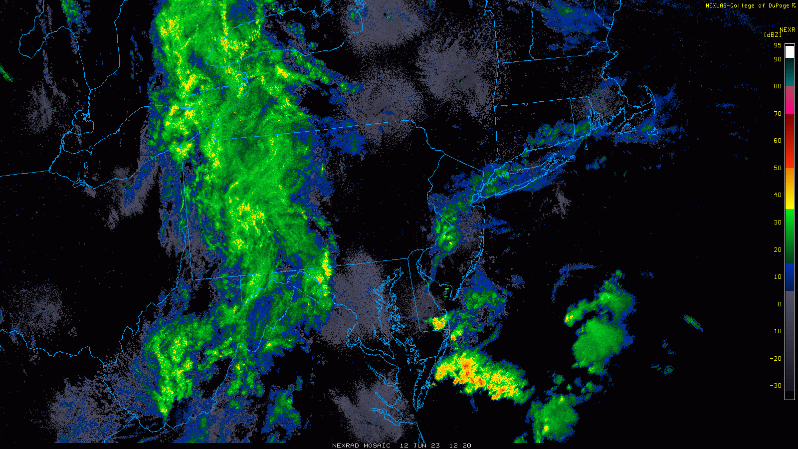
Showers and embedded thunderstorms are advancing to the east this morning and will reach the I-95 corridor during the mid-day and afternoon hours. Images courtesy NOAA, College of DuPage
Overview
Low pressure over the Ohio Valley this morning has a frontal system extending southward from its center to the Southeast US and this front will only inch along as it approaches the eastern seaboard. As such, low pressure will form along the frontal boundary zone enhancing shower and thunderstorm activity in the Mid-Atlantic region from mid-day through the evening. Some of the rain that falls later today can be heavy at times and some of the thunderstorms can reach strong-to-severe levels with the potential of damaging wind gusts and small hail in addition to the heavy downpours. The upper-level low associated with this system swings overhead at mid-week increasing the chance for more shower and thunderstorm activity on Wednesday after a less humid day on Tuesday featuring comfortable temperatures.

There is the risk today for strong-to-severe thunderstorm activity in the Mid-Atlantic region. Any storm can produce heavy rainfall, damaging wind gusts and even small hail. Map courtesy NOAA/SPC
Details
One big difference in the atmosphere this morning quite readily noticeable to Mid-Atlantic residents is the higher humidity compared to recent days. Dew points are in the 60’s this morning across the DC-to-Philly-to-NYC corridor which is considerably higher than the 30’s that was commonplace last week in the region. Last week, low-level winds were typically from a north-to-northwest direction ushering in cool, dry (and smoky) air from southeastern Canada to the northeastern states. This morning, the low-level flow of air ahead of an incoming frontal system is primarily from a southeasterly direction and moisture levels have risen noticeably as a result.

Low-level southeasterly flow is pumping up the moisture content today in the Mid-Atlantic region with dew points in the 60’s…a far cry from last week’s cool, dry air mass that featured dew points in the 30’s. Map courtesy NOAA/WPC
The combination of higher moisture content, an upper-level low over the Great Lakes, and a slow-moving surface frontal system is leading to rain across much of western Mid-Atlantic region this morning and there is a batch of light rain or drizzle along coastal sections. The main batch of rain in the western Mid-Atlantic will spread east during the next few hours with shower activity likely reaching the DC and Philly metro regions around mid-day or early afternoon and then NYC by early-to-mid afternoon. Thunderstorms are a possibility from later today into early tonight and any storm that forms can reach strong-to-severe levels with the potential of damaging wind gusts, small hail in addition to the threat for downpours.

An upper-level low currently over the Great Lakes will play a role in today’s expected rainfall and it will only slowly push to overhead in the Mid-Atlantic region by Wednesday producing a renewed threat for showers and thunderstorms at mid-week. Map courtesy NOAA, tropicaltidbits.com
On Tuesday, less humid air should push into the Mid-Atlantic region following the passage of the surface frontal system and temperatures should be in the comfortable range. The upper-level low currently over the Great Lakes that is contributing to today’s expected rainfall will actually wait until mid-week to spin overhead into the Mid-Atlantic region and this is likely to increase the chances on Wednesday for more in the way of shower and thunderstorm activity.
Meteorologist Paul Dorian
Arcfield
arcfieldweather.com
Follow us on Facebook, Twitter, YouTube
Video discussion: