
10:00 AM | ****Snow squalls on Sunday with Arctic front…accumulating snow later Monday into Tuesday…another threat of accumulating snow on Friday to be followed by an Arctic blast****
Paul Dorian

Snow squalls are likely to develop on Sunday in the Mid-Atlantic region with the arrival of an Arctic front and there can be powerful wind gusts as well. Any heavy snow burst can put down a quick coating to an inch or so and create a rapid reduction in visibilities. Map courtesy NOAA, tropicatltidbits.com
Overview
It’ll be quite an active week in the Mid-Atlantic region beginning with the arrival of an Arctic front on Sunday followed by a couple chances for accumulating snow during the work week and then there can be another Arctic blast next weekend. The arrival of the Arctic front on Sunday can come with powerful wind gusts and snow squalls that can put down a quick small accumulation anytime from late-morning to mid-afternoon. During the week, low pressure is likely to intensify just off the Carolina coastline on Monday night and Tuesday and this system will bring some accumulating snow to the I-95 corridor from later Monday into Tuesday. Another system will likely push into the Mid-Atlantic region at the end of the work week - possibly with another round of accumulating snow - and there is likely to be an impressive Arctic blast to follow for next weekend.

A dynamic Arctic cold frontal system on Sunday is likely to generate snow showers and heavier snow squalls in the Mid-Atlantic region. Map courtesy NOAA, tropicaltidbits.com
Snow squalls on Sunday with Arctic front and powerful wind gusts
A reinforcing Arctic cold front will sweep across the region on Sunday and it can produce snow showers and heavier snow squalls anytime from late-morning to mid-afternoon. The frontal passage may come with powerful wind gusts and winds can gust up to 50 mph or so for several hours behind the frontal passage. A strong upper-level jet streak overhead will be a catalyst in helping to provide strong upward motion along the frontal boundary zone. Any heavy burst of snow on Sunday can rapidly reduce visibilities and there is the potential for a flash freeze and a quick ice-up on the roadways in some spots. The most vulnerable areas for these heavier snow squalls on Sunday will be across the higher elevation locations of eastern PA including the Poconos and Lehigh Valley; however, even the I-95 corridor can get in on some of the action.
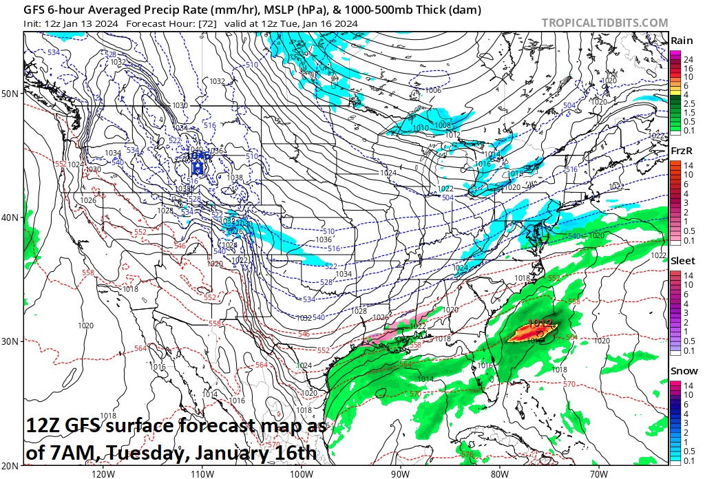
Low pressure will form and intensify just off the Carolina coastline on Tuesday and possibly produce some accumulating snow in the DC-to-Philly-to-NYC corridor. This particular forecast by the 12Z GFS for 7AM Tuesday is rather unimpressive and I believe it may very well be too weak with this system…stay tuned. Map courtesy NOAA, tropicaltidbits.com
Accumulating snow threat later Monday into Tuesday
Temperatures are likely to drop into the teens on Sunday night and they may actually hold below the freezing mark on Monday for the first time this season in many spots of the Mid-Atlantic region. By late Monday into Tuesday, low pressure is likely to first form and then intensify just off the Carolina coastline. This system will push northeastward thereafter - just off the east coast - and some accumulating snow will fall all along the DC-to-Philly-to-NYC corridor. At this point, a “minor-to-moderate” snow event seems likely with a few inches possible, but there are still some details to be ironed out.
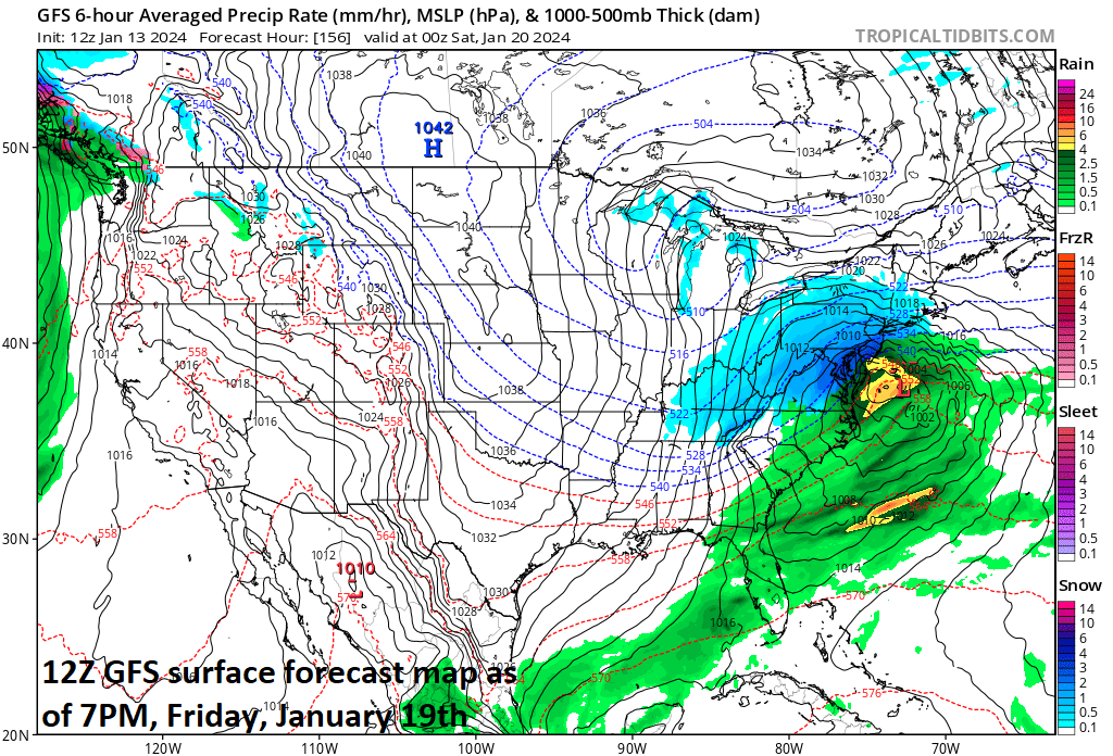
Another accumulating snow event is possible in the Mid-Atlantic region on Friday and this one has quite a deal of potential…and it looks like there will an impressive Arctic blast on its backside. Map courtesy NOAA, tropicaltidbits.com
Accumulating snow threat next Friday/Friday night…Arctic blast to follow
Later in the week, high pressure is likely to take control and then another coastal low pressure system could develop by Friday or Friday night potentially bringing additional accumulating snow to the Mid-Atlantic. This system does have the potential to be a significant snow producer; however, it is still several days away. Signs point to a direct discharge of Arctic air to follow the late week system potentially making for very cold conditions during next weekend (20th/21st) with single digits on the table in many areas. Looking well ahead, there is likely to be a general relaxation in temperatures during the week of the 22nd, but given the on-going stratospheric warming event, other Arctic air masses are destined to come this way during late January and February.

Buckle up…it looks like quite an interesting week.
Meteorologist Paul Dorian
Arcfield
arcfieldweather.com
Follow us on Facebook, Twitter, YouTube