1:50 PM | ***Powerful cold front sweeps across the region later today/early tonight with some wild weather***
Paul Dorian

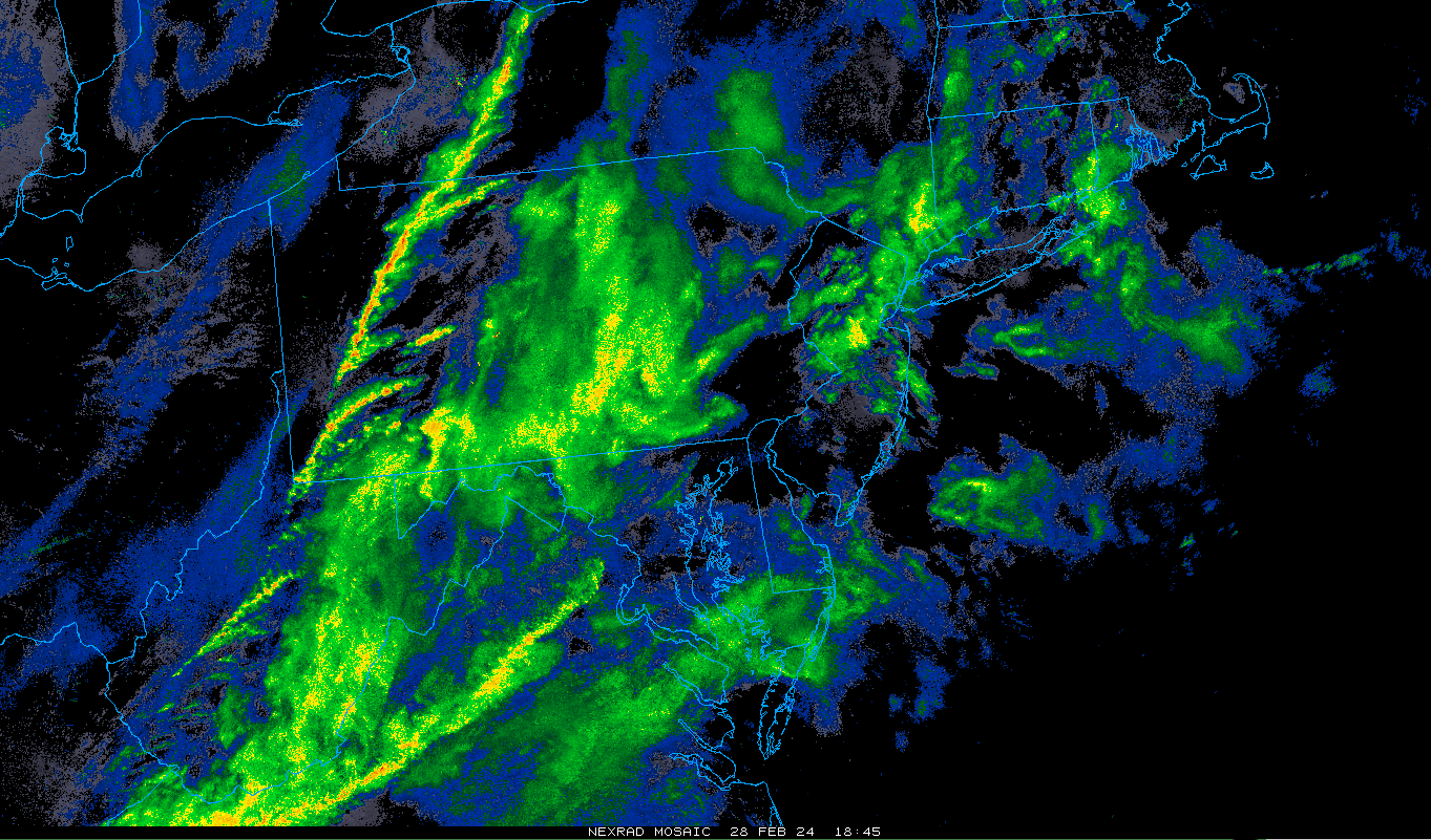
A line of showers and embedded thunderstorms has formed along the incoming frontal boundary zone out across western Pennsylvania and it is headed east towards the I-95 corridor. There are batches of showers out ahead of this line - producing some heavy rainfall - and this will too will impact the I-95 corridor. Map courtesy College of DuPage, NOAA
Overview
A powerful cold front is pushing through the Ohio Valley this morning and it will produce some wild weather in the DC-to-Philly-to-NYC corridor from early-to-mid afternoon to late evening. Winds will become very strong this afternoon ahead of the frontal system and stay very strong into the overnight hours following the passage of the cold front. In fact, gusts can surpass 50 mph in the Mid-Atlantic region later this afternoon and evening including along coastal sections of New Jersey and the Delmarva Peninsula.
Temperatures will peak today near 60 degrees in many spots along the I-95 corridor and then plunge following the frontal passage to the upper 20’s or lower 30’s by later tonight…a drop off of some thirty degrees from today’s highs to the overnight lows. Showers will come in waves today and tonight with some of it heavy at times and there can be a strong thunderstorm or two mixed into the picture. There is an outside chance that the evening rain showers change to snow showers for a brief time before the precipitation winds down later tonight. It stays cold on Thursday, but the cold shot will be rather short-lived and we’ll be pushing to 60 degrees again by the second half of the upcoming weekend.

Some thunderstorms later today and early tonight can reach strong-to-severe levels in the eastern states associated with the incoming powerful cold frontal system. The best chance for a strong thunderstorm in the Mid-Atlantic region will likely come along and to the west of Route I-95. Map courtesy NOAA
Details
This approaching strong cold front produced some very active weather last night in the Upper Midwest with northern Illinois, as an example, hit by severe thunderstorm activity and there were unconfirmed reports of tornadic activity near Chicago. This same front is now barreling through the Ohio Valley and will reach the Mid-Atlantic’s I-95 corridor later today/early tonight with some wild weather likely in DC, Philly, NYC between about 2 pm and 10pm. Winds will increase in intensity this afternoon from a S-SW direction ahead of the front likely with gusts past 40 mph. The threat of strong winds may then actually increase just behind the frontal system later this evening when air pressure rises rapidly with gusts of 50+ mph (NW direction) on the table later throughout the Mid-Atlantic region.

Temperatures will drop sharply following the passage of the strong cold front from near 60 degrees around mid-day (left map) to the upper 20’s around midnight or shortly thereafter (right map). Maps courtesy NOAA, tropicaltidbits.com
In terms of precipitation, there will be waves of showers throughout the day that will tend increase in intensity for the afternoon and evening and there can be a strong PM thunderstorm or two mixed into the picture as well; primarily, along and to the west of Route I-95. The rain showers this evening following the frontal passage can briefly change to snow showers in portions of the I-95 corridor, but accumulations are not expected.

By 6pm, the precipitation is likely to have changed to snow (shown in blue) across the western Mid-Atlantic region and bands of rain (shown in green, yellow) with possible embedded thunderstorms are likely in the eastern sections. Map courtesy NOAA, tropicaltidbits.com
In terms of temperatures, a sharp drop off is likely in the couple hours immediately following the frontal passage as cold air rushes in from the north and west. After highs today not far from 60 degrees, temperatures should plunge to the upper 20’s or lower 30’s by midnight or so all along the DC-to-Philly-to-NYC corridor. It stays cold on Thursday – much colder than today or yesterday – with highs generally in the 40-45 degree range along the I-95 corridor. The winds remain a factor on Thursday as well gusting up to 35 mph or so, but not as strong as to what is expected later today and tonight. The cold shot will be rather short-lived with a warm up beginning this weekend and temperatures are likely to be pushing 60 degrees by Sunday and Monday.
Meteorologist Paul Dorian
Arcfield
arcfieldweather.com
Follow us on Facebook, Twitter, YouTube
Video discussion: