
8:30 AM | *Warm, humid and unsettled pattern next few days...slow-moving nature of showers and storms increases the chance for some heavy rainfall amounts in a given location*
Paul Dorian

While temperatures have dropped noticeably from last week’s high heat, the humidity levels remain quite high in the Mid-Atlantic region and this is contributing to some heavy rainfall in the area. Map courtesy NOAA, tropicaltidbits.com
Overview
What a difference a week makes...a week ago the Mid-Atlantic region was experiencing high heat with triple digit highs in some spots and significant rainfall was hard to come by. Severe thunderstorms then took place last Tuesday and Wednesday causing numerous power outages in the Mid-Atlantic region...all part of a transition in the overall pattern that resulted in an influx of cooler air on Thursday. Since then, and for the rest of this week, temperatures will be much closer to seasonal norms with afternoon highs generally in the 80’s and no triple digit heat is in sight for the I-95 corridor. In terms of rainfall, weak winds in the lower and middle atmosphere are contributing to slow movement of showers and thunderstorm cells and - given the high amounts of available moisture - this has increased the chance for some heavy rainfall amounts in a given location and this threat will remain with us through Thursday. Beyond that, high pressure over the Great Lakes is likely to bring about a warm and dry period from Friday through Sunday.
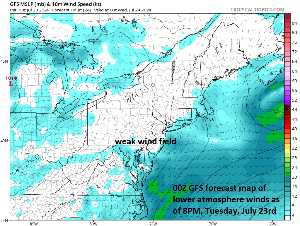
Another factor in some heavy rainfall across the Mid-Atlantic region this week is the weak wind field in the lower atmosphere which is resulting in slow-moving showers and thunderstorms cells…adding to the chance for heavy rainfall amounts in a given location. Map courtesy NOAA, tropicaltidbits.com
Details
A week ago on Tuesday, July 16th, temperatures peaked at 104 degrees at Reagan National Airport (DCA) in Washington, D.C., but the high temperatures yesterday was only 83 degrees. This change to cooler weather in the Mid-Atlantic region began late last week and should continue through the remainder of this week with afternoon highs generally in the 80’s along the I-95 corridor. A week ago significant rainfall was hard to come by, but then severe thunderstorms rocked the Mid-Atlantic region on Tuesday night and Wednesday resulting in power outages in many areas.
This week’s overall pattern favoring warm, humid and unsettled conditions features generally weak winds in the lower and middle parts of the atmosphere and the result has been some rather slow-moving showers and thunderstorm cells. The slow movement combined with high moisture levels has contributed to some very heavy rainfall amounts in localized areas and this threat will continue through the day on Thursday. There are several disturbances in the atmosphere that will enhance upward motion in the Mid-Atlantic region from later today through the day on Thursday likely resulting in numerous rounds of showers and thunderstorms...and any of these can produce heavy rainfall.

We are likely setting up for a pretty decent stretch of warm and dry weather from Friday to Sunday in the Mid-Atlantic region. Map courtesy NOAA, tropicaltidbits.com
Looking ahead, strong high pressure will build over the Great Lakes later in the week and it should be strong enough to edge into the Mid-Atlantic region on Friday. The result could be a warm and dry period for the Mid-Atlantic region from Friday through Sunday with afternoon high temperatures generally in the middle or upper 80’s.
Meteorologist Paul Dorian
Arcfield
arcfieldweather.com