
Tuesday, 3:00 PM - **Low pressure to bring beneficial rain to some areas of the Mid-Atlantic region and accumulating snow to others**
Paul Dorian
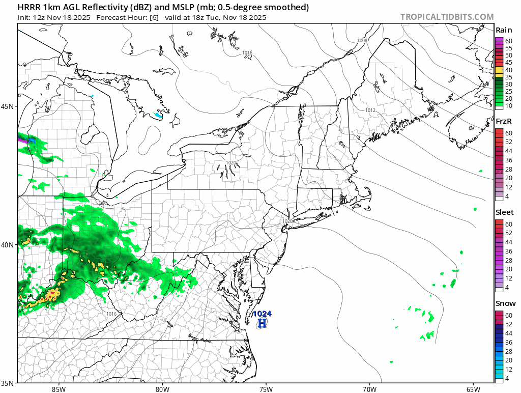
Low pressure will move in a general eastward direction from the Midwest to the Mid-Atlantic region during the next several hours bringing rain to some areas and accumulating snow to others. Maps courtesy NOAA, tropicaltidbits.com
Overview
It has been quite dry in the Mid-Atlantic region during the past several weeks with below-normal rainfall so far during the month of November, and this current dry stretch has come after the drier-than-normal months of September and October. While not a heavy rain event, low pressure will bring some beneficial rainfall to portions of the Mid-Atlantic region from late today into late tonight with up to half an inch possible in some locations. And, with a cold, dry air mass in place, the precipitation could be a mix of snow, sleet and rain in some spots or even “all” snow for awhile; especially, in those inland, higher elevation locations of the Mid-Atlantic region. In fact, minor snow accumulations of a couple of inches are possible by early tomorrow across places like central PA, northeastern PA, and in the interior sections of northern New Jersey.
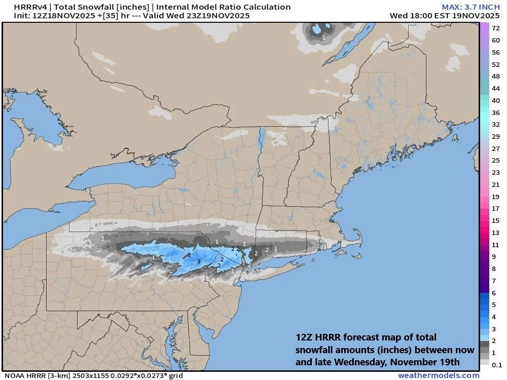
With a cold and very dry air mass in place, there is the chance for accumulating snow from late today into late tonight across some of the inland, higher elevation locations of the Mid-Atlantic (e.g., central PA, northeastern PA, interior northern NJ). In fact, some of these areas could wake up on Wednesday with a couple inches of snow on the ground. Map courtesy NOAA, weathermodels.com
Details
Colder-than-normal air pushed into the Mid-Atlantic region on Sunday following the passage of a strong cold front and this unseasonably cold air mass is firmly entrenched as a precipitation shield of low-pressure approaches from the west. Temperatures remain at well below-normal levels at mid-day across much of the Mid-Atlantic region and dew points – a true measure of overall humidity – are way down in the 20’s in many spots, indicative of a very dry air mass. The cold and very dry air can lead to evaporative cooling in the lower part of atmosphere as the precipitation gets underway later today/early tonight bringing the surface temperatures down a few notches in a hurry. In some areas, this may be enough to allow for a mix of snow, sleet and rain or even “all” snow for awhile - including in some of the far northern and western suburbs of the big cities along the I-95 corridor. Furthermore, minor accumulations of up to a couple of inches are possible in some of the interior, higher elevation locations of the Mid-Atlantic region (e.g., central PA, northeastern PA, interior northern NJ).

Up to half an inch of precipitation can fall by early Wednesday in the Mid-Atlantic region which would be quite welcomed as we have gone through a dry stretch since earlier in the fall. Map courtesy NOAA, tropicaltidbits.com
In terms of total precipitation amounts, this low-pressure system can produce half an inch in some areas, which would be quite welcomed considering the dry stretch we are going through in much of the area. The precipitation shield associated with the approaching low-pressure system is making inroads at mid-day across the central Mid-Atlantic; however, it is battling the very dry air mass that is entrenched in the lower atmosphere. By later this evening, the precipitation shield will expand markedly in coverage as the lower atmosphere moistens up and as strong upper-level support passes nearby and gives the overall system quite a boost of energy...the rain and/or snow can last all the way into the daybreak hours on Wednesday.
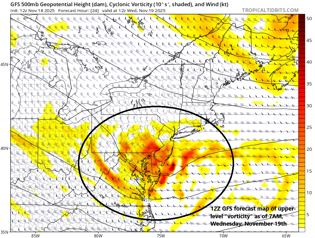
Surface low pressure headed this way from the Midwest will be supported aloft by a strong vorticity maximum which will enhance upward motion in the Mid-Atlantic region. Map courtesy NOAA, tropicaltidbits.com
Meteorologist Paul Dorian
Arcfield
arcfieldweather.com
Follow us on Facebook, Twitter, YouTube
Video discussion: