
***An active cold front to bring some heavy rain and strong winds to the region from later tomorrow night into Friday...temperatures to drop markedly behind the front***
Paul Dorian
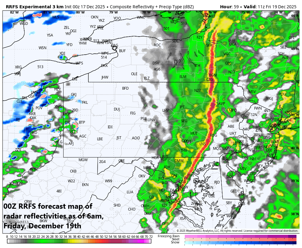
There is the chance that a line of gusty thunderstorms forms along an incoming strong cold front early in the day on Friday and it could impact the Friday AM commute in some portions of the I-95 corridor. Map courtesy NOAA, Weather Bell Analytics
Overview
A strong cold front will barrel through the Mid-Atlantic region on Friday morning and this system will be quite active with heavy rainfall and powerful winds from later tomorrow night into Friday. There is even the chance that a squall line of gusty thunderstorms forms right along the frontal boundary zone which could result in downpours and gusty winds right around the Friday AM commute in the I-95 corridor. After a mild start to the day on Friday, temperatures are likely to drop markedly during the mid-day and afternoon hours as the next colder-than-normal air mass pours into the Mid-Atlantic region. Snow showers will develop on Friday across some of the higher elevation interior locations and one or two of these can make their way into the I-95 corridor. The weather will settle down for the weekend with dry conditions expected on both days and a moderate chill in the air.
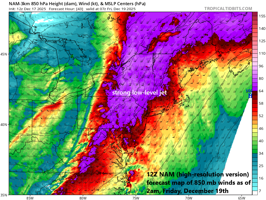
Winds will become quite strong on Thursday night ahead of the cold front and continue strong through the day on Friday behind the front and a key contributor will be a powerful low-level jet which will feature wind speeds of 70 knots or higher about five thousand feet above ground level. Map courtesy NOAA, tropicaltidbits.com
Details
It has turned milder today in the Mid-Atlantic region with “seasonable” temperatures for a change following what has been a relentless stretch of colder-than-normal weather since around Thanksgiving Day (20 straight days of below-normal temperatures in Washington, D.C.). After another cold night, temperatures should rebound tomorrow to relatively mild levels as clouds begin to increase ahead of an incoming strong cold frontal system that will reach the Ohio Valley by late in the day. Rain is likely to break out in the DC-to-Philly-to-NYC corridor region on Thursday evening, and it can become heavy at times in the overnight hours. In addition, winds will become quite strong from a southwesterly direction on the front side of the incoming strong cold front…potentially gusting up to 45 mph or so.
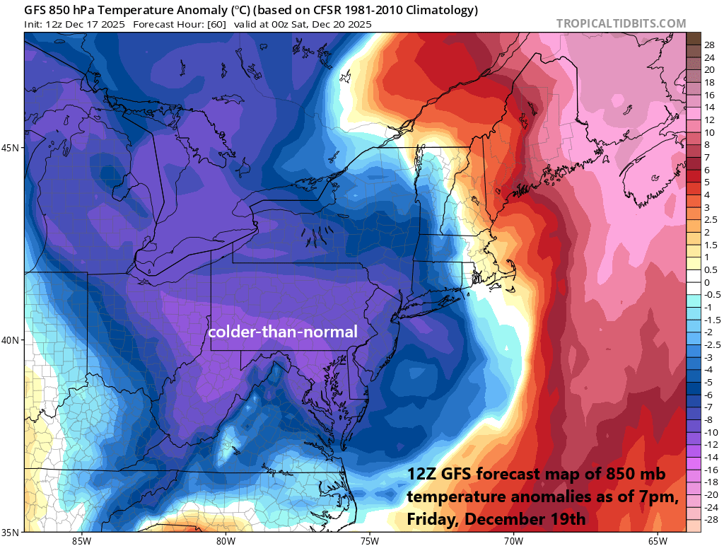
The passage of a strong cold front on Friday will result in another colder-than-normal air mass pushing into the Mid-Atlantic region. The weekend will start with chilly conditions, but there will be some moderation in temperatures on Sunday ahead of yet another colder-than-normal air mass that arrives for the early part of next week. Map courtesy NOAA, tropicaltidbits.com
As the cold front approaches the I-95 corridor on Friday morning, temperatures will be quite mild, winds will be quite strong, and there can be a line of gusty thunderstorms moving in from west-to-east...perhaps impacting the Friday AM commute in some areas. The strong cold front should clear through the DC-to-Philly-to-NYC corridor sometime between the mid-morning and mid-day hours and winds will shift to a northwesterly direction...likely gusting to 50 mph during the PM hours. After the mild start to the day, temperatures are likely to drop noticeably during the mid-day and afternoon hours as the strong NW winds usher in another in a series of colder-than-normal air masses to the Mid-Atlantic region. The weather should quiet down this weekend with some sunshine on both days and temperatures will be moderately chilly for this time of year.
Meteorologist Paul Dorian
Arcfield
arcfieldweather.com
Follow us on Facebook, Twitter, YouTube
Video discussion: