***Active pattern can bring rumbles of thunder and heavy downpours to the Mid-Atlantic region later tonight, and severe weather is a threat on Friday in the nation’s mid-section***
Paul Dorian

There can be rumbles of thunder later tonight across the Mid-Atlantic region and a heavy downpours as an upper-level wave passes by just to the north. Map courtesy NOAA, Weather Bell, Tony Pann (X)
Overview
The overall weather pattern remains quite active across the continental US, and it is the time of year for thunderstorm activity to become more prevalent compared to recent weeks. In fact, there can be some thunderstorm activity in the Mid-Atlantic region later tonight as a strong upper-level disturbance passes through the area and heavy downpours are on the table. On Friday, there is an enhanced risk of severe weather across the nation’s mid-section including the threat of tornadoes as a strong upper-level trough ejects northeastward from the southwestern states along with its associated powerful jet streak.
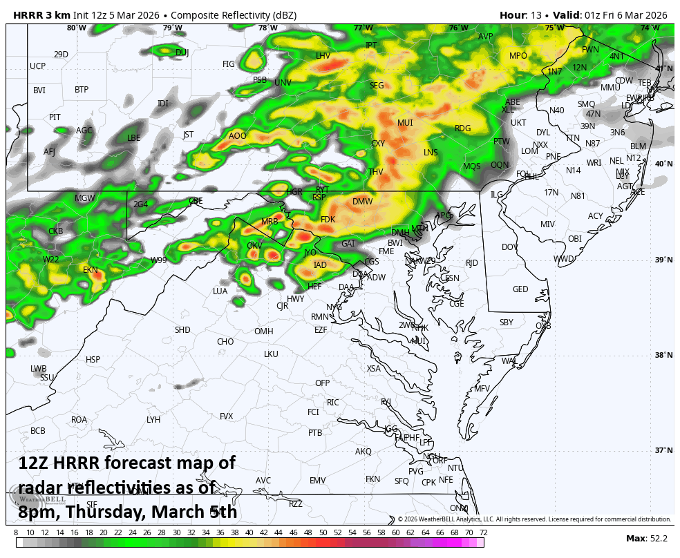
Strong thunderstorms can form later today across portions of the Appalachians from eastern West Virginia to western Virginia. It is not out of the question that a few of these storms make their way into portions of the I-95 corridor later tonight as well as heavy downpours. Map courtesy NOAA, tropicaltidbits.com
Mid-Atlantic region
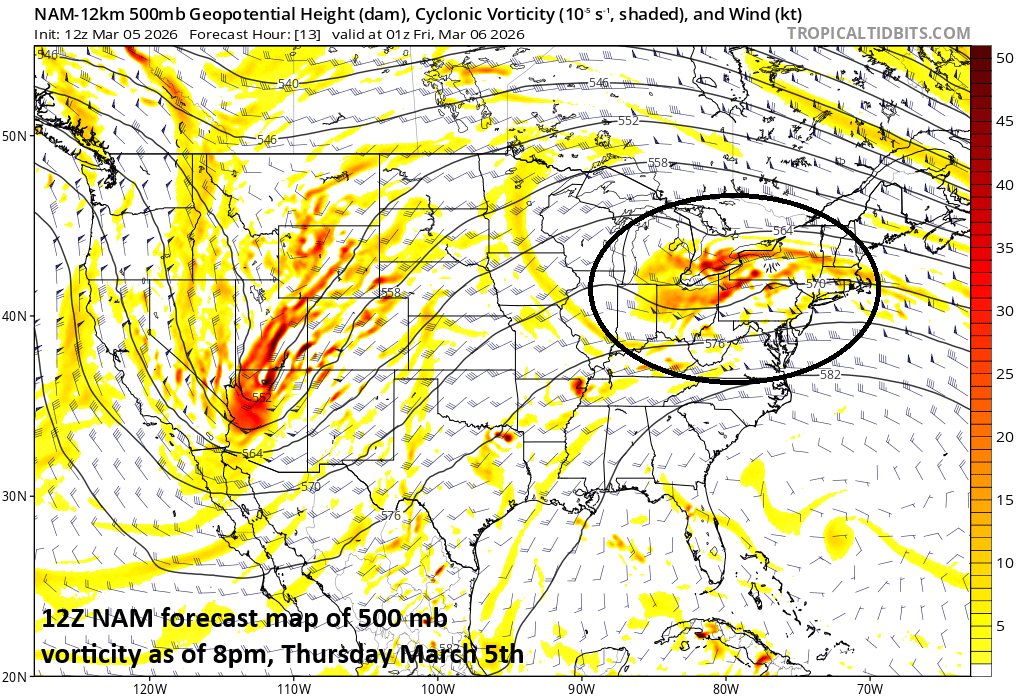
Cool, ocean flow has developed in the Mid-Atlantic region, and the result has been plenty of fog and occasional rain. The overall pattern will become more unstable this evening as an upper-level disturbance pushes into the northeastern states from the Great Lakes. This wave in the upper atmosphere will likely help to generate thunderstorms across the Appalachians later this afternoon and early evening and some can be on the strong side across the higher elevations of eastern West Virginia and far western portions of Virginia.
Farther to the east, the instability levels will be lower due to the influx of cool ocean air, but rumbles of thunder are certainly on the table in portions of the I-95 corridor later tonight, and heavy downpours will be likely. The downpour threat should diminish in the overnight hours, but fog and drizzle can certainly return as our damp ocean flow of air persists. This ocean-originated air mass will stick around on Friday limiting temperatures to the 40’s in many places and there will be plenty of low clouds, fog and occasional rain or drizzle in the region.
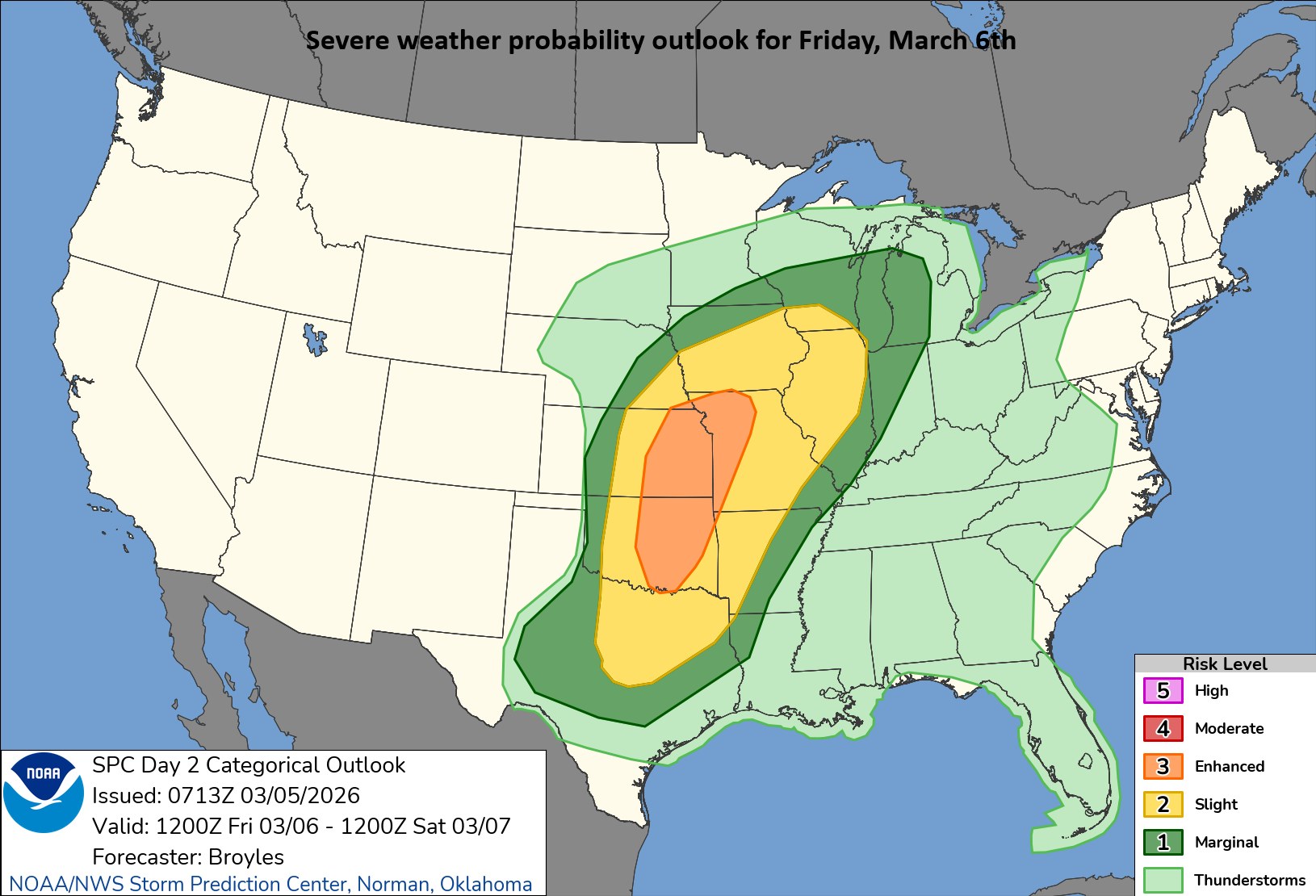
The ingredients appear to be coming together for a significant severe weather threat including possible tornadoes on Friday across the central states from Texas-to-Iowa and eastward to Missouri. The ingredients include an upper-level trough, powerful jet streak, and an influx of warm and humid air from the Gulf. Map courtesy NOAA/SPC
Nation’s mid-section severe weather threat on Friday
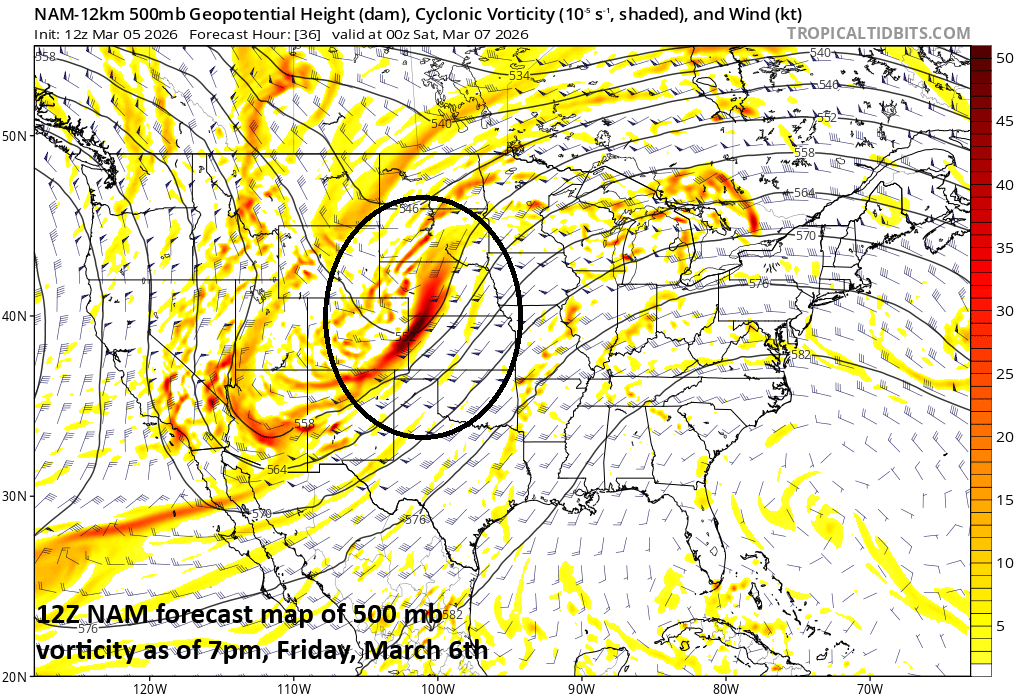
A strong upper-level trough will push out of the southwestern states on Friday and into the central Plains along with an associated powerful jet streak of 70 to 90 knots. This combination will combine with a moistening environment to increase upward motion during the day as surface temperatures climb.
There is an enhanced threat of severe weather on Friday in the nation’s heartland due in part to an upper-level trough that will push northeastward from the southwestern states. The greatest chance for severe weather on Friday is likely to come in the region from Texas-to-Iowa and eastward to Missouri. Map courtesy NOAA, tropicaltidbits.com
By later in the afternoon, strong thunderstorms will develop in the central US states of Texas, Kansas, Oklahoma, Iowa and Missouri and a significant severe weather event including possible tornadoes will be on the table from later tomorrow into tomorrow night across this region. The risk of severe weather will push eastward on Saturday to the Ohio and Tennessee Valleys and next week will likely feature a powerful frontal system that crosses the country from west-to-east producing another shot at some severe weather.
Meteorologist Paul Dorian
Arcfield
arcfieldweather.com
Follow us on Facebook, Twitter, YouTube
Video discussion: