
****Wild weather for the Mid-Atlantic region from later today into the overnight...severe storms including isolated tornadoes and flash flooding on the table****
Paul Dorian

Thunderstorms are increasing in intensity and coverage across the western part of the Mid-Atlantic and the I-95 corridor is likely to be impacted with severe weather/flash flooding from later this afternoon into the overnight hours. Images courtesy NOAA, College of DuPage
Overview
Low pressure will impact the Mid-Atlantic region from later today into the overnight hours with two threats on the table...severe weather and flash flooding. This low-pressure system will push eastward into southern Pennsylvania later today and end up over southern New England by late tonight. An upper-level jet streak will add fuel to the fire in the Mid-Atlantic region with strong upward motion that is destabilizing the atmosphere and thunderstorm coverage is increasing across western sections. Localized flash flooding can result from the “training” of thunderstorm cells meaning multiple storms may move over the same general area producing excessive rainfall amounts.
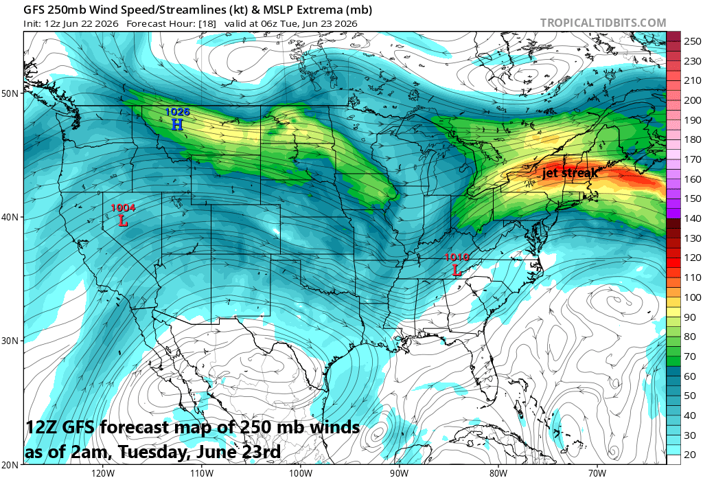
An upper-level jet stream will play a vital role in today’s severe weather and excessive rainfall threats as it will enhance upward motion in the Mid-Atlantic region. Map courtesy NOAA, tropicaltidbits.com
Details
Ingredients are coming together for severe weather in much of the Mid-Atlantic region from later today into the overnight hours including hail, damaging wind gusts, and isolated tornadoes. In addition, there can be localized flash flooding as well due to multiple storms moving over the same general area. Despite overall dry soil conditions, “training” of storms can result in 3+ inches of rain in some spots which can certainly be an “overload” for the ground threatening flash flooding conditions. The active weather pattern remains here in early summer as the upper jet stream continues to drop down over the CONUS at times and a jet streak is moving right overhead later today and tonight. The jet streak will enhance upward motion and is already destabilizing the atmosphere across western sections of the Mid-Atlantic.
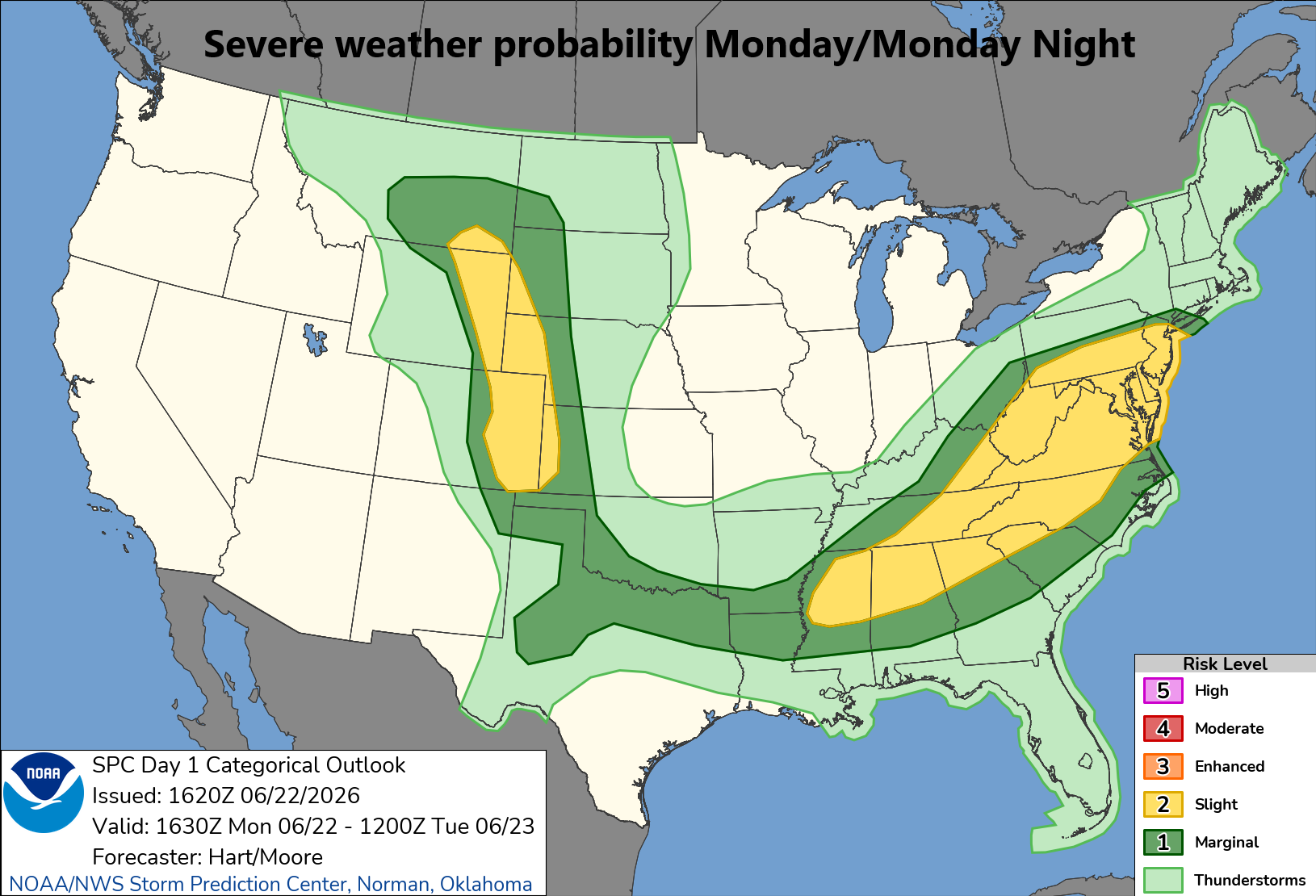
Today’s severe weather threat extends from the Mid-Atlantic region to the southeastern states and also across the Front Range of the Rocky Mountain States. Map courtesy NOAA/SPC
This particular threat of severe weather and heavy rainfall is likely to arrive after 4pm in most areas and can continue into the overnight hours with low pressure only slowly moving through the region. In fact, there can be residual shower activity through Tuesday morning before some clearing takes place during the PM hours. Another system threatens to impact the area later in the week and after a dry quiet day on Wednesday, the threat of showers and storms will return for the late week.
Meteorologist Paul Dorian
Arcfield
arcfieldweather.com
Follow us on Facebook, Twitter, YouTube
Video discussion: