****Severe weather/heavy rain threat continues for Saturday in the Mid-Atlantic region...frontal system and an impressive wave aloft will boost instability…more wildfire smoke****
Paul Dorian
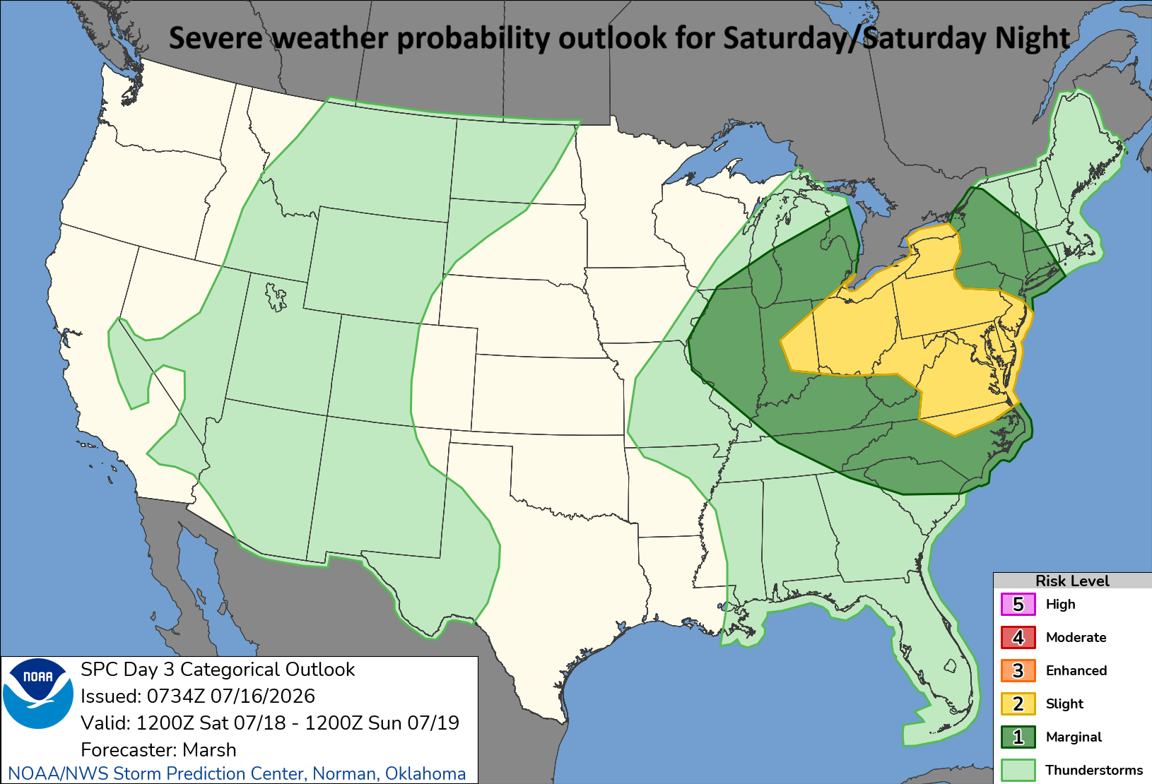
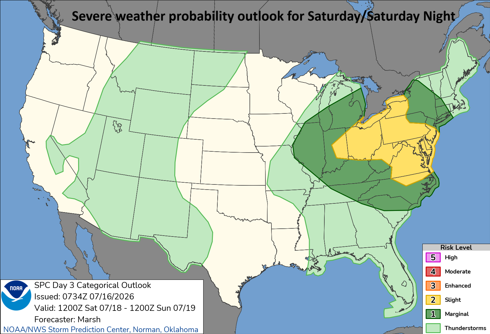
NOAA’s Storm Prediction Center (SPC) has placed the Mid-Atlantic region in a “slight” risk zone for severe weather on Saturday/Saturday night. Map courtesy NOAA/SPC
Overview
There is the threat of severe weather and heavy rainfall on Saturday in the Mid-Atlantic region as the overall weather pattern will result in high instability across the area. The pattern will feature an intense ridge of high pressure centered over the Rocky Mountain States with northwesterly flow over the Great Lakes/Northeast US. Often, this kind of flow results in “lines” or “complexes” of thunderstorms dropping to the south and east from the Great Lakes to the northeastern states and that is on the table for the first half of the weekend. The potential exists for damaging winds, isolated tornadoes, heavy rain and localized flash flooding as precipitable water amounts in the atmosphere will climb to quite high levels. Meanwhile, wildfire smoke from Canada will continue to be an issue as we slide into the end of the week, and it will dim the skies at times through Friday.
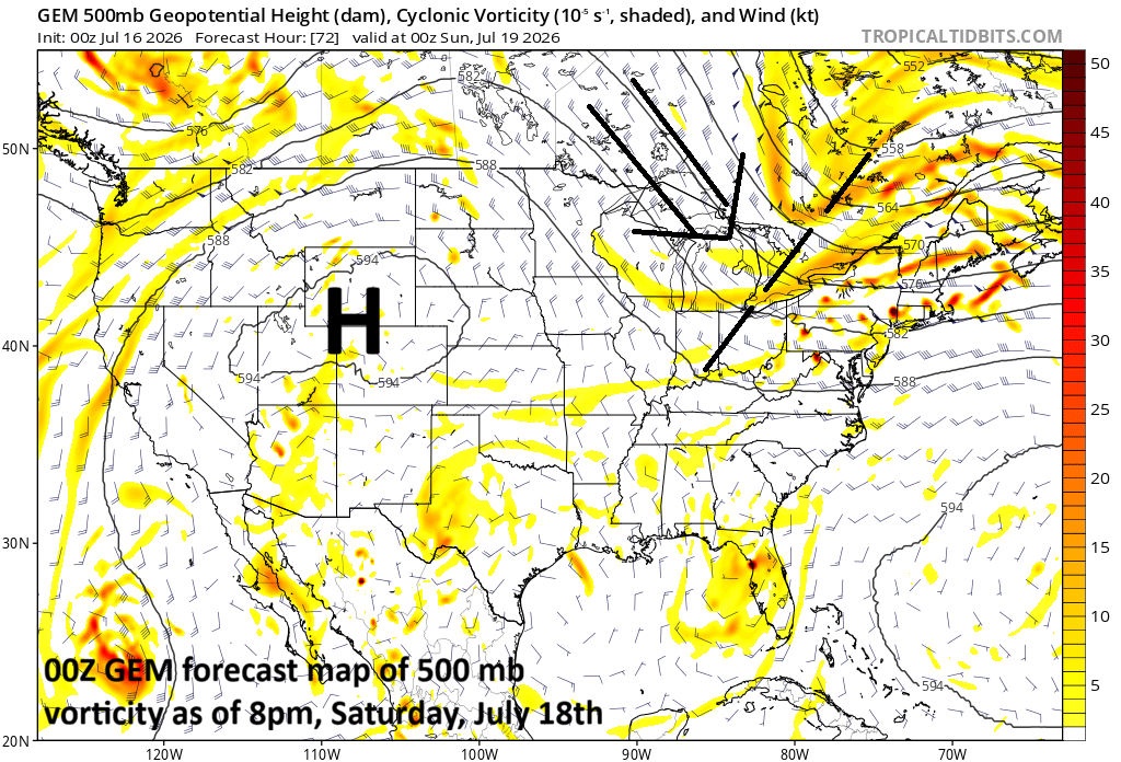
Intense high pressure ridging will be positioned over the Northern Plains/Rocky Mountains and there will be northwesterly flow from the Great Lakes into the northeastern states. In this northwesterly flow of air around the outer perimeter of the high, there are likely to be multiple “lines” or “clusters” on Saturday in the Mid-Atlantic/NE US. Map courtesy NOAA, tropicaltidbits.com
Details
The outer perimeter of an intense high-pressure ridge can be an area where severe weather develops during the summer season. Specifically, the far northeastern quadrant of an intense high-pressure ridge can feature “lines” or “complexes” of thunderstorms that drop to the south and east riding along in broad northwesterly flow of air. In fact, this is the type of upper air pattern that can produce derechos which are defined as long-lasting “lines” of thunderstorms that travel across a large area.
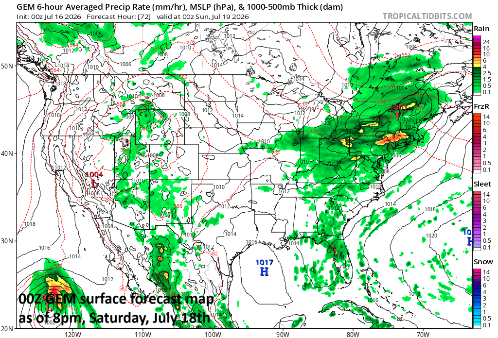
Saturday will likely be an active day in the Mid-Atlantic region and Northeast US with numerous showers and thunderstorms. Some of the storms can be strong-to-severe and some of the rainfall can be heavy. Map courtesy NOAA, tropicaltidbits.com
By Saturday, intense ridging of high pressure will be centered over the Rocky Mountain States and northwest flow will be found aloft in the far northeastern quadrant of the ridge. In addition, a surface frontal system will sink into the area, and it could stick around into Sunday. Another key player this weekend will be a wave of energy in the upper atmosphere that can enhance upward motion and shear all the way from the Great Lakes to the Mid-Atlantic...potentially resulting in strong-to-severe thunderstorms that can travel in a southeastward fashion and can produce damaging wind gusts and isolated tornadoes. In addition, the moisture levels in the atmosphere will become quite high in the Mid-Atlantic region (2+ inches precipitable water values) meaning the thunderstorms can generate some very heavy rainfall…localized flash flooding is a concern.
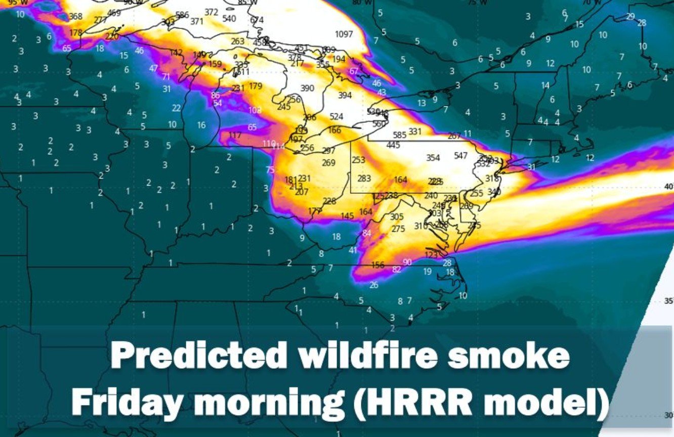
Wildfire smoke will continue to be an issue for the Mid-Atlantic region as we head into the end of the week. Some high-resolution forecast models depict widespread smoke from late Thursday into Friday morning. Map courtesy NOAA, Capital Weather, Weather Bell Analytics
Before we get to the weekend event, wildfire smoke will continue to be a factor in the Mid-Atlantic region. The wildfire smoke had its origins in south-central Canada and low-level winds have brought it south and east into the Mid-Atlantic region. The smoke will likely stick around into late Friday and certainly can dim the skies at times helping to knock off a few degrees from afternoon highs…a positive impact in what is quite a hot air mass entrenched in the area.
Meteorologist Paul Dorian
Arcfield
arcfieldweather.com