3:00 PM | *Cold blast brings a taste of winter to the Mid-Atlantic region on Sunday following a warm Friday/Saturday*
Paul Dorian
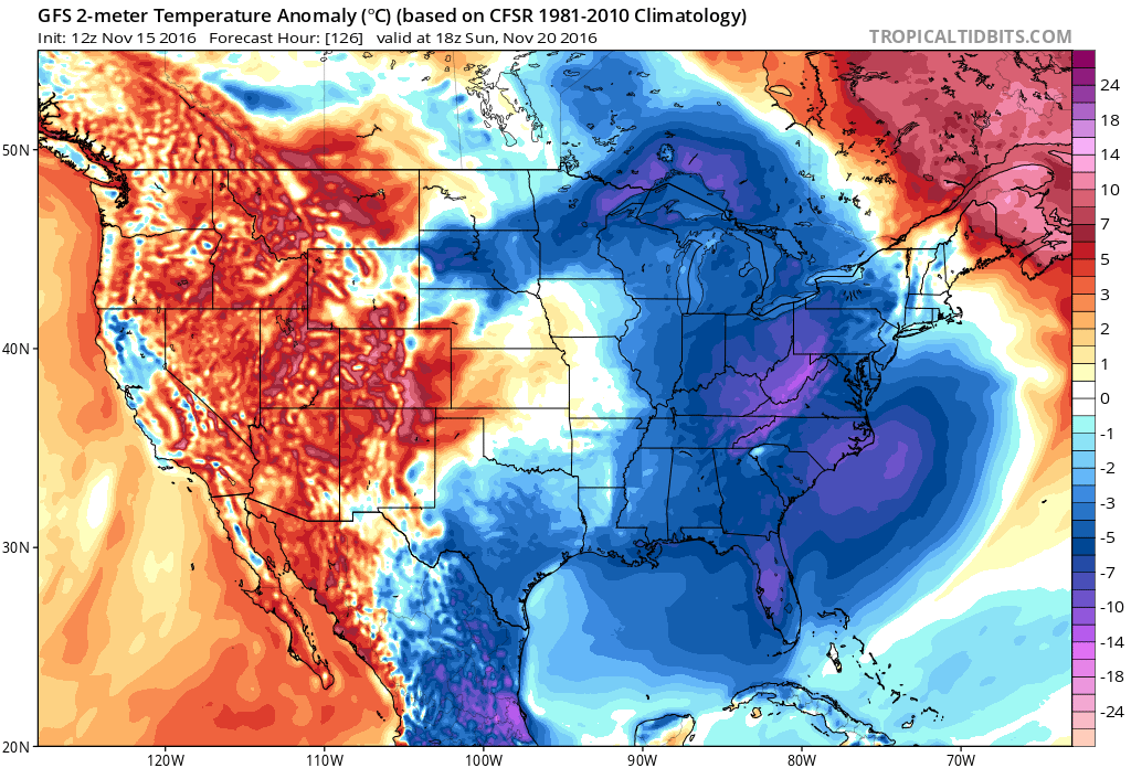
12Z GFS temperature anomaly forecast map for Sunday afternoon; map courtesy NOAA, tropicaltidbits.com
Overview
A blast of cold air will rush into the Mid-Atlantic region on Saturday night and Sunday promises to be a wintry day for the region with winter-like chill in the 40's, strong winds and perhaps even some snow shower activity reaching close to or actually into the immediate I-95 corridor region from DC-to-Philly-to-NYC. This weekend cold blast will turn on the Great Lakes snow machine resulting in the first widespread Great Lakes snow event of the season in higher-elevation locations just downstream from the water. This weekend blast of cold air will follow a couple of warm days around here with high temperatures on Friday afternoon soaring well into the 60’s and then returning to near 60 degrees for highs on Saturday ahead of the strong cold front that will be advancing rapidly towards us from the Great Lakes.
12Z GFS temperature anomaly forecast map for Friday afternoon; map courtesy NOAA, tropicaltidbits.com
Details
High pressure will slide off the coast by the end of the work week and temperatures could reach 60 degrees for highs on Thursday, well into the 60’s on Friday, and then back to near the 60 degree mark again on Saturday afternoon. This late week warmth will come ahead of a powerful cold front that will be accompanied by a strong jet stream which will amplify in the Northeast US during the weekend. This weekend cold frontal system will usher in the coldest air of the season so far and the Great Lakes snow machine will turn resulting in widespread accumulating snow in interior, high-elevation locations just downstream of the Lakes. The combination of cold air and still relatively warm waters will result in some serious lake effect snow on Sunday. Given the likelihood of a strong upper-level low nearby, there can even be some snow shower activity that makes it close to or into the immediate I-95 corridor on Sunday and the winds will bring wind chills to noticeably lower levels. This cold shot will stick around early next week, but should then ease somewhat at mid-week. The latest temperature anomaly forecasts by the 12Z GFS show the big change between Friday afternoon and Sunday afternoon with warmth dominating the eastern US on Friday and winter-like chill in control on Sunday.
Meteorologist Paul Dorian
Vencore, Inc.
vencoreweather.com


