
1:50 PM | **Bitter cold air on Thursday and Friday and this is likely to set us up for big problems on Saturday**
Paul Dorian
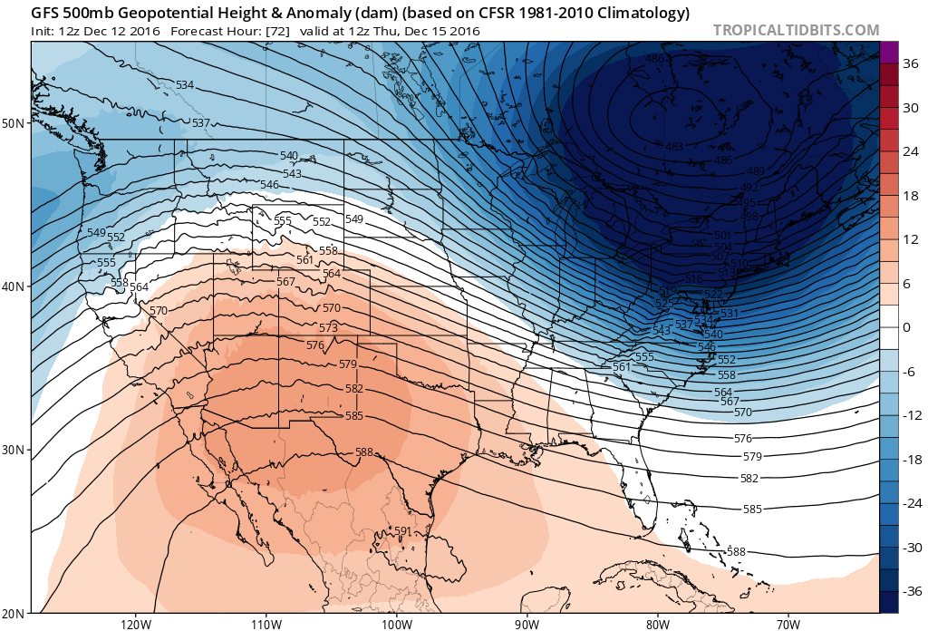
12Z GFS forecast map for Thursday morning of 500 mb height anomalies featuring an unusually deep upper-level low across the Northeast US; map courtesy tropicaltidbits.com, NOAA
Another Arctic blast arrives later this week in the Mid-Atlantic region and it’ll be colder than the last one. In fact, temperatures on Thursday and Friday are likely to hold in the 20’s on both days and overnight lows by Friday morning could be record-breaking and bottom out in the single digits near New York City, near 10 degrees in the Philly metro region, and in the 10-15 degree range across DC. This bitter cold, dense Arctic air mass will then begin to retreat on Saturday, but not before moisture reaches us from the Midwest and this potential collision of moisture and retreating Arctic air could lead to significant snow and/or ice problems in the DC-to-Philly-to-NYC corridor before a late day or nighttime changeover to plain rain.
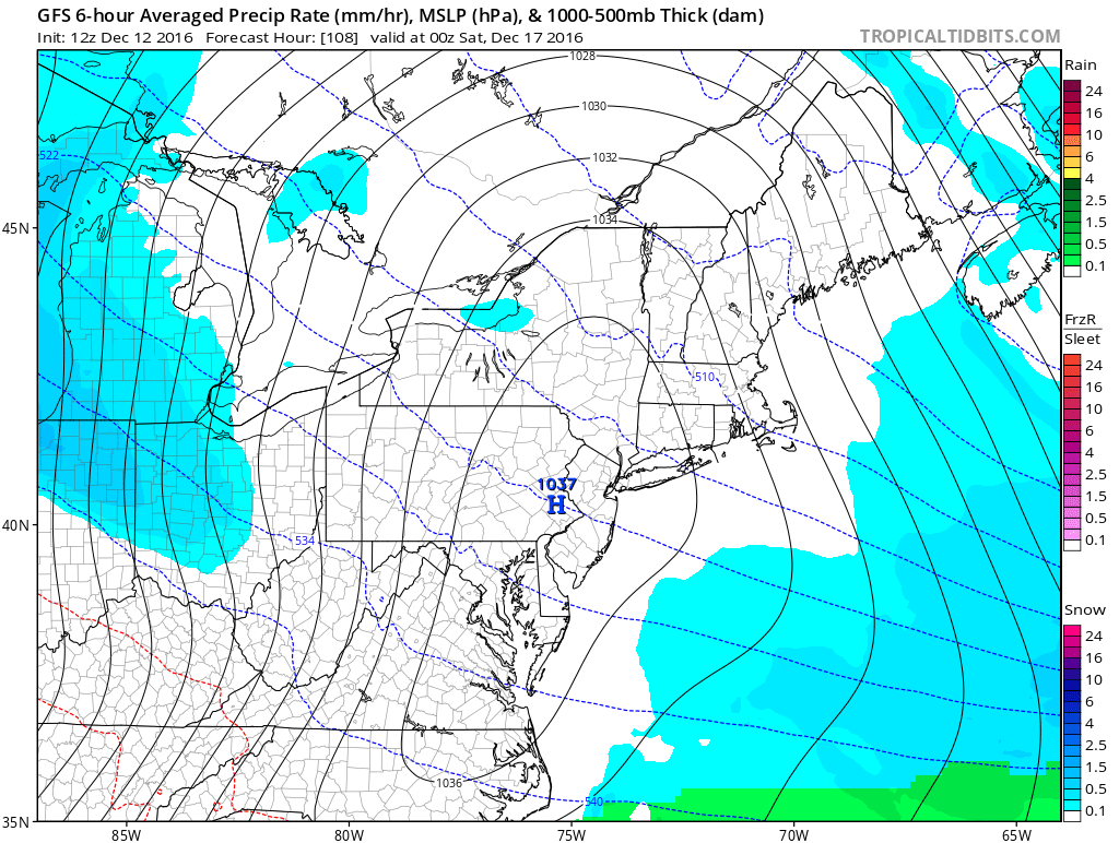
12Z GFS surface forecast map for Friday evening featuring strong Arctic high pressure right on top of the Mid-Atlantic and snow (in blue) over the Ohio Valley; map courtesy tropicaltidbits.com, NOAA
The next two days will likely feature partly sunny skies and cold conditions, but nothing too severe. There can be some snow shower activity tomorrow night and during the day on Wednesday as the next Arctic front begins to close in on the region. By Thursday, the Arctic winds will be howling around here as a very deep upper-level low builds into the Northeast US. Temperatures both Thursday and Friday will hold in the 20’s and strong N-NW winds could produce wind chill values of below zero at times. In addition, there can be more snow shower activity on Thursday and Friday and perhaps even a few heavier snow squalls with the Great Lakes snow machine turned on in full force.
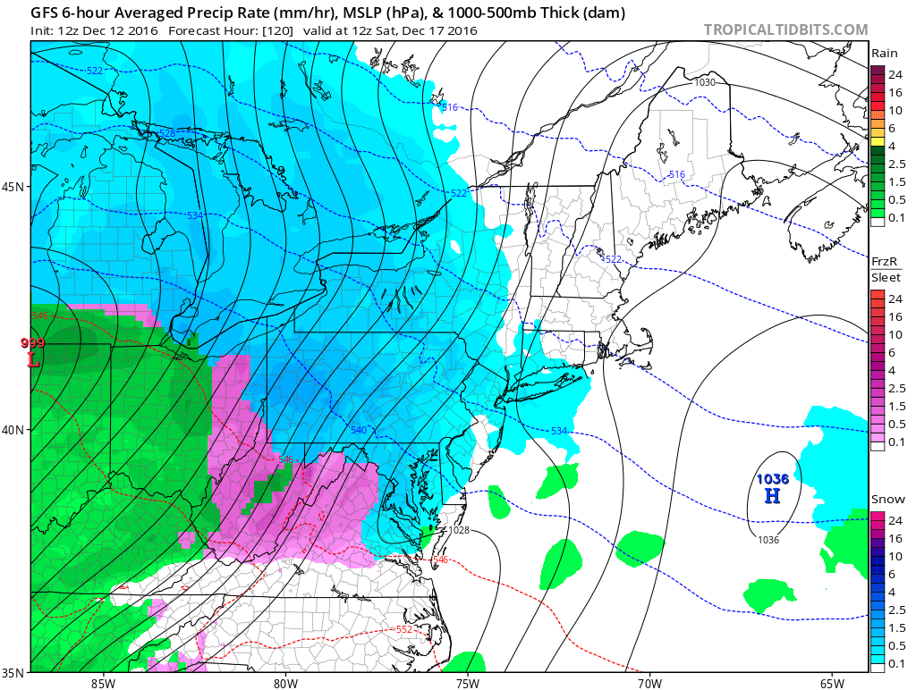
12Z GFS surface forecast map for Saturday morning with snow (blue) and ice (pink) in the Mid-Atlantic region; map courtesy tropicaltidbits.com, NOAA
The potential problems then begin late Friday night/early Saturday morning with the arrival of moisture at the same time cold, dense Arctic air begins its slow retreat to the north. Eventually, milder air will win out around here, but it’ll take awhile to erode the entrenched Arctic air. Also, the ground will no doubt be quite cold following what could turn out to be 48 hours or more of below freezing temperatures. It is way too early to tell what the exact breakdown of snow, ice and rain will be for this weekend event, but significant accumulations of snow and ice are on the table for DC, Philly and NYC during the front end of the storm.
Stay tuned.
Meteorologist Paul Dorian
Vencore, Inc.
vencoreweather.com